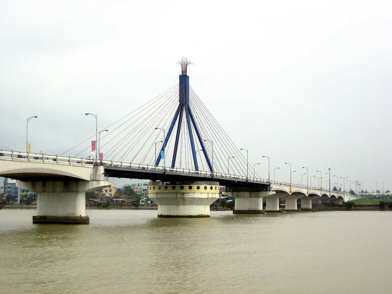

Hàn River Bridge
After midnight, the traffic stops. The pedestrians clear the deck. Then the bridge does something no other bridge in Vietnam does: it rotates. The entire 122.7-meter steel swing span pivots on a circular turntable pier, opening a navigation channel for river traffic, and closing again before the city wakes. The Hàn River Bridge has performed this nightly rotation since it opened on 29 March 2000, and it has become so central to Da Nang's identity that its silhouette appears on the city's official logo.
A City Divided by Water
For most of Da Nang's modern history, the Hàn River was a boundary as much as a waterway. The city developed on the western bank — the urban side, with its commerce, government buildings, and established neighborhoods. To the east lay fishing villages and long white beaches, but getting there required the single aging bridge that had served the city since 1965 (the Nguyễn Văn Trỗi Bridge). In 1997, when Da Nang was separated from Quảng Nam province and elevated to a centrally controlled municipality — giving the city its own budget and administrative independence — the decision was made to build something new. The new bridge would connect Le Duan Street on the western bank directly to Pham Van Dong Street on the east, linking the urban core to the coast.
Built by Da Nang, for Da Nang
The bridge carries a specific civic pride that distinguishes it from other infrastructure projects in Vietnam. It was designed by Vietnamese engineers, financed substantially by Vietnamese companies and private donors from Da Nang, and built entirely by Vietnamese workers. A plaque on the western ramp records the total amount donated by the community: 27,409,353,544 Vietnamese đồng. That transparency — naming the sum, acknowledging the donors — was deliberate. The bridge was presented to the city as a collective achievement, not a government imposition. When it opened with a grand ceremony on 29 March 2000, the celebration reflected something real: Da Nang had built this itself, and the eastern bank of its river was now open for development. Within years, hotels, resorts, and residential projects had transformed what had been a shoreline of fishing villages into one of the fastest-growing urban waterfronts in Southeast Asia.
Engineering the Swing
The bridge is a cable-stayed design with a symmetrical tower rising from the central pier. That pier conceals the mechanism that makes the bridge unusual: a rim-bearing circular turntable, the only one operating on any bridge in Vietnam. The swing span's steel girder and tower structure rotates on this turntable, while the eleven fixed side spans on either approach are prestressed reinforced concrete. The geometry of the rotation is precise — the 122.7-meter span must swing clear of the navigation channel without fouling the approaches. On weekdays the bridge opens after midnight; on weekends the rotation begins at 11pm, with traffic halted fifteen minutes earlier. The process takes about fifteen minutes to complete.
Symbol and Skyline
Da Nang spent the decades after the Vietnam War rebuilding slowly. The Hàn River Bridge arrived at the moment the city was ready to announce itself — a Vietnamese-engineered landmark opening the century with a ceremony, not a ribbon-cutting. The bridge is lit up brightly after dark, its cables glowing above the river, and the nightly rotation draws crowds of locals and tourists to both banks. In a city that now also boasts a Dragon Bridge that breathes fire on weekend nights, the Han River Bridge remains the original spectacle, the one that started the tradition of Da Nang treating its bridges as civic theater. Its image on the city seal is not nostalgia. It is an ongoing statement about what Da Nang became.
From the Air
The Hàn River Bridge crosses the Hàn River at 16.07°N, 108.23°E in central Da Nang. From the air at 2,000–4,000 feet, the bridge is clearly visible as the northern-most major crossing on the Han River within the city center, identifiable by its distinctive cable-stayed tower. The Dragon Bridge lies approximately 1.5 km to the south. Da Nang International Airport (VVDN) is 4 km to the northwest. The Han River runs roughly north–south here before opening into Da Nang Bay, which is visible to the north. The Marble Mountains (Ngũ Hành Sơn) are visible to the southeast as a cluster of rocky outcrops rising from the coastal plain.
Nearby Stories
- Mỹ Sơn 6.7 km away
- Tomb of Tự Đức 9.5 km away
- Chàm Islands 16 km away
- Thiên Mụ Temple 41 km away
- Chu Lai Air Base 47 km away
- Tomb of Gia Long 54 km away
- Dong Ampham National Biodiversity Conservation Area 81 km away
- Battle of the Paracel Islands 321 km away