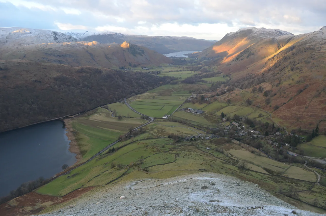

Hartsop
Some Cumbrian dalesman, sometime in the 18th century, came home from the fields to find that someone had extended Hartsop Hall across the old right-of-way he was used to walking. The hall stood between his house and somewhere he wanted to go. He refused to walk round it. So instead, the story goes, he walked through it - opening one door, crossing a room, opening the next door, and walking out the other side - and he kept doing this, day after day, until the right-of-way was officially preserved. Whether the story is true is impossible to say. That it is the kind of story people tell about Hartsop says something about the place. It is a village that resists being pushed around.
Stone Cottages and Spinning Galleries
Hartsop is small. Two streets, a footpath up to Hayeswater, a parking area at the village edge for fellwalkers, and a cluster of 17th-century grey-stone cottages crouching together against the wind. Some of these cottages still have spinning galleries - the raised wooden balconies, partly enclosed, where women used to spin wool by daylight, with shelter from the rain. Spinning galleries are a Cumbrian peculiarity, common in the small upland villages of the central Lake District, and Hartsop preserves one of the better surviving collections of them. They are the kind of architectural feature that survives only because no one has had the money or the inclination to tear them down for two and a half centuries.
Hartsop Hall
Across the valley from the village stands Hartsop Hall, in the care of the National Trust. It dates from the 16th century. In its earliest years it was the home of the de Lancaster family, then in the 17th century it passed to Sir John Lowther, ancestor of the family that would later become the Earls of Lonsdale - the same Lowthers whose name appears all over Cumbrian estate records, mineral rights, and shipping concerns. The hall eventually came down in status to an ordinary farmhouse, which is how the National Trust now holds it. It was during one of its 18th-century extensions that the right-of-way story is supposed to have happened. The hall is plain and stoutly built, and looks across at the village it served.
Hayeswater, Brock Crags and the Walkers
A mile east and several hundred metres up from the village lies Hayeswater, an upland tarn that served as the reservoir for Penrith - twelve miles north - from the late 19th century until 2014, when United Utilities removed the dam and restored it to an open mountain tarn. The walk up to Hayeswater is one of the standard short hikes from Hartsop, climbing the steep bracken-and-grass flanks beneath Brock Crags and Hartsop Dodd. From the tarn it is possible to continue up onto the High Street ridge, which runs north-south along the eastern skyline of the Patterdale valley. The High Street range takes its name from a Roman road - yes, there really was a Roman road along its summit ridge, connecting the Roman forts at Brougham and Ambleside, running open across the fells at over 800 metres. Helvellyn, the higher and busier range, lies to the west of the valley. Hartsop is well-positioned for both.
Lead, Sheep and Quiet
Like many of the small dales villages, Hartsop was a lead mining community in its working life. Lead ore was found in the surrounding fells, and small workings supplemented the income from farming. The mines are gone, the spoil heaps grassed over, and the village now lives on the very modest tourism that walking-route accommodation provides. There is no shop. No pub. No school. The civil parish of Patterdale, which contains Hartsop, has fewer than five hundred residents in total. The village is officially part of Patterdale for civil administration. In the deeper sense it is itself - a small group of houses on a single lane that climbs into the fells - and it keeps to itself.
Brothers Water and the Pass
Just south of Hartsop the road climbs toward Kirkstone Pass, the highest paved road pass in the Lake District. On the way it passes Brothers Water, a small dark lake that fills the floor of the valley between the village and the pass. Two brothers are said to have drowned there in the 18th century, giving the lake its current name; before that it was called Broad Water. Whether the story of the brothers is true is, as with so many of Hartsop's stories, unverifiable - but the lake is real, dark with peat, and remarkably quiet. From the lay-by above it, on a still summer evening, the only sound you will hear is the wind in the fellside bracken and the occasional bleat of a sheep on Place Fell. Hartsop, less than a mile away, is just behind your right shoulder. You cannot see it. That is, in a way, the point.
From the Air
Hartsop sits at 54.52 degrees north, 2.92 degrees west, in the Patterdale valley about a mile north of Brothers Water and 2 miles south-east of Glenridding. From the air the village reads as a small grey cluster of stone buildings on the valley floor, with the upland tarn of Hayeswater visible to the east at higher ground. The Helvellyn range (950 m) rises to the west, the High Street range (828 m) to the east. Kirkstone Pass climbs steeply south. Nearest airfields: Carlisle Lake District (EGNC) approximately 23 nm north-west, Newcastle (EGNT) about 55 nm east. Cruise altitudes of 4,500-6,500 feet provide views over the Patterdale valley and both flanking ranges. The valley is sharply incised - mountain weather can change very quickly here.
Nearby Stories
- Parton railway station 4.4 km away
- Brough Castle 11 km away
- Cartmel Racecourse 13 km away
- Caerlaverock Castle 15 km away
- Vindolanda 18 km away
- Yorkshire Dales 25 km away
- Cashtal yn Ard 55 km away