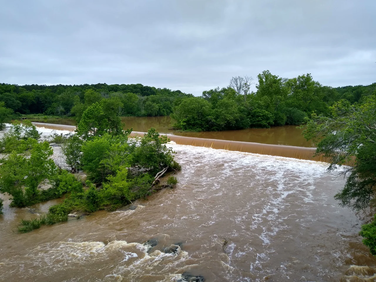

Haw River
The river's name is older than English. The Catawban word sakyapha means foothill, from sak for hill and yapha for step, and the Sissipahaw people who lived along its banks used some shortened form of it long before the English botanist John Lawson wrote it down as the Hau River in his 1709 A New Voyage to Carolina. By the time the colonists arrived, the Sissipahaw were nearly gone, and the river that carried their name kept running anyway - 110 miles of Piedmont water rising near Kernersville, looping around Greensboro to the north, then turning southeast to feed Jordan Lake and finally, below the dam, joining the Deep River to make the Cape Fear.
How the Water Falls
The Haw rises high in Forsyth County, just north of Kernersville near the Guilford line, and flows northeast. It crosses the corner of Rockingham County, passes through Haw River State Park above Greensboro, then bends southeast through Alamance County - past Ossipee, north of Burlington, through the namesake town of Haw River - and is joined by Great Alamance Creek at Swepsonville. Saxapahaw is downstream from there. South of Saxapahaw the river forms a watery border between Orange and Chatham counties before dropping into Jordan Lake, the reservoir created by damming the Haw and New Hope Creek. Below the dam, four more miles and the Haw becomes the Cape Fear.
Mills on the Fall Line
The Piedmont gives water enough drop to turn a wheel, and from the 1850s onward the Haw turned plenty of them. The first dam went in at Saxapahaw. Glencoe, Granite Mills, Indian Valley, Altamahaw, Swepsonville, Puryear, Bynum, B. Everett Jordan - the river is studded with dams, some still standing, some breached, one (Granite Mills) removed in 2016. Alamance Plaids, the bright cotton check that became a national fashion in the 1800s, were developed near Glencoe. The cloth from these mills helped Alamance County rebuild after the Civil War. The mills also defined the towns around them - mill villages of small houses, company stores, churches built within walking distance of the spinning rooms.
Poisoning, and Patience
Industry that built the river towns also nearly killed the river. Twentieth-century textile dyes and finishing chemicals went into the Haw because the mills were on the bank, and for decades the water ran in colors no fish should swim through. The decline of the mills reduced the load, but suburban nutrient runoff and sediment kept the river under pressure. Cleanup has been a slow argument among environmental groups, local governments, and economic interests. The Jordan Lake Rules, recently revised, tightened the regulatory limits. Most stretches now test clean enough for recreation and water supply. The combined Durham wastewater treatment plant keeps Jordan Lake itself within limits except in occasional shallow upper-pool conditions, when normal flow dilutes the excess back down. Ten percent of North Carolina's population lives in the Haw River watershed.
The Trail and the Wine
The Haw River Trail, formally undertaken by local governments and private groups in 2006, is the modern restoration in physical form. A combined land trail and paddle trail will eventually connect Haw River State Park to Jordan Lake State Recreation Area, with the land portion stitched into the broader North Carolina Mountains-to-Sea Trail. There is also a wine trail - the Haw River Valley has turned into a respected grape-growing region, with wineries clustered along the river in Guilford and Alamance Counties. Towns that once smelled like dye now smell of fermenting Cabernet Franc. Indian Valley, Town and Country, Swepsonville River Park, Great Bend at Glencoe - the river has more public parks along it now than at any point in the last century.
Wildlife and the Long Future
Blue herons stalk the shallows. Beavers cut willows along the banks and rebuild their dams every spring. White-tail deer ford the river at dusk; river otters fish the deeper pools; bluegill and bream rise to dry flies in summer. None of this was guaranteed forty years ago. The Haw River Assembly, founded in 1982, has spent four decades arguing with regulators, mill owners, and developers over what the river is owed. The water that comes out of Jordan Lake's tap into the kitchens of Cary and Apex starts as Haw River runoff. The Sissipahaw who named the river would still recognize most of its bends. They would not recognize the towns. But the foothills still step down into the floodplain the way their language described them - one step at a time.
From the Air
The Haw River runs roughly from 36.20N, 80.05W (headwaters near Kernersville) to 35.62N, 79.05W (confluence with Deep River below Jordan Lake). The river is best traced from 3,000 to 5,000 ft AGL with the long axis running northeast-to-southwest. Notable visual landmarks: the Saxapahaw mill complex; Jordan Lake's broad reservoir with the B. Everett Jordan Dam; the meander tightening through Alamance County. Nearest airports: Greensboro-Piedmont Triad (KGSO) over the headwaters area, Burlington-Alamance Regional (KBUY) over the middle reach, Raleigh-Durham (KRDU) east of Jordan Lake, Siler City Municipal (KSCR) near the confluence. Field elevation along the river ranges from about 800 ft MSL at the headwaters to 200 ft at the Cape Fear confluence.
Nearby Stories
- Bentonville Battlefield 7.3 km away
- Research Triangle Park 7.8 km away
- Johnston County, North Carolina 8.8 km away
- Tobacco Road 13 km away
- Pope Field 20 km away
- North Carolina Aviation Museum 40 km away
- Rockingham Speedway 42 km away
- Cherry Hill Plantation 53 km away