
Hellhole
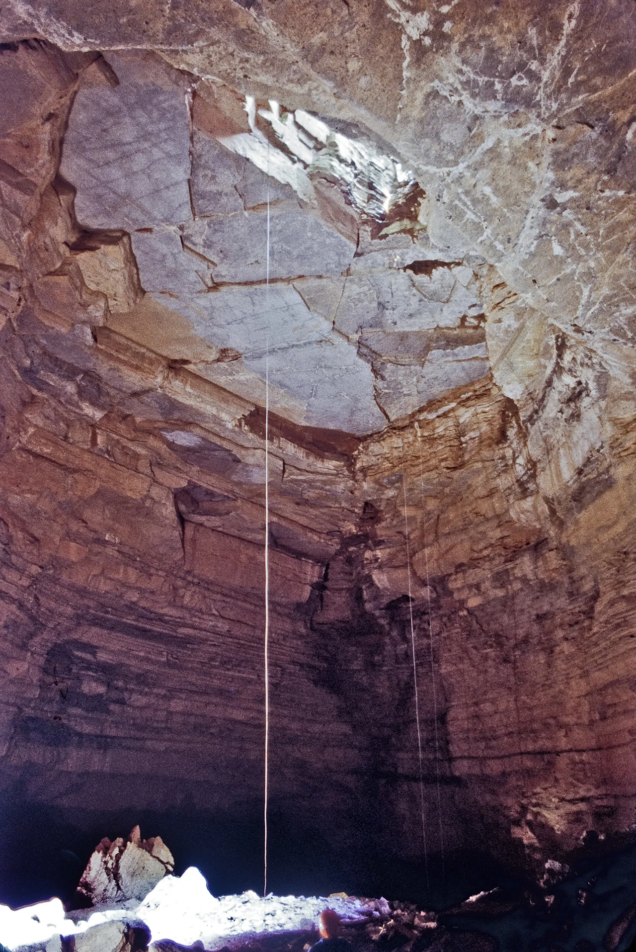
The entrance to Hellhole is a funnel-shaped pit in the lower slope of North Fork Mountain. To get in, you tie off a rope and rappel 154 feet straight down into a vast chamber. From there, the cave opens into more than 42 miles of mapped passage - the seventh longest cave in the United States, the deepest cave in West Virginia at 737 feet, and one of the most consequential places in the world for endangered bats. Hellhole holds about 9,000 Virginia big-eared bats - roughly 45 percent of the entire global population. It holds another 9,000 endangered Indiana bats. It holds over 100,000 little brown bats. And the limestone walls that make Hellhole what it is sit next to an active quarry, separated by buffer zones that exist only because cavers managed to map enough cave to define them.
Why Hellhole Is Cold
Most West Virginia caves sit at about 57 degrees Fahrenheit. Hellhole averages 47 degrees - ten degrees colder than its peers. That difference is what makes the cave a globally significant bat hibernaculum. Bats hibernating at temperatures too warm burn through their fat reserves faster than they can survive until spring. At 47 degrees, the Virginia big-eared bat can hold its winter metabolism low enough to make it through. The cold is not random. Hellhole sits at the bottom of an enclosed valley - Germany Valley - with only one entrance. Cold air flowing off North Fork Mountain in winter drains into the cave. Once inside, the cold air has no way to escape. It pools in the massive passages, filling them like water in a sink. The phenomenon is called a cold-air trap, and it makes Hellhole exceptional. It also makes the cave brutally vulnerable to anything that might breach its walls below entrance elevation.
Where Caving Techniques Were Invented
Hellhole and the broader Germany Valley cave systems were central to the founding of the National Speleological Society in the early 1940s. Many of the techniques that modern cavers take for granted were developed or refined at Hellhole's 154-foot entrance drop. The single rope technique - a method of rappelling and ascending on a single line without a backup rope - was largely developed here. Generations of cavers learned vertical work, navigation, and survey methods in Hellhole's enormous passages. By the 1980s, cavers had mapped about 8.5 miles of the system. Then, in 1986, the Greer Limestone Plant in Riverton leased the entrance from the private landowner. By 1988, access was largely closed. The bi-annual bat counts by the West Virginia Division of Natural Resources continued, but exploration paused for a decade.
Krause Hall and the Hidden Cave
What happened between 1995 and 1997 changed everything. Limited mapping resumed, and cavers discovered Krause Hall in the extreme northwest portion of the system. In 1996, exploration reached more than 400 feet below the entrance elevation. In 1997, a breakthrough discovery extended the known cave well to the south of its previously documented range. The historically known portions of Hellhole turned out to be a side passage off a much larger system. The implications were immediate. Greer's no-blast buffer zone of 500 feet from 'known' cave passages was suddenly inadequate. The cave had been much bigger than the buffer assumed. Greer responded by halting further exploration. Cavers responded by petitioning federal and state regulators. In 2002, after extended negotiations, the U.S. Fish and Wildlife Service, state agencies, caving organizations, and Greer agreed to the Germany Valley Karst Survey, a formal contract to map the cave's full extent.
The 16-Week Window
Because Virginia big-eared bats and Indiana bats are federally endangered, all survey work in Hellhole must happen within a 16-week summer window when the bats are not hibernating. Disturbing hibernating bats can cause them to use stored energy reserves and die before spring. Within that compressed timeframe, GVKS members surveyed more than 12 miles of new passage between 2002 and 2005. They established Hellhole as the deepest cave drop in West Virginia at 265 feet. Subsequent expeditions through 2015 extended the figures to 42 miles of mapped passage and 737 feet of depth. The GVKS-Greer contract ended in 2007. The cave's full extent is still not known. Each year of surveying, when permitted, has added passage. The mapping has informed regulatory decisions about where the quarry can expand and where it cannot.
White-Nose Syndrome and What Comes Next
In 2010, the West Virginia Division of Natural Resources documented white-nose syndrome in Hellhole - the fungal disease that has devastated bat populations across North America since the late 2000s. The survey that year counted 66,789 bats, a 40 percent decline from 2007. Most of the losses were in little brown bats. The disease, caused by Pseudogymnoascus destructans, disrupts hibernation and dehydrates infected bats. There is no cure. The Virginia big-eared bats at Hellhole have so far been less affected than the little brown bats, but the species remains vulnerable. Hellhole today is a cave under multiple threats: the quarry next door, the disease in its bats, and the broader pressures of climate change on the cold-air trap that makes the cave possible. The Germany Valley Cave Millipede and Luray Caverns Blind Cave Millipede - rare invertebrates - also live here. The cave is the 38th longest in the world. It is also a fragile, irreplaceable refuge.
From the Air
Located at 38.77 degrees north, 79.38 degrees west, in Germany Valley, Pendleton County, West Virginia. Best viewed from 4,000 to 5,500 feet AGL. The cave entrance is on the lower slopes of North Fork Mountain, near the Greer Limestone Plant - look for the active limestone quarry and the village of Riverton to the west. Cave access is restricted; the entrance is private property. Nearest airports are Grant County (KW99) and Elkins-Randolph County (KEKN). The valley itself is a clear visual landmark, with North Fork Mountain to the east and the River Knobs to the west.
Nearby Stories
- Reddish Knob 4.9 km away
- Allegheny Front 5.8 km away
- Randolph County 6.1 km away
- Green Bank Observatory 7 km away
- Battle of New Market 13 km away
- Barbour County, West Virginia 21 km away
- Rapidan Camp 29 km away
- Willa Cather Birthplace 46 km away