
Îles de Los
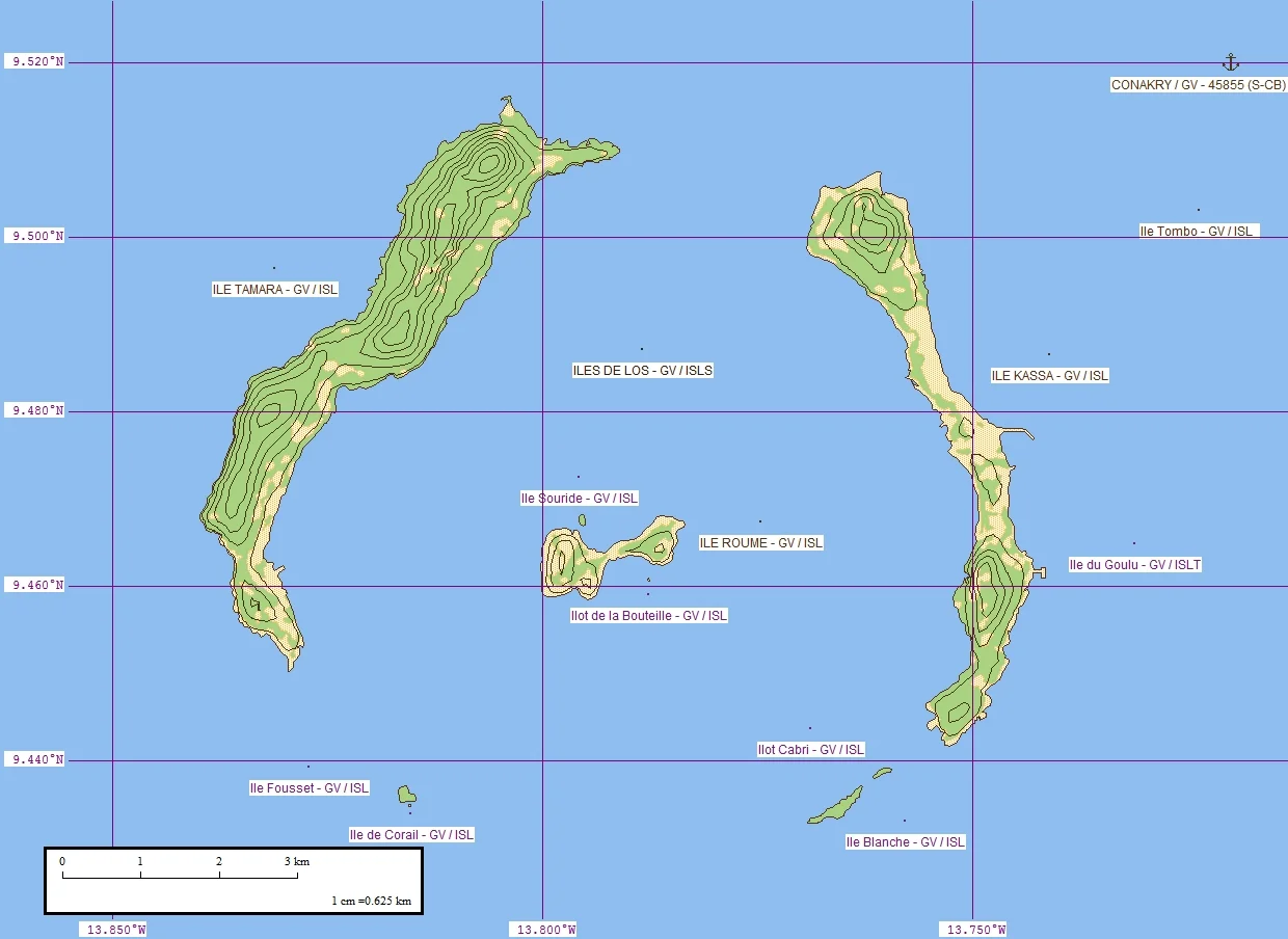
The Portuguese who first charted them called them the Ilhas dos Ídolos - the islands of the idols - and over the centuries sailors mangled the name into a dozen forms: the Isles of Loss, the Edlesses, Las Idolas, and finally simply Los. Scattered just off Conakry, these green islands ringed by beaches look like nothing more than a pleasant weekend escape. Their shape, though, gives away a deeper story. Seen from above, the archipelago curves in a broken ring - the worn rim of something that once burned.
The Ring of an Ancient Volcano
That ring is no accident of the coastline. The Îles de Los are the eroded remains of a volcanic structure, a mass of molten rock that pushed up into the sediments of the West African shelf during the Cretaceous Period, as the South Atlantic was tearing open and Africa drifting away from the Americas. The same upheaval raised nearby Mount Kakoulima on the Guinean mainland and the hills around Freetown down the coast. The islands are built largely of syenite, an uncommon coarse-grained rock found in only a handful of places on Earth - among them the Monteregian Hills of Quebec and the Ilímaussaq complex in Greenland. To walk these beaches is to stand on the stump of a vanished mountain of fire.
Factory Island
The islands have been inhabited for a very long time; a group of Baga people once spoke the Kalum dialect of the Baga language here. Their quiet was broken by commerce of the cruelest kind. In 1755 the English merchant Miles Barber, of the African Company of Liverpool, set up a trading post on Kassa - a 'factory,' in the language of the era - staffed with men skilled at ship repair and pilots who knew the local rivers. The name stuck: Kassa became 'Factory Island.' What was traded here, alongside the ship's stores, were human beings. The Îles de Los rose to prominence as a node in the Atlantic slave trade, a waypoint where captured Africans were held, sold, and loaded for the crossing. The pretty harbours were working machinery in an apparatus of suffering, and the people who passed through them were not commodities but stolen lives.
The First Man Tried
By the early nineteenth century the law had begun, slowly, to turn. In 1812 a Dutch slave trader named Samuel Samo was seized by the British on these islands and carried to Freetown to face the Vice Admiralty Court. He has a grim distinction: he was the first person ever tried under Britain's Slave Trade Felony Act of 1811, which made the trafficking of human beings a serious crime under British law. The trial unfolded against a wider effort, soon formalised in the 1818 Anglo-Dutch treaty that created mixed international courts to prosecute the trade. The machinery of empire that had built the factories was, at last and unevenly, being turned against them - though for the tens of thousands already carried away, justice came far too late.
Traded Between Empires
On 6 July 1818, Charles MacCarthy, Governor of Sierra Leone, signed a treaty with a local ruler named Mangé Demba, and the islands passed to the British Empire in exchange for an annual rent. MacCarthy promptly dispatched a surgeon of the West India Regiment to write up the islands and their hinterland, published as Travels into the Baga and Soosoo Country. Britain held the Los for the better part of a century. Then, in July 1904, as the colonial map of West Africa was redrawn, it handed them to France - and the islands, sitting directly opposite the French colonial capital of Conakry, were folded into French Guinea. Scipio O'Connor became their first French administrator. Today the islands belong to independent Guinea, their lighthouse on Tamara still turning, their old prison long abandoned, their layered history written into the rock itself.
From the Air
The Îles de Los lie at approximately 9.46°N, 13.80°W, just southwest of Conakry, Guinea, in the Atlantic. From altitude the archipelago reads as a distinctive broken ring of three main islands - Tamara (Fortoba), Kassa, and Roume - trailed by smaller islets to the south, an obvious coastal waypoint. Conakry-Gbessia International Airport (ICAO: GUCY) sits on the mainland peninsula just to the northeast. The Île Tamara Lighthouse is a useful visual marker. Recommended viewing altitude 3,000-6,000 ft. Best visibility falls in the December-April dry season; the harmattan wind can haze the coast in the early part of the day, and the wet season brings heavy monsoon cloud.
Nearby Stories
- Pongo River (Guinea) 47 km away
- Kindia 70 km away
- Bunce Island 73 km away
- King's Yard 102 km away
- Sierra Leone River 102 km away
- Poilão 195 km away
- João Vieira and Poilão Marine National Park 223 km away
- Rocas Atoll 2590 km away