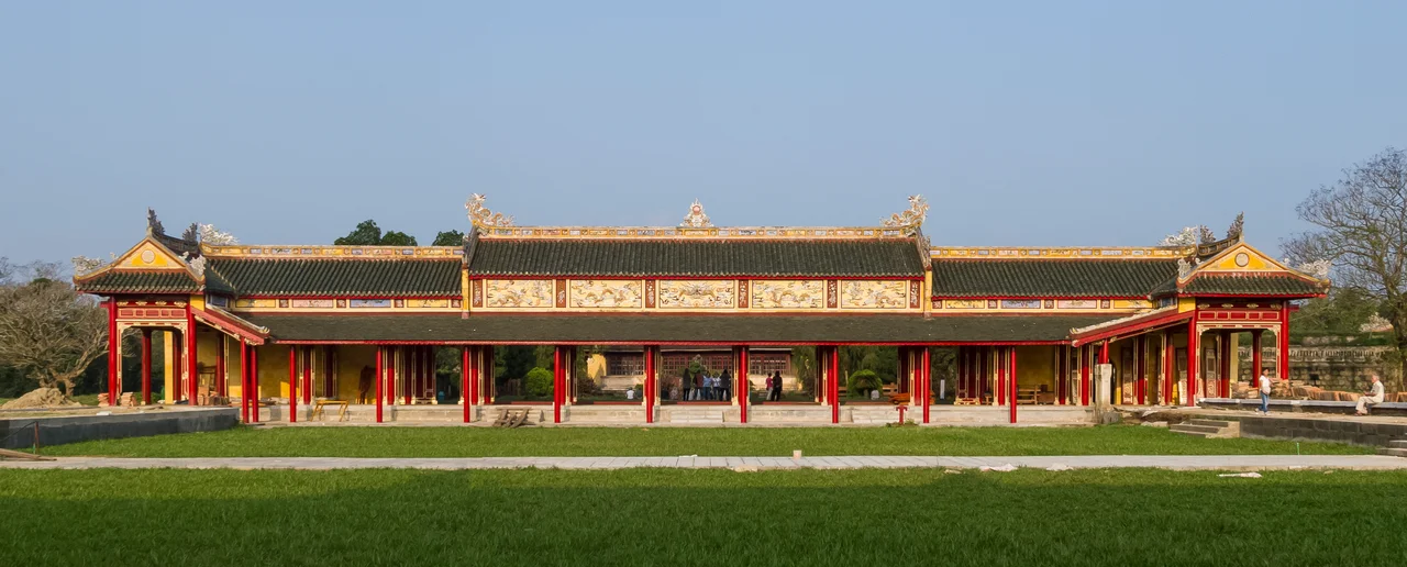

Imperial City of Huế
In June 1802, a man who had spent years in exile and then decades fighting to reclaim his country's throne ascended as Emperor Gia Long, ruler of a unified Vietnam stretching from the Red River Delta to the Mekong. His first act of permanence was to build a capital worthy of that reunification. He consulted geomancers, chose a site on the north bank of the Perfume River where two small islands flanked the approach like guardian symbols — the Azure Dragon to the left, the White Tiger to the right — and ordered the construction of a citadel modeled on Beijing's Forbidden City. The result was the Imperial City of Huế, seat of the Nguyễn dynasty for nearly 150 years, and now one of Vietnam's most significant UNESCO World Heritage Sites.
Walls Within Walls
The architecture of Huế's Imperial City is a system of containment. The outer citadel — Kinh thành — has a circumference of nearly 10 kilometers, its walls 6.6 meters high and 21 meters thick, zigzagging in Vauban style with forts at intervals and artillery positions throughout. Inside that sits the Imperial City itself, enclosed by walls 2.5 kilometers in perimeter. Inside the Imperial City, another enclosure: the Purple Forbidden City, accessible only to the imperial family and their closest attendants.
Tens of thousands of workers built this over thirty years under the first two emperors, moving millions of cubic meters of earth and stone. The moat water was routed from the Perfume River through a series of sluice gates, creating a living defensive system. The entire complex was oriented toward the river to the southeast — a deliberate departure from Beijing's true-south orientation, adapted to the local geography and geomantic conditions of this particular bend in the river.
Power and Its Symbols
Every element of the citadel expressed imperial power through symbol. Nine bronze cannons — cast in 1803 from the melted-down weapons of the defeated Tây Sơn dynasty — were installed at the citadel's front. Emperor Gia Long awarded them the rank of "Invincible General of the Gods" in 1816, and their titles were engraved directly into their barrels: Spring, Summer, Autumn, Winter, and the five elements. The court assigned officers to guard them. The emperors held solemn worship ceremonies in their honor. These nine cannons, recognized as a National Treasure of Vietnam in 2012, were a statement: the old enemies were literally transmuted into instruments of the new dynasty's authority.
The flag tower — Kỳ Đài — stood at the citadel's center, its three-tiered stone base rising 17.5 meters before the flagpole itself added another 20. On August 23, 1945, after Emperor Bảo Đại's abdication, the flag of the Nguyễn dynasty came down and the red flag with yellow star of the Democratic Republic of Vietnam was raised in its place. The moment was watched by a city that had lived under imperial rule for 143 years.
The Costs of Geography
Critics of Huế as a capital — including British Ambassador John Crawfurd, who visited in 1822 — pointed out its vulnerabilities: too far from both the Red River Delta in the north and the Mekong in the south, too exposed on the coast, too dependent on supplies that could be cut off by hostile navies. The Nguyễn emperors were aware of these problems. But Phú Xuân, as Huế was formally known, had been the seat of the Nguyễn lords since the 16th century. Moving the capital to Hanoi risked inflaming the northern population, where loyalty to the previous dynasty had not fully dissolved.
This geographic compromise would prove costly. When France moved against Vietnam in 1883, it cut off Thuận An estuary just as Crawfurd had predicted — exactly how he said it could be done — and Huế fell. The French colonial government established their offices inside the citadel's northern quarter, the only foreigners ever permitted to reside within the walls. The emperors continued to reign in ceremony, but power had shifted outside the walls.
Survival and Loss
The 20th century was unkind to the Imperial City. Neglect, termites, typhoons, and the humidity of Central Vietnam all took their share of the complex's hundreds of buildings. But the worst damage was human. On the morning of January 31, 1968, as part of the Tet Offensive, a division-sized North Vietnamese and Viet Cong force seized most of Huế and occupied portions of the citadel. The Battle of Huế lasted 26 days of brutal, close-quarters fighting. U.S. Marine commanders were initially ordered not to bomb the historic structures. As casualties mounted in street-by-street combat, those restrictions were progressively lifted.
When the battle ended, 150 of the citadel's 160 buildings had been destroyed or severely damaged. Only 10 major sites remained, among them the Thái Hòa Palace and Thế Miếu ancestral temple. The bullet holes are still visible in the walls. The complex was designated a UNESCO World Heritage Site in 1993, and restoration has continued since — painstaking work on what was once the seat of a dynasty, and now stands as evidence of both the grandeur it achieved and the destruction it survived.
What Remains
Walking through what survives today, the scale of the original ambition is still legible. The Meridian Gate — Ngọ Môn — anchors the southern approach with its Five-Phoenix Pavilion and imperial yellow roof tiles. The Phu Văn Pavilion, where examination results were posted and edicts displayed, still stands near the flag tower. The Long An Hall, now the Hue Royal Antiquities Museum, holds objects rescued from what was lost. The Tịnh Tâm Lake, once a retreat for emperors, still reflects the sky.
Abdications, occupations, battles, and restoration efforts have layered themselves over the original vision Gia Long brought here in 1802. The city he built to anchor a unified Vietnam outlasted the dynasty that built it, survived a war that destroyed most of it, and is slowly — brick by brick, tile by tile — being brought back toward the form it once held.
From the Air
The Imperial City of Huế sits at approximately 16.47°N, 107.58°E on the north bank of the Perfume River (Sông Hương), roughly 13 kilometers inland from the coast. From altitude, the citadel's distinctive square-within-square layout is visible — the outer walls forming a nearly 10-kilometer perimeter square, with the Imperial City's smaller enclosure visible within. The Perfume River sweeps past the citadel to the south. The Hai Van Pass is visible to the southeast where the mountains meet the sea. Nearest airport: Phu Bai International (VVPB), approximately 14 kilometers southeast of the citadel. At lower altitudes, the moat surrounding the inner walls is clearly visible, as is the flag tower rising from the citadel's southern face. Recommended viewing altitude: 3,000–5,000 feet for the full citadel geometry.
Nearby Stories
- The Rockpile 9.4 km away
- Operation Texas Star 19 km away
- Bà Nà Hills 21 km away
- Quảng Trị Citadel 24 km away
- Lăng Cô 26 km away
- Battle of Nam Dong 30 km away
- Saravan 65 km away
- Hainan Island Incident 378 km away