
Inchaffray Abbey
On 23 June 1314, the night before Bannockburn, Abbot Maurice of Inchaffray walked the lines of the Scottish army carrying the relics of St Fillan. The Scots were outnumbered, and Edward II's English host lay across the burn waiting for morning. Maurice came from a small abbey in a marshy patch of Strathearn, midway between Perth and Crieff, surrounded by water and famous for eels. By the next afternoon Robert the Bruce had won the most important battle in Scottish history, and the abbot of Inchaffray had a place in the national story that the abbey itself would never lose, even after time reduced it to a single gable-end wall.
Island of the Offerings
The name puzzles modern Gaelic speakers. Folk etymology says Inchaffray comes from innis abh reidh, the island of the smooth water, which sounds plausible until you find the earliest Latin form: Insula missarum, the island of the masses. In Gaelic the mass is oifrend, in Welsh offeren. The name actually means the island of the offerings. Before drainage, the abbey stood on rising ground that was a true island most of the year, ringed by marsh and pools thick with eels. A community of clerics called the brethren of St John of Strathearn had been here since the 1190s, drawn perhaps by the same isolation that earlier hermits sought. In 1200 Gilbert, Earl of Strathearn, and his wife Maud d'Aubigny upgraded the existing community into a priory in memory of their first-born son Gilchrist, who had been buried there in 1198. By 1221 it was a full abbey, and Inchaffray began its rise.
Rich, Then Poor
In 1275, the Scottish church was assessed for a crusading tithe. Inchaffray's annual income came in at 246 pounds, fourth among all Augustinian houses in Scotland, exceeded only by St Andrews, Scone, and Holyrood. The abbey's lands and dependent churches reached across the country, from Uist in the west to Balfron in the south. To improve its marshland holdings, the monks ordered the digging of the Pow of Inchaffray, a nine-mile drainage ditch that still carries water out of the basin today. Then the slow decline came. By 1561, just before the Reformation swept Scotland's monasteries away, Inchaffray's income was assessed at 667 pounds, now the third lowest of the Augustinian abbeys in the kingdom. Five years before that, in 1556, the abbey had already been turned into a secular lordship for a Drummond, and the monastic life that had defined the island for three and a half centuries was finished.
Bannockburn and Flodden
The abbots of Inchaffray were political figures as much as religious ones. Maurice, who blessed the army at Bannockburn, carried the relics of St Fillan, a saint particularly associated with the Bruce family. Two centuries later, in 1514, the commendatory abbot Laurence Oliphant marched south with James IV's army and died at Flodden, the catastrophic defeat that killed the king and a generation of Scottish nobles in a single afternoon. Oliphant came from a notable Strathearn family, and his death in English mud is a small part of the larger ruin that Flodden inflicted on the country. James VI later visited the lay holder of the abbey lands, James Drummond, on 5 October 1601, and the property eventually passed to the Earls of Kinnoull, who held it as ordinary estate.
A Road Through the Ruins
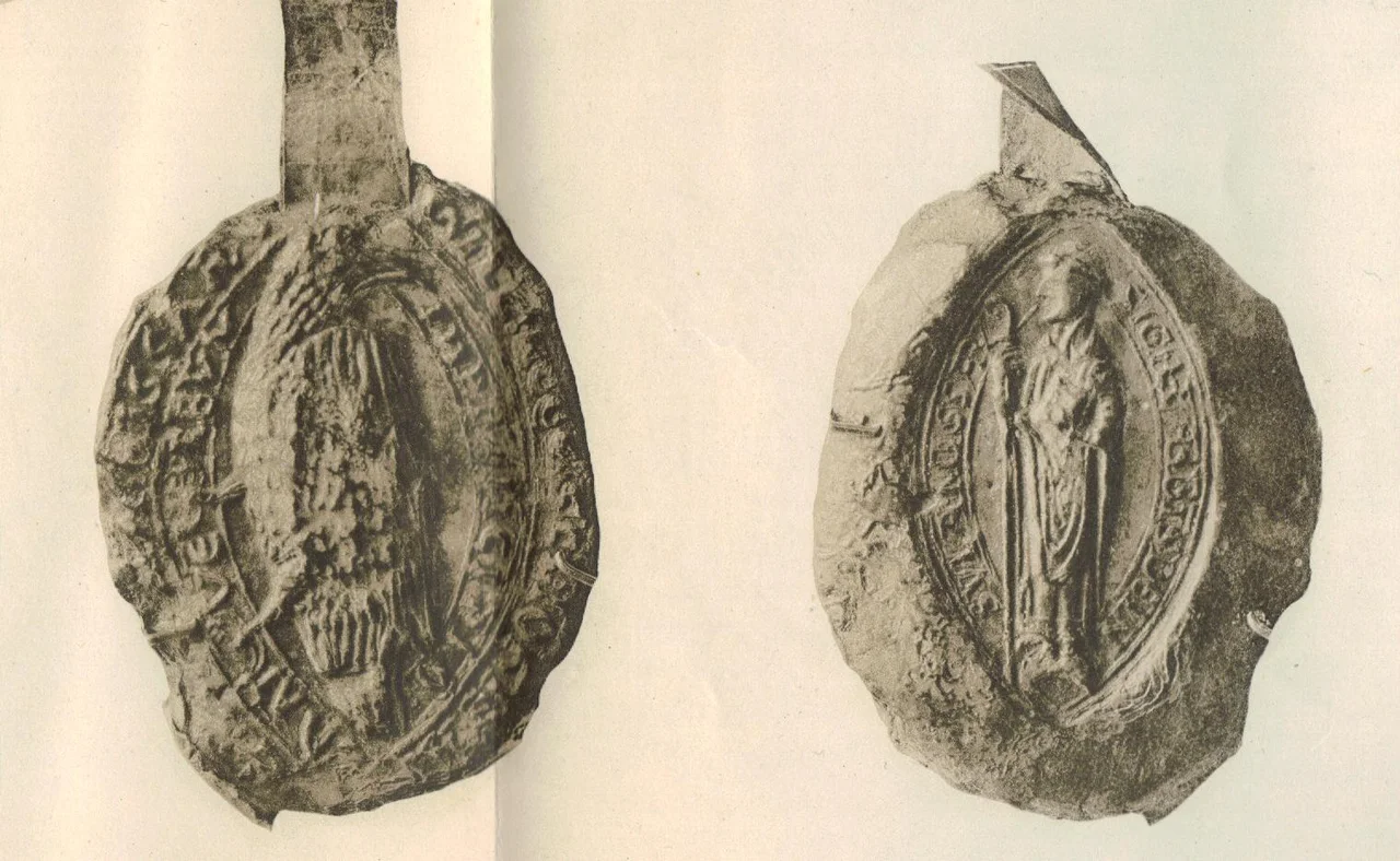
In 1816 a road was driven straight across the abbey site, demolishing most of what remained. The destruction is hard to picture from the surviving photograph of the ruins as they appeared in 1794: still substantial walls, a recognisable abbey footprint, monuments and burial markers. After the road came through, almost none of that survived. Today a single gable-end wall stands on private land, visible from the public road but not approachable. The ruins are a scheduled monument, the surrounding fields still drained by the abbey's own nine-mile ditch. The seal of Inchaffray, recovered late in the 13th century, sits in the British Museum, a two-sided pendant showing the abbey at its medieval height. The abbots who once ranked with Scotland's greatest churchmen are reduced to that single fact: one wall, one ditch, one small carved seal, and the memory of a blessing given the night before Scotland's most famous victory.
From the Air
Inchaffray Abbey lies at 56.38 degrees N, 3.70 degrees W, midway between Perth and Crieff in Strathearn near the village of Madderty. Recommended viewing altitude 2,000 to 3,000 feet AGL. The Pow of Inchaffray drainage ditch traces a long straight line through the surrounding farmland and is easier to spot from the air than the ruins themselves. Nearest airport is Perth/Scone (EGPT) approximately 7 nm east-northeast. Dundee (EGPN) lies about 30 nm east. Crieff sits about 4 nm to the west. The Ochil Hills rise to the south. Best viewed in slanting light when the dark line of the medieval ditch contrasts with surrounding fields.
Nearby Stories
- Culross Abbey 4.5 km away
- Inner Tay Estuary 5.8 km away
- Airlie Castle 6.1 km away
- Lochearnhead 6.8 km away
- Pitlochry Festival Theatre 11 km away
- Union Canal (Scotland) 12 km away
- Mugdock Castle 14 km away
- Rannoch Railway Station 24 km away