
Inverness-shire
In 1955 the United Kingdom claimed a small uninhabited islet called Rockall, jutting alone out of the North Atlantic 301 kilometres west of St Kilda. Under the Island of Rockall Act 1972, Westminster assigned the rock to the Harris district of Inverness-shire. Ireland still disputes the claim. The decision tells you something about Inverness-shire, the largest historic county in Scotland and the second largest in the United Kingdom: only Yorkshire ever exceeded it in land area. From Ben Nevis to St Kilda to a contested rock most of the way to Iceland, this single county once contained more wild geography than any other unit of British local government.
The Province That Was Almost a Kingdom
The mainland portion of Inverness-shire is built on the bones of the medieval Province of Moray. For most of the early medieval period, Moray's earls or mormaers ruled this territory as something between a vassal of the Scottish crown and a separate kingdom. The crown finally absorbed Moray during the 12th century, and to enforce its authority it divided the province into shires administered by royal sheriffs. Inverness-shire emerged as one of these shires, swallowing the subordinate lordships of Badenoch and Lochaber on the way. The sheriff of Inverness was also given nominal authority over the unsubdued territories of Ross and Caithness to the north, an absurdly large remit for one administrator on horseback.
Mountains, Lochs and Ben Nevis
The county is split in two by the Great Glen, a roughly 60-mile fault running southwest to northeast. The glen separates the Northwest Highlands to the west from the Grampian and Monadhliath Mountains to the east. Loch Ness, Scotland's second-largest lake and deepest by volume, sits along the fault, joined to Loch Oich and Loch Lochy by the Caledonian Canal. East of Fort William rises Ben Nevis, at 1,345 metres the highest mountain in Britain. The west coast is a fretwork of long sea lochs and peninsulas: Glenelg, Loch Hourn, Knoydart, Loch Nevis, Morar, Loch Ailort, Moidart. Inland are dozens of lochs, many now used as hydroelectric reservoirs. The terrain is generally mountainous and emptier of people than almost anywhere else in lowland Europe.
The Islands Out West
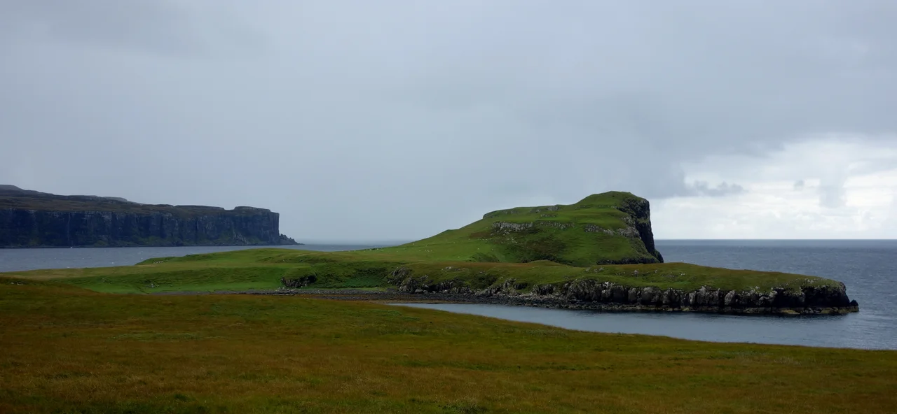
Inverness-shire reaches well past the mainland. Skye, the second-largest island in Scotland, lies just offshore across the Sound of Sleat and was part of the county until 1975. Across the Little Minch, most of the Outer Hebrides belonged to Inverness-shire, with the notable exception of Lewis, which went to Ross-shire. Further west still lie the St Kilda archipelago, evacuated in 1930 when its small population voted to leave the lonely cliffs and seabird colonies; the islands have been uninhabited ever since. The Small Isles of Eigg, Rum, Canna and Muck became part of Inverness-shire after the 1891 parish review put the whole Small Isles parish in one county. Out beyond everything floats Rockall.
An Administrative Memory
Inverness-shire stopped functioning as a local government unit in 1975, when the UK reformed Scottish local government into regions and districts. The mainland and the Inner Hebrides were folded into the Highland Region; the Outer Hebrides portions became the Western Isles, now Na h-Eileanan an Iar. A second reform in 1996 abolished the regions and turned Highland into a single council area, the largest in Scotland by land area. But the historic county boundaries did not vanish. They survive as a registration county for land records, and as the basis of the Inverness lieutenancy area, which still appoints a Lord Lieutenant on behalf of the Crown. The motto on the old county arms is in Gaelic: Air son Math na Siorrachd, for the good of the county.
Where the Land Runs Out
Three towns once held burgh status here: Inverness on the Moray Firth, Fort William at the southern end of the Great Glen, and Kingussie in Strathspey. Everywhere else is small, scattered, often empty. Barra Airport in the Outer Hebrides is famous within aviation circles as the only scheduled airport in the world that uses a tidal beach as its runway. The Highland Main Line carries trains from Perth to Inverness through Kingussie and Aviemore. The West Highland Line runs to Mallaig past Fort William. The county that once stretched from Ben Nevis to Rockall is gone administratively. The land is still there. So is the silence.
From the Air
Historic Inverness-shire covers a vast area of the Scottish Highlands, with the city of Inverness at 57.48 N, 4.22 W as its administrative heart. The Great Glen Fault bisects the mainland portion. Inverness Airport (EGPE) is the main commercial airfield at Dalcross. Other airports within the historic county include Benbecula (EGPL) in the Outer Hebrides and Barra (EGPR), notable for its beach runway. From cruising altitude the mainland presents long sea lochs cutting deep into mountain ranges, Ben Nevis prominent west of Fort William, and the lochs of the Great Glen lined up southwest to northeast. Weather changes rapidly off the Atlantic; mountain wave is common.
Nearby Stories
- Cannich wildfire 1 km away
- Corrour railway station 3.9 km away
- Highland Folk Museum 7.7 km away
- Lochalsh 11 km away
- Tomatin distillery 14 km away
- Battle of Glen Shiel 15 km away
- Falls of Bruar 17 km away
- Strontian 20 km away