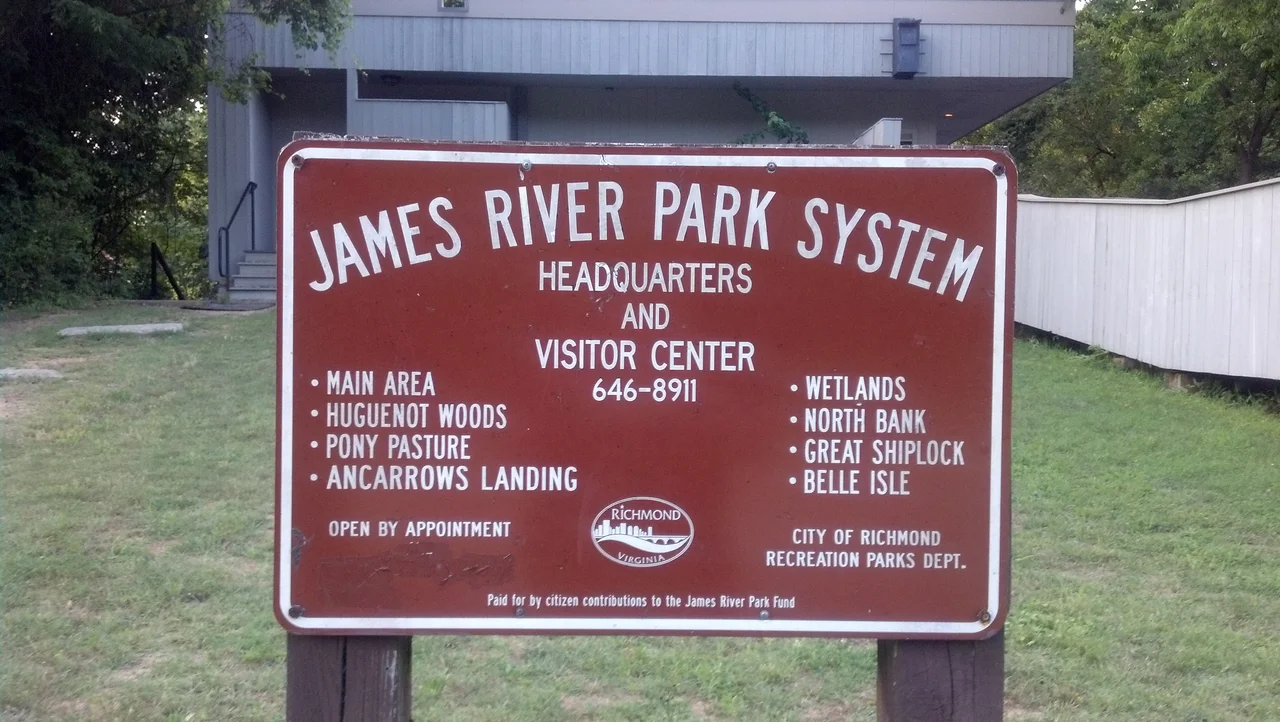

James River Park System
In 1965, a Richmond scout leader named Joe Schaefer wanted to take his troop camping on an island in the James River. He couldn't get permission. So he and his old roommate from Virginia Military Institute spent the next year identifying a two-mile stretch of riverfront property and arranging its donation to the City of Richmond as a public park. That 380-acre tract, donated in 1966, became the first piece of what is now the James River Park System - over 600 acres of land threaded along both banks of the James from the Huguenot Memorial Bridge in the west to a half mile past the I-95 bridge in the east. JRPS is the rare American urban park where the founding act was not a millionaire's bequest or a planner's grand design but a frustrated scoutmaster's stubbornness.
From Donation to System
Richmond formally created the James River Park System in 1972, stitching Schaefer's gift together with other donated parcels. The river it ran through was not, at the time, in good shape - decades of industrial discharge had left both banks neglected and the water carrying more than it should. The transformation of JRPS into the park Richmond knows today is largely the work of Ralph White, a former Peace Corps volunteer and National Park Service employee hired by the city in 1980. White spent thirty-two years as manager, mobilizing volunteer cleanups, courting community groups, and slowly turning what had been an industrial corridor back into a working river ecosystem. He retired in January 2013 and was succeeded by Nathan Burrell. In May 2009 a conservation easement was placed on parcels of the system, held jointly by the Virginia Department of Conservation and Recreation, the Capital Region Land Conservancy, and the EnRichmond Foundation - the legal instrument meant to keep what Schaefer started from being undone by some future development pressure.
Whitewater Through Downtown
What makes JRPS genuinely unusual among American urban parks is the river itself. The James drops through downtown Richmond in a series of rapids that range from quiet wave trains to legitimate Class III and Class IV whitewater. Pony Pasture Rapids, near the western end of the park, is the city's beach and tubing playground - warm summer water, gentle ledges, the kind of place where a family can spend a Sunday afternoon. Move downstream and the rapids escalate. Belle Isle, reached by a pedestrian bridge slung beneath the Robert E. Lee Memorial Bridge, sits in the middle of the harder whitewater. The Manchester Climbing Wall - a literal climbing wall on the surviving piers of a nineteenth-century railroad bridge - is one of the strangest features in any American park system. The Pipeline Trail walks the top of an actual sewage pipeline through the city's heron rookery. Great Shiplock Park preserves a piece of the old James River and Kanawha Canal.
Nineteen Sections
Some sources count nineteen distinct sections of the park, stitched along both banks of the river. From west to east: Huguenot Flatwater, the calm stretch between Bosher's Dam and Z Dam that draws kayakers, canoeists, and paddleboarders, with sandy beaches on Nash's Island and Channing's Island. Pony Pasture Rapids. The Wetlands. The Main Area, which includes 43rd Street, the Buttermilk Trail, the Reedy Creek Park Headquarters, and the 22nd Street access with its pedestrian crossing to Belle Isle. Manchester Climbing Wall. Ancarrow's Landing and Manchester Docks. Pumphouse Park and the North Bank Trailhead near Byrd Park. Texas Beach and the North Bank Trail near Maymont. The Tredegar Street put-in, named for the Confederate ironworks whose buildings now house the American Civil War Museum. The Pipeline Trail. Great Shiplock Park and Chapel Island. Each section has its own character. Together they make the river usable from Bosher's Dam all the way through downtown.
Still Growing
The park is not done. New parcels continue to be added; a major expansion effort was underway between 2024 and 2025, including a $4 million land donation along the Richmond Slave Trail - a piece of riverfront where enslaved Africans were marched up from the docks at Manchester to be sold at the Shockoe Bottom auction blocks. JRPS now lives at the intersection of conservation, recreation, and historical memory. It is the kind of park where a kayaker running rapids passes pedestrians walking through the rookery, where a family on the beach at Pony Pasture is upstream of a climber on a sandstone pier in the middle of the city. The single most important thing about it remains true: a public river runs through a public park through a city of nearly 240,000 people, and most days, somebody is using it for exactly the kind of recreation Joe Schaefer wanted his scouts to have.
From the Air
The park is centered around 37.53 N, 77.48 W, running along both banks of the James River through downtown Richmond from the Huguenot Memorial Bridge in the west to about a half mile beyond the I-95 James River Bridge in the east. Best viewed from 1,500-3,500 ft AGL. The whitewater rapids around Belle Isle and the Manchester Wall are most distinctive from above - look for the cluster of islands in the river immediately south of downtown. Richmond International Airport (KRIC) is 5-8 miles east-northeast depending on which park section; Chesterfield County (KFCI) is 5-8 miles south.
Nearby Stories
- Kings Dominion 8.4 km away
- Battle of Hatcher's Run 9.7 km away
- Francisco's Fight 14 km away
- Piney Grove at Southall's Plantation 17 km away
- Jamestown Settlement 19 km away
- Battle of Amelia Springs 22 km away
- Menokin 29 km away
- Highland (James Monroe House) 42 km away