.jpg)
Kalahari Desert
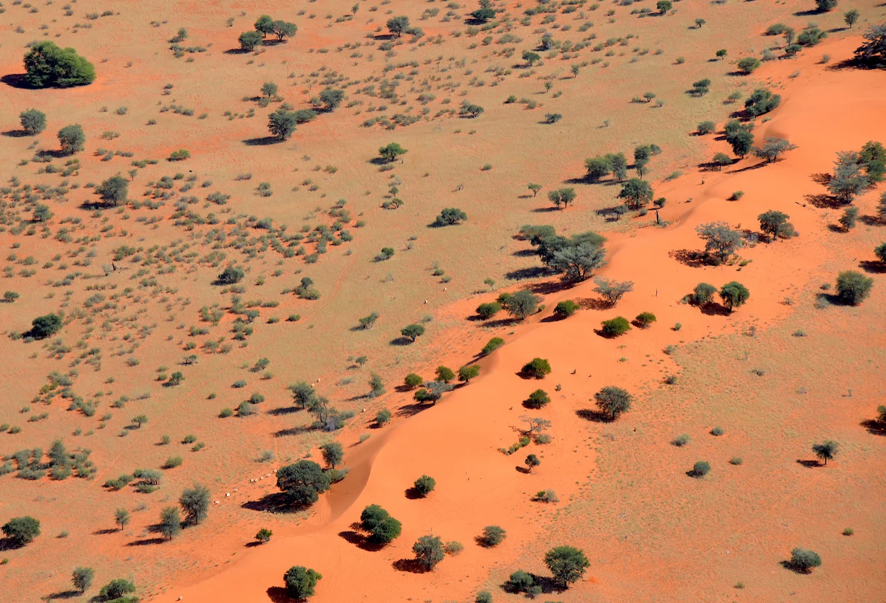
The name is a warning. Kgalagadi, the Tswana word that gave the Kalahari its name, means "a waterless place" - and a related word, Kgala, translates as "the great thirst." Yet anyone who calls this a true desert has not seen it after the rains. Grasses surge across the dunes, camelthorn trees throw long shadows, and herds of gemsbok move through country that, for eight months of the year, holds no surface water at all. The Kalahari is a paradox written across roughly 900,000 square kilometers of southern Africa: red sand to the horizon, and more living things than a desert has any right to support.
The Great Thirst
Stretch a hand into Kalahari sand and it runs through your fingers the color of rust, stained iron-red by the oxides that coat each grain. This is sand sea country, an erg, where ancient dunes have long since stopped moving and settled into low ridges. There are no rivers here that you can count on. The only permanent one, the Okavango, refuses to reach the sea at all - it spills instead into a vast inland delta in the northwest, drowning the sand in marshland that draws elephants and lions and ten thousand birds. Everywhere else, water is a rumor. It pools briefly in seasonal pans after a storm, then vanishes upward into the dry air, leaving cracked clay and the white crust of salt.
Not Quite a Desert
Geographers argue about whether the Kalahari deserves the name at all. By the strict definition - low rainfall - much of it qualifies. But a desert is also supposed to be bare, and across most of the Kalahari the ground is too well covered in grass and scrub to count. Only the southwest, in the parched heart of the Kgalagadi Transfrontier Park where Namibia, Botswana, and South Africa meet, opens into the kind of open emptiness people picture. The heat fits the legend - daytime temperatures can climb toward 45 degrees Celsius, and a thermometer at Twee Rivieren rest camp once read 44.8. Yet the Kalahari is gentler than the Sahara in one respect: it sits high, around a thousand meters, so even its hottest month averages a relatively mild 29 degrees.
A Wetter Past
It was not always this dry. During the late Pleistocene, the Kalahari ran with water. Between roughly 30,000 and 11,000 years ago, fossil evidence from caves in northwestern Botswana records abundant vegetation and standing lakes, with the wettest stretch coming after 17,500 years ago. A great inland sea, ancient Lake Makgadikgadi, once spread across an area that may have reached 120,000 square kilometers before it drained away around 10,000 years ago. When the climate tipped into the warm Holocene, the rains failed, evaporation won, and the lakes shrank to the salt pans you see today. The water did not entirely disappear, though - huge reserves still lie hidden underground, the buried residue of that vanished, wetter world.
The People of the Sand
The San have lived in the Kalahari for some 20,000 years, and their knowledge of this land is encyclopedic in a way no map could capture. They learned to read water where there appears to be none, drawing moisture from plant roots and from the wild tsamma melons that grow on and beneath the sand, and storing precious reserves in the blown-out shells of ostrich eggs buried for the dry season. They hunt with bows and poisoned arrows, gather berries and nuts and insects, and build shelters of branch and grass. In recent decades that ancient relationship has collided with the modern world: in 1997 the government of Botswana began evicting San and Bakgalagadi communities from the Central Kalahari Game Reserve, on land that also held diamonds. In 2006 the country's High Court ruled the eviction unlawful - one chapter in a longer story of people fighting to remain in a place their ancestors never left.
From the Air
The Kalahari sprawls across the heart of southern Africa, centered near 23.0°S, 22.0°E, covering much of Botswana plus slices of Namibia and South Africa. From cruising altitude in the dry season, the defining feature is color: rust-red dune fields and the blinding white of salt pans like Makgadikgadi to the northeast. The green ribbon of the Okavango Delta marks the northwest. Nearest major airports are Gaborone's Sir Seretse Khama International (FBSK) in eastern Botswana, Maun (FBMN) at the edge of the Okavango, and Upington (FAUP) in South Africa's Northern Cape. Visibility is exceptional - the driest reaches log over 4,000 hours of sunshine a year - though summer afternoons (December to February) can boil up towering, isolated thunderstorms over otherwise cloudless terrain.
Nearby Stories
- New Xade 77 km away
- Botswana 134 km away
- Central Kalahari Game Reserve 174 km away
- Jwaneng diamond mine 268 km away
- ǀXam and ǂKhomani Heartland 297 km away
- Kgalagadi Transfrontier Park 327 km away
- Tsumkwe 357 km away
- South African Airways Flight 228 405 km away