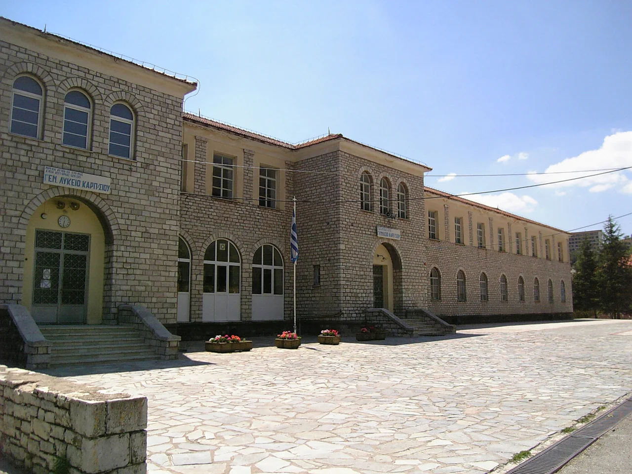

Karpenisi
The name Karpenisi turns out, on examination, to be something of an accident. It derives from the Aromanian word kárpinu, meaning hornbeam — a type of tree — with the suffix -iş added to form a place name. But the Greek spelling of the word, Καρπενήσι, looks remarkably like it ends in νησί, the Greek word for 'island.' There is no island here. Karpenisi sits inland, in the valley of the Karpenisiotis River, cradled between the southern flank of Mount Tymfristos to the north and the foothills of Kaliakouda to the south. The first written record of the name appears in an Ottoman tax ledger from 1454 to 1455, within a few years of the Ottomans consolidating their hold on this part of Greece. Whatever the scribes who entered it were thinking, they were recording a place that already had centuries of history and would accumulate considerably more.
Oechalia, Evrytos, and the Invention of the Bow
Long before the Ottomans arrived, Karpenisi was known in antiquity as Oechalia, and it was ruled — according to myth and the local tradition that clings to myth — by King Evrytos, who was said to have invented the bow. The story marks this mountain town as a place of military ingenuity from its earliest imaginable past, even if the claim is woven into legend rather than documented history. The town's location explains why. Karpenisi stands in the southern part of the Pindus Mountains, commanding the valley of the Karpenisiotis River, a tributary of the Megdovas. Access routes through this terrain are few and easily defended. Whoever controlled Karpenisi controlled movement through a significant stretch of central Greece, a fact that remained true from antiquity through the Greek Revolution of 1821, when the town's mountain position gave Greek fighters decisive advantages in the surrounding campaigns.
Mountain Capital
Today Karpenisi is the capital of the Evrytania regional unit, with a population of approximately 8,000 — small for a regional capital, but entirely expected for a town that serves one of the least densely populated parts of Greece. It is a proper mountain town: the square is lined with cafes, the streets climb steeply in places, and the surrounding forests are visible from almost everywhere in the center. Mount Tymfristos, at 2,315 meters, rises directly to the north, and its slopes are home to a ski resort that draws visitors from across central Greece in winter. In summer the heat that makes the plains of Thessaly uncomfortable barely reaches the valley here; the altitude keeps temperatures mild, and the river gorges and forests provide the kind of walking terrain that draws hikers and trekkers from across the country. The municipality of Karpenisi, reformed in 2011, covers 948 square kilometers and includes numerous smaller villages and hamlets scattered across the surrounding mountains.
An Olympic Bronze and Other Notable Departures
The people Karpenisi has produced tend to be significant beyond its size. Ioannis Theodoropoulos came from here, and at the 1896 Summer Olympics in Athens — the first modern Games — he won a bronze medal in the pole vault. Georgios Kondylis, born in 1878, became a general of the Greek army and served as Prime Minister of Greece. Charalambos Katsimitros, born in 1886, distinguished himself as a general in the Greco-Italian War of 1940 to 1941, when Greek forces drove an invading Italian army back into Albania. Zacharias Papantoniou, born in 1877 and a significant figure in modern Greek letters, spent his formative years here before leaving for Athens. Pavlos Bakoyannis, a liberal politician and journalist who was assassinated in 1989, also traces his roots to Evrytania. This is a recurring pattern for mountain towns: they produce people of consequence who leave, and the town keeps a certain quiet pride in having made them.
The Revolution and What It Left Behind
During the Greek Revolution of 1821, Karpenisi's mountainous position made it a pivot point for the campaigns in central Roumeli — the mainland region whose control mattered enormously to both sides. The battle that took place near the town on the night of August 21, 1823, became one of the Revolution's most remembered engagements: a night raid by the Souliote captain Markos Botsaris against an Ottoman-Albanian army encamped at Karpenisi. The town has not forgotten Botsaris. There is a square in Karpenisi named for him, and in 2022 the municipalities of Karpenisi and Missolonghi — where the most famous episodes of the war were played out — formally twinned with each other in a ceremony at that square. The connection between these two places, forged in the shared experience of the revolution two centuries ago, finds its formal expression in a modern act of municipal affection.
Winter Town, Summer Town
Karpenisi operates somewhat differently in different seasons. Winter brings skiers up the mountain to the Tymfristos resort; the town's cafes and tavernas fill with people escaping the flat, cold plains to the east. Summer brings hikers, cyclists, and people seeking cool air and green valleys. The Karpenisiotis River, which flows through the valley below the town, offers gorge walks and swimming holes. The surrounding Evrytania region — often marketed as the 'Greek Switzerland' for its combination of forests, rivers, and ski terrain — draws visitors who arrive expecting ruggedness and generally find it. The town of Karpenisi itself is pleasant without being dramatic: a place to base yourself for the terrain around it, where the real stories of this particular corner of Greece were, and continue to be, written.
From the Air
Karpenisi lies at approximately 38.912°N, 21.795°E, in the valley of the Karpenisiotis River in central Greece. From altitude, the town is the most visible settlement in the Evrytania highlands — a small but distinct urban cluster in a landscape of forested ridges, identifiable by its position at the head of a valley with Mount Tymfristos (2,315 m) rising sharply to the north. Recommended viewing altitude is 6,000–10,000 feet for a clear sense of the town's relationship to the surrounding peaks. The nearest major airport is LGBL (Nea Anchialos National Airport, near Volos), approximately 85 km to the northeast. Athens Eleftherios Venizelos (LGAV) is roughly 195 km to the southeast. The mountain ridges surrounding Karpenisi exceed 2,000 meters; pilots should expect significant orographic turbulence and rapid weather changes, especially in afternoon hours.
Nearby Stories
- The 1954 Sofades Earthquake 3.4 km away
- Ypati 11 km away
- Lake Trichonida 13 km away
- Kommeno 14 km away
- Duchy of Neopatras 14 km away
- Lake Plastiras 16 km away
- Phaneromeni Monastery, Lefkada 19 km away
- Battle of the Echinades (1427) 34 km away