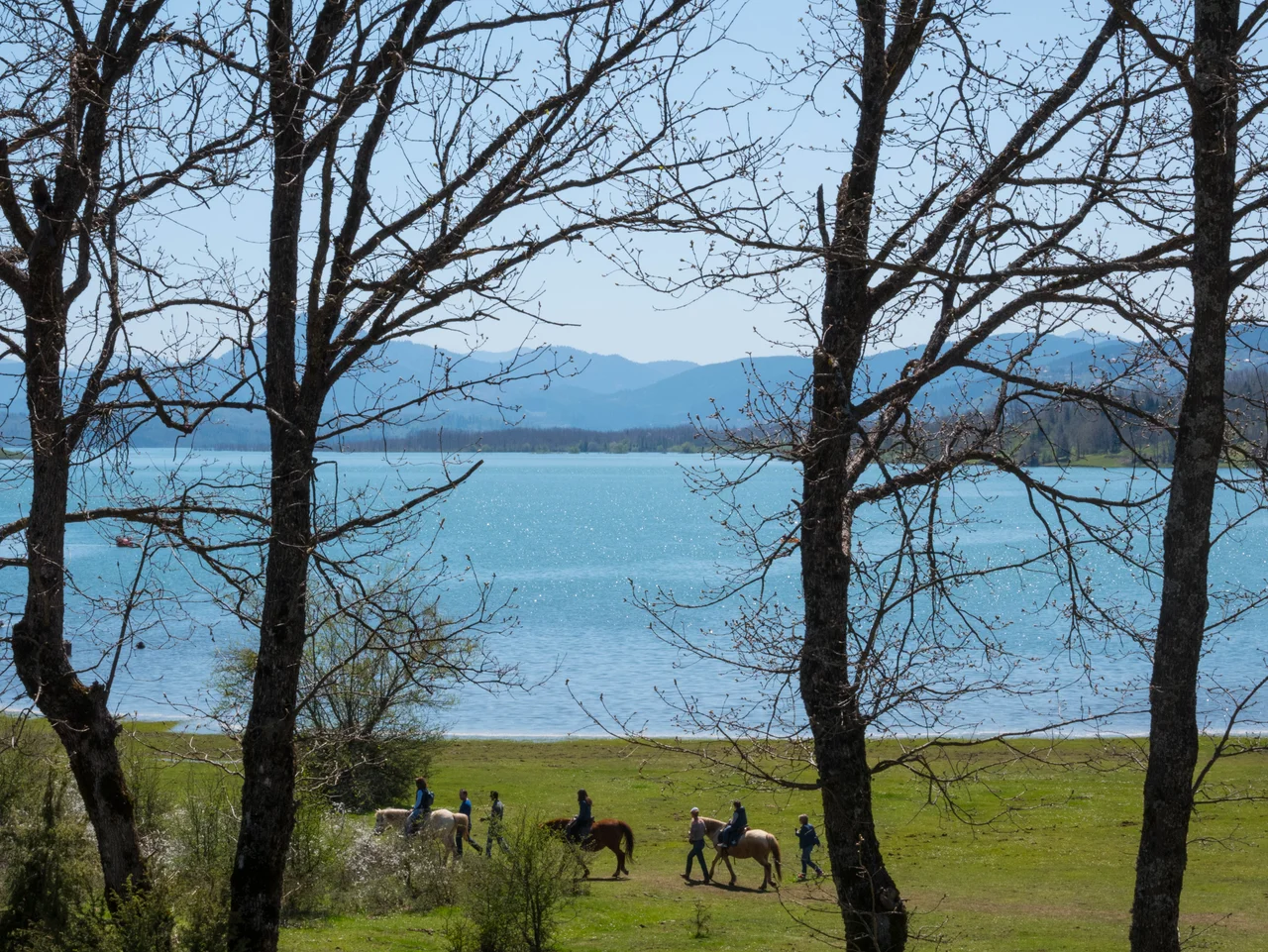

Lake Plastiras
In 1925, General Nikolaos Plastiras stood near his hometown in the Thessalian uplands and watched the Tavropos river tear through the landscape. The flood was severe, the valley laid waste, and Plastiras — a soldier who had survived the Asia Minor Campaign and would survive two more coups — decided that this river needed to be stopped. What he imagined that day, and what took decades of political battles, a world war, and a French construction firm to finally build, is now one of the most striking bodies of water in Greece: a glittering reservoir cradled in the mountains at one of the highest elevations of any lake in Europe.
A General's Dream
Plastiras pushed hard. After witnessing the 1925 flood, he went to the Ministry of Agriculture. By 1929 the ministry had assembled a committee to investigate. Then politicians stalled, argued, and eventually the whole idea was swallowed by the gathering darkness of World War II. The general himself survived the occupation, the civil war, and returned to power as Prime Minister in the early 1950s. It was from that position that he revived the project with real force. The newly formed Public Power Corporation of Greece adopted the reservoir as part of its drive to electrify the country — a postwar priority across southern Europe. An international competition was held in 1953. The French firm Omnium Lyonnais won the contract. Construction of the dam began on December 14, 1955, and the dam was inaugurated on October 30, 1960, though water had likely begun filling the reservoir as early as late 1959. Plastiras died in 1953, just before the contest was held — but the lake carries his name, a posthumous monument to a man who wanted to remake a river.
Water in the Mountains
The lake holds up to 400 million cubic meters of fresh water, fed by the Tavropos (also called the Megdovas) river. Its altitude — high on the Thessalian uplands — gives it a character very different from the sun-baked flatlands of the Karditsa plain below. The surrounding landscape is dense with oak and chestnut forest, the shoreline irregular and wooded, the water often reflecting a sharp blue sky that surprises visitors expecting a Mediterranean glare. Winter brings snow; summer brings cool evenings. The reservoir serves Karditsa's drinking water needs, powers a hydroelectric plant, and irrigates the agricultural land of the regional unit. But it has also become something no one originally planned for: a destination in its own right, with hiking trails, small lakeside villages, and a sense of quiet that the big coastal resorts never quite manage.
A Landscape Made Unique
The lake is designated a Natura 2000 special area of conservation, which tells you something about what the decades of water have produced. The flooded valley created a habitat mosaic — deep cold water, reed beds at the margins, forested slopes rising steeply above — that supports a range of bird species and fish. The shoreline road winds through a series of small communities that look out over the reservoir from different angles, each village offering a slightly different frame on the same body of water. At night, with the mountains dark against the sky, the lake has a stillness that few Greek landscapes can match. The name Plastiras appears on every map, every road sign, every tourism brochure — ensuring that the general who dreamed this water into existence is remembered not on a battlefield, but here, in the mountains he called home.
From the Air
Lake Plastiras lies at approximately 39.30°N, 21.75°E in the Thessalian uplands, at an elevation of roughly 800 meters. From the air the reservoir's irregular wooded shoreline is immediately distinctive — it does not look like a natural lake, with the dam visible at its eastern end. The nearest major airport is LGBL (Nea Anchialos / Volos), approximately 80 km to the northeast; Athens Eleftherios Venizelos (LGAV) lies about 220 km to the south. Approach from the east along the Spercheios and Karditsa plains to locate the upland basin. Mountain wave turbulence is possible in strong northerly winds. Best viewed in morning light when the water is calm and reflects the surrounding forest ridgeline.
Nearby Stories
- The 1954 Sofades Earthquake 6.7 km away
- Phaneromeni Monastery, Lefkada 11 km away
- Evrytania 14 km away
- Nativity of the Theotokos Monastery 15 km away
- Ypati 19 km away
- Meteora: The Monasteries Built on Impossible Pillars 19 km away
- Tempi Train Crash 46 km away
- Vikos Gorge 52 km away