
Kelin
We know this vanished city's name because it stamped it onto money. Small bronze coins scattered across the Iberian Peninsula carry a single word in the swirling, still only partly understood Iberian script: Kelin. That word once named a walled town of some 3,800 people on the hill of Los Villares, above the modern village of Caudete de las Fuentes in western Valencia province. Its houses are ruins now, its language a puzzle, but the coins remain - proof that this was a place important enough to speak for itself in metal.
A City Named on Its Coins
Minting coins in the ancient world was a statement of standing, and Kelin made it. Between the mid-second and early first centuries BC the town struck its own bronze ases and semis, and it appears to have been the only site in the whole district to do so during the Roman Republican period. Those coins have turned up not just on the hill itself but far across Iberia, carried along trade routes by hands that are long gone. To an archaeologist, a coin is a message in a bottle: it tells you a community had authority, reach and confidence. Kelin, it seems, had all three.
Capital of the Plateau
Kelin was no ordinary village. Spread across about ten hectares behind its walls, it was the largest known Iberian settlement in the surrounding submeseta of Utiel-Requena, the high inland plateau west of Valencia. Excavations have found a greater range of imported goods here than at any neighbouring site, a sign that Kelin sat at the centre of the region's trading and distribution networks. More written material has surfaced here too. Taken together, the evidence points to a town that was at least the pre-eminent settlement of its area, and perhaps the capital of a complex Iberian polity that controlled much of the plateau around it.
Houses of Stone and Adobe
Two zones of house remains survive on the hill, and reading between them is like watching architecture evolve across five centuries, from the seventh to the second century BC. The homes were long, narrow rectangles with few internal walls, built on stone foundations beneath walls of adobe brick. At the edge of the settlement a stretch of the defensive wall still stands, along with a quarry that may have supplied stone for both walls and houses. The pottery tells its own story of connection and imitation: locally hand-made vessels copying the shapes of wheel-thrown ware, alongside amphorae, Western Phoenician storage jars, and the fine Iberian Red Slip pottery that decorated Iberian tables.
The Name That Moved Downhill
As Rome absorbed the region from the second century BC, life on the hilltop gradually shifted down to the banks of the nearby Madre river. From that new settlement rose a new, Latin name - Caput Aquae, 'the water source.' And that name proved remarkably durable. It passed through Arabic as Qabdaq, through Valencian as Cabdet, and finally settled into the modern Caudete de las Fuentes, whose second half - 'of the springs' - still remembers the water that Caput Aquae was named for. Kelin the city died, but its landscape kept naming itself, tongue after tongue, for more than two thousand years.
Digging It Up
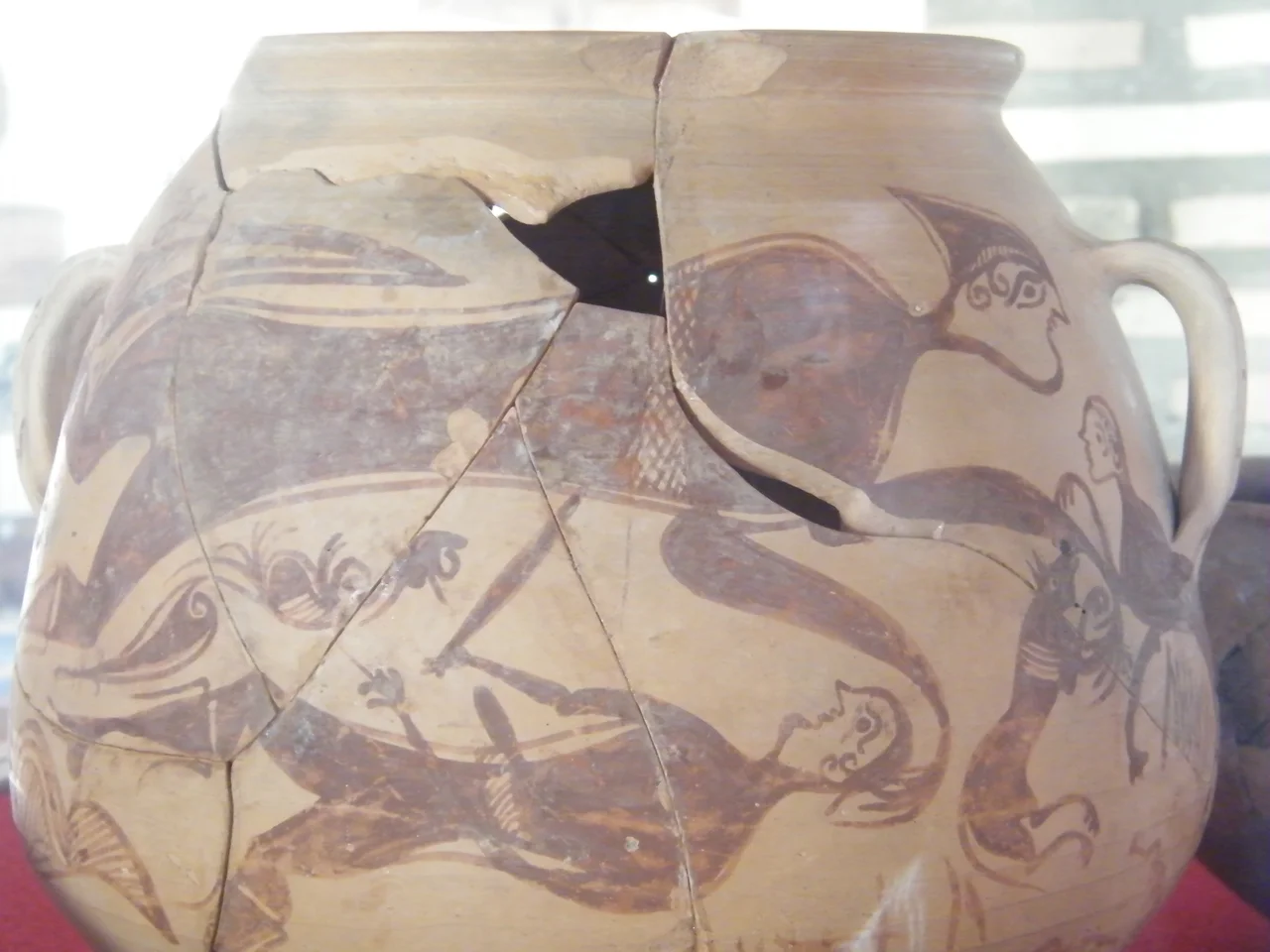
The ruins on Los Villares have been known since the mid-eighteenth century, but it was not until 1956 that archaeologists first excavated the site properly, with further campaigns continuing as recently as 2011. Each dig has added to the portrait of a sophisticated Iberian society flourishing here long before Rome arrived. A painted Iberian storage jar recovered from the hill now sits in the museum of Caudete de las Fuentes, a tangible link between the modern village and the city on the ridge above it. For visitors, Kelin offers a quieter kind of ruin - not monumental, but eloquent, a hilltop where you can stand among stone foundations and read the plateau the way its ancient people did. There are no soaring columns here, no temples rebuilt for the camera; instead there is the low outline of a real town, and the rare chance to imagine the daily life of a people who thrived on this land long before Rome, Islam or Castile ever laid claim to it.
From the Air
Kelin lies on the hill of Los Villares at 39.554°N, 1.283°W, beside Caudete de las Fuentes on the Utiel-Requena plateau, about 75 km inland from Valencia and near the wine town of Requena. From the air the low ruins are hard to pick out, but the site sits on a modest hill amid the vast vineyards of the Bobal wine country; the village of Caudete de las Fuentes marks the spot. Nearest airport is Valencia (LEVC) to the east, with Alicante–Elche (LEAL) and Murcia (LEMI) farther south. At roughly 750 m elevation the plateau air is clear; a low pass at 2,500–4,000 ft over the vineyard grid best reveals the hill and the settlement pattern around it.
Nearby Stories
- Battle of Alcalá (1129) 8.7 km away
- Llíria 9.3 km away
- Rincón de Ademuz 20 km away
- Cofrentes Nuclear Power Plant 24 km away
- Castle of Alarcon 30 km away
- Cuenca Cathedral 37 km away
- Penyagolosa 47 km away
- Battle of Las Navas de Tolosa 193 km away