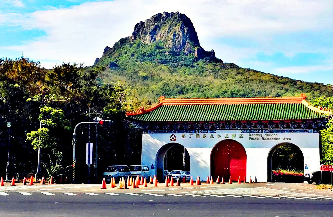

Kenting National Forest Recreation Area
Long before there was a forest here, there was a sea. Hundreds of thousands of years ago, the land that would become the Kenting National Forest Recreation Area lay submerged beneath tropical waters, its limestone bones slowly built up by living coral. Then the earth moved. Tectonic forces pushed the ancient reef upward out of the ocean, and rain and wind went to work on the exposed stone for millennia — carving cliffs, hollowing caves, and sculpting canyon walls. Eventually, soil accumulated in the crevices, seeds arrived on the wind, and a dense tropical forest took root on what had once been a coral garden. Walking through this forest today, you are walking on a fossilized reef.
Stone That Used to Live
The geological story of Kenting's forest begins under the sea. Coral polyps built their calcium carbonate structures over vast stretches of shallow tropical ocean, layer upon layer across hundreds of thousands of years. When tectonic uplift raised this peninsula from the water, the reef became cliff. Weather and water then did what they do: dissolved joints in the limestone, enlarged fractures into canyons, and hollowed chambers into caves. The result is a landscape of dramatic vertical relief — ridgelines of pale, pitted rock rising above dense canopy — that carries the ocean's architecture into the interior of a forest. Two caves punctuate the experience for visitors: Fairy Cave and Silver Dragon Cave, both carved into the living limestone by groundwater over geological time. They are cool and dim, with formations that reward a slower eye.
A Garden the Japanese Started
The forest's institutional history begins in 1906, when the Japanese colonial government established the Hengchun Tropical Botanical Garden here, recognizing the unusual richness of the peninsula's biodiversity. Under Japanese administration, Taiwan's southern tip was seen as a natural laboratory for tropical species, and the garden grew accordingly. After the end of Japanese rule, the site was reorganized as the Kueizhijiao Tropical Botanical Garden under the Hengchun Center of Forestry Research Institute, continuing the work of documenting and preserving the region's plant life. The shift from scientific garden to public recreation area came in 1967, when the Forestry Bureau reoriented the site toward tourism. Two years later, in 1969, the forest opened its gates to the public. The botanical roots remain visible in the variety of the canopy — this is not a single-species plantation but a mosaic of tropical species accumulated over more than a century of intentional cultivation.
Seventeen Scenes, One Tower
The recreation area covers 150 hectares at an elevation of around 300 meters — high enough to catch cooler air than the beaches below, but not so high as to leave the tropics behind. Temperatures range between 20 and 28 degrees Celsius through the year, and annual rainfall averages 2,200 millimeters, enough to keep the canopy thick and the stone perpetually green with moss and fern. Seventeen designated scenic spots are linked by a network of walkways, giving the area a gentle circuit quality: enough structure to orient a first-time visitor, enough breathing room to find your own pace. At the center of it all stands a 27-meter observation tower. From its upper platform, the forest canopy spreads below and the narrow peninsula reveals itself in both directions — the Taiwan Strait to the west, the Pacific to the east, and the low ridgeline of Hengchun stretching toward the tip of the island.
Where the Peninsula Narrows
The Hengchun Peninsula is the southernmost reach of Taiwan, pinched between two seas where the island tapers to its final point at Cape Eluanbi. The forest recreation area sits near the heart of this narrow land, within the larger boundaries of Kenting National Park, Taiwan's oldest national park. The ecological setting amplifies the geological spectacle: this is a transition zone where temperate and tropical species meet, where the wind that howls off the Taiwan Strait differs from the gentler air on the Pacific side, and where the limestone topography creates microclimates that shelter unusual plant communities. Getting here requires either a bus from Zuoying Station on the Taiwan High Speed Rail or a car on the coastal highway that winds down the peninsula from Kaohsiung, a route that takes you from the edge of a major city to the edge of a primordial forest in under two hours.
From the Air
Kenting National Forest Recreation Area sits at approximately 21.959°N, 120.812°E on Taiwan's Hengchun Peninsula, at an elevation around 300 meters. Approaching from the north, pilots will see the peninsula tapering between the Taiwan Strait to the west and the Pacific to the east, with forested limestone ridgelines visible just inland from the southern tip. The nearest major airport is RCKH (Kaohsiung International), approximately 70 kilometers to the north-northwest. Cape Eluanbi and its lighthouse mark the southern tip of the island and provide a strong visual anchor for orientation. At low altitude, the contrast between pale limestone cliff faces and the dark tropical canopy makes the recreation area's elevated terrain stand out clearly from the beach resort zones below.
Nearby Stories
- Mudan Incident 2 km away
- Lanyu Flying Fish Cultural Museum 30 km away
- Zhaori Hot Spring 59 km away
- Ten Drum Rende Creative Park 88 km away
- Mavulis Island 89 km away
- Barclay Memorial Park 121 km away
- 1991 Eruption of Mount Pinatubo 722 km away
- Scarborough Shoal 762 km away