
Killin
Elizabeth Christina McDiarmid died in April 2024, aged 92, at the Falls of Dochart Care Home in Killin. With her death, the last native speaker of Perthshire Gaelic was gone. The dialect had been losing ground since the 19th century, hollowed out by the Highland Clearances and the Education (Scotland) Act of 1872, which had excluded Gaelic from the formal school curriculum. By 1881 the census recorded over 1,100 Gaelic speakers in the parish, 78.5 percent of the population. By 2001 the electoral division of Killin held only 63. The dialect itself, the particular cadence and vocabulary of Perthshire Gaelic, is now considered effectively extinct. That is what makes this place strange and a little tender. Killin is one of Scotland's most photographed villages, an alpine-postcard setting where the River Dochart pours through a multi-arched stone bridge and the Ben Lawers range rises behind. But the language that named every burn and brae here is gone.
Where the Waters Meet
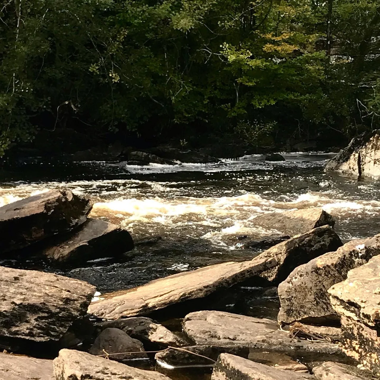
The west end of the village is built around the Falls of Dochart, called Eas Dochard in the Gaelic that once filled these streets. The falls are not a single cascade but a long stretch of foaming rapids on the River Dochart, crossed by the narrow A827 bridge whose stone arches frame every visitor's first photograph. Below the bridge sits Inchbuie, an island in the river. The MacNab clan have buried their dead there for centuries, and the burial ground is still accessible by a path from the bridge. The main street leads down to where the Dochart meets the Lochay, two rivers ending in Loch Tay. Killin sits at the very head of the loch, in the historic region of Breadalbane, from the Gaelic Bràghad Albann, meaning the high part or upper part of Scotland. The mountain ranges around it are not metaphors but actual alpine peaks: Meall nan Tarmachan, the Ben Lawers range, framing the village like a stage set.
Picts, Gaels, and Clan MacNab
Killin sat on a frontier. For a stretch of early medieval history, this was the front line between the Pictish people of the Highlands and the Gaels who had crossed from Ireland, before Kenneth MacAlpin united the two peoples in the 9th century. The Scottish Crannog Centre on the loch shore reconstructs the wood-and-thatch dwellings prehistoric people built on artificial islands offshore. A standing stone circle known as the Kinnell Stone Circle still stands in the grounds of Kinnell House, once the seat of Clan MacNab. The MacNabs were the dominant family here for centuries, but the Campbells of Breadalbane gradually displaced them, taking their land and eventually Kinnell House itself. North of the village sit the ruins of Finlarig Castle, the Campbell stronghold. In 1694 Sir John Campbell of Glenorchy, the 1st Earl of Breadalbane, made Killin a Burgh of Barony, giving it the legal status of a market town. The MacNabs did not regain Kinnell until 1949, and lost it again in 1978 when death duties forced the chief, James Charles Macnab of Macnab, to sell.
The Killin Incident
In August 1749 the village witnessed one of the more strange moments of post-Culloden Scotland. Four years after Bonnie Prince Charlie's defeat, Parliament had passed the Dress Act of 1746, making it illegal for Highlanders to wear traditional Highland dress. Two men, plundering at will through the glens in full Highland kit, were captured by British Army soldiers at Killin. Before the soldiers could march them away, a large mob gathered and secured their release. It was a small act of defiance in a country still raw from the rising, the sort of moment that suggests the new order had not quite settled into the hills. The Killin Incident, as it came to be called, hints at how thin the British hold over the central Highlands really was in the years after the '45.
The Outdoor Capital of Breadalbane
Today Killin draws walkers, climbers, and skiers. The village sits within the Loch Lomond and The Trossachs National Park and serves as a base for the Munros of Meall nan Tarmachan and Ben Lawers. The Ben Lawers National Nature Reserve protects internationally important alpine plants. The Heart 200, a long-distance driving route through Perthshire similar to the North Coast 500, passes through. The Rob Roy Way, a 127-kilometre walking path, runs through too, along with National Cycle Route 7. Glencoe Ski Centre is about forty minutes away by car, putting Scotland's longest and steepest runs within easy reach. Wildlife tourism has become serious business: red squirrels, pine martens, otters, beavers, osprey, even the rare Scottish wildcat. In July 2023, the expert travel site Planetware.com voted Killin one of the most desirable locations to live and visit in Scotland. A 2021 analysis named it the second-best wellness holiday destination in the UK. The marketing is real. So is the slow-burning loss the village has been living with for two centuries.
From the Air
Killin sits at 56.466°N, 4.318°W at the western head of Loch Tay, in the central Highlands of Scotland. From the air, the village is unmistakable: the Falls of Dochart cut a foaming line through the village centre, and the loch stretches northeast for roughly fifteen miles. Visual landmarks include the Ben Lawers massif rising to 3,983 ft on the north shore of Loch Tay, and Meall nan Tarmachan immediately north of the village. Finlarig Castle ruins sit at the very head of the loch. Nearest airports: Glasgow (EGPF) approximately 55 nm south-southwest, Edinburgh (EGPH) approximately 55 nm southeast. Recommended viewing altitude 5,000-7,000 ft AGL for a sweep of Loch Tay, the Ben Lawers range, and the surrounding Munros. The A827 follows the north shore of Loch Tay east toward Aberfeldy.
Nearby Stories
- Loch Achray 2.6 km away
- Ben Nevis 5.4 km away
- Ben Alder 5.9 km away
- Inveraray Castle 9.5 km away
- Kilchurn Castle 14 km away
- Massacre of Monzievaird 14 km away
- Battle of Dollar 16 km away