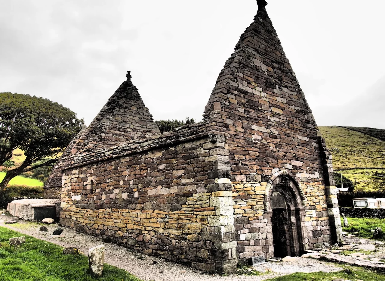

Kilmalkedar
There is a hole carved through the east wall of the chancel, and the locals call it the eye of the needle. The rule is straightforward: if you can fit through it, you are certain to go to heaven. Generations have shimmied through, the worn stone at its edges polished by shoulders and hopes. The church around it was built in the mid-12th century, modeled on Cormac's Chapel at the Rock of Cashel, but the site is older than that — much older. Kilmalkedar sits at the foot of Mount Brandon on the Dingle Peninsula, and the layers of belief here run deep enough that no one can quite tell where the Christian site ends and the older one begins.
The Saint's Road
Kilmalkedar was an assembly point. Pilgrims gathered here before walking the Saint's Road northeast to the summit of Mount Brandon, where Brendan the Navigator was said to have looked out across the Atlantic and decided to sail west. The route is still walkable, marked by ancient crosses and standing stones — the medieval equivalent of route markers along a long, ascetic trail. The hike took pilgrims through the heart of the Corca Dhuibhne peninsula, and the church at Kilmalkedar served as both starting line and final blessing. The name comes from Saint Maolcethair, who died in 636, though the building you see today rose half a millennium after him.
An Older Rhythm
Other rituals at Kilmalkedar suggest the site predates Christianity by a long stretch. On Easter Sunday, people would walk nine clockwise circuits of the grounds. Holes were bored into standing stones — a practice with deeper roots than the Christian calendar. One bullaun (a stone basin used for grinding or ritual) is associated with the mythical cow Glas Gaibhnenn, an inexhaustible giver of milk in Irish folklore. The early Irish church did not so much replace the older religion as overlay it, building churches on sites that had already been sacred for centuries. Kilmalkedar is one of the clearest examples of this layering anywhere on the peninsula.
Writing in Stone
Beside the church stands an Ogham stone, the script of early medieval Ireland — short notches and lines cut along the edge of a tall pillar. This one reads ANM MAILE-INBIR MACI BROCANN, "Name of Máel-Inbher son of Broccán," and was carved around AD 600. Strangely, a hole is bored through the top of the stone, and people still link fingers through it to seal agreements and promises. Nearby is an even rarer object: a stone carved with the Latin alphabet in uncial script, dated to between AD 550 and 600. It is essentially a teaching slate — an instructor's tool for showing students the letters. Few such stones survive anywhere in Europe.
The Hiberno-Romanesque Doorway
The doorway into the nave is one of the finest examples of Hiberno-Romanesque carving in Ireland. Concentric arches of chevrons and beasts surround the opening, the kind of detailed work that suggests the masons knew Cormac's Chapel and wanted to bring something of its sophistication to this remote western place. Inside, blind arcades run along the walls, and steep antae — projecting wall ends — flank the nave in the older Irish style. The chancel was extended around AD 1200. Walking the church today, you can read the seams: 12th-century work, 13th-century alterations, centuries of weather, and still the eye of the needle, waiting.
From the Air
Coordinates 52.1848°N, 10.3365°W, on the Dingle Peninsula 4.8 km east of Ballyferriter and 6.7 km northwest of Dingle town. The church sits in green fields with Mount Brandon (952 m) rising to the northeast — a useful navigation reference. Best viewed at 1,500–3,000 ft AGL. Kerry Airport (EIKY) is the nearest field, roughly 50 km east. The Saint's Road pilgrim route to Mount Brandon can be traced from the air on a clear day.
Nearby Stories
- Ballyheigue Castle 1 km away
- Killemlagh Church 2.8 km away
- Pouldergaderry Sinkhole 6.8 km away
- Derreen Garden 11 km away
- Kilkee 59 km away
- The Laki Eruption: The Volcano That Changed World History 1366 km away
- The Northern Lights: The Sky Show That Vikings Thought Was Bridge to the Gods 1469 km away
- Sao Miguel 1935 km away