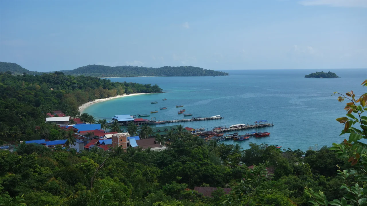

Koh Rong Marine National Park
Cambodia declared its first marine national park in February 2018. The environmental rangers meant to patrol it were not expected on the water until the following year at the earliest, and the fisheries officers who already held jurisdiction were short of boats, short of fuel, and — by the account of the ministry's own marine conservation director — had not been succeeding. Five hundred and twenty-four square kilometres of the Gulf of Thailand changed legal category overnight and changed almost nothing else. That gap between the map and the water is the real subject here, and it is not a Cambodian peculiarity. It is what most marine protection looks like in its first years anywhere.
Drawing a Line Around Water
The park wraps the islands of the Koh Rong archipelago — Koh Rong and Koh Rong Sanloem chief among them, along with Koh Oun, Koh Song Saa, Koh Tatiem, Koh Touch, Koh Manoa Krav and Koh Manoa Knong, plus uninhabited scraps like Koh Koun to the north. It did not appear from nothing. A 405-square-kilometre protected area had been declared in 2016 and managed since 2012 by Fauna and Flora International, the British conservation organisation; the 2018 designation enlarged that footprint by nearly thirty percent and handed responsibility to the Ministry of Environment. Ten and a half kilometres of open sea separate the archipelago from the mainland — far enough to have kept the reefs alive, close enough that everything happening on shore eventually arrives.
What the Seagrass Holds
The value here is not spectacle so much as inventory. Coral reef, mangrove and — most importantly — seagrass meadow, which is the least photogenic and most consequential habitat in these waters. Seagrass is nursery, pasture and carbon sink at once. Seahorses hold onto it. Sea turtles graze it. Dugongs, the shy and dwindling sirenians of Southeast Asian coastal water, depend on it entirely. The threat is correspondingly unglamorous. Blast fishing and cyanide were once common here and have largely gone, replaced by trawling for shrimp and crab — nets dragged across the bottom that take the catch and the meadow together, and leave scoured sand where a nursery used to be. A reef damaged by dynamite is obvious from the surface. A seagrass bed torn up by a trawl is invisible from six feet above it.
Thirty-Five Grams of Reason
BirdLife International designated the archipelago an Important Bird Area, and the bird responsible weighs about as much as a slice of bread. The Malaysian plover stands fifteen centimetres tall, weighs between thirty-five and forty-two grams, and is near threatened with perhaps ten thousand left in the world. It does not build anything. It scrapes a shallow depression in open sand above the tideline, lays two or three eggs the colour of the beach, and both parents take turns sitting on them for a month, then shepherd the chicks for another month before they can fly. Every element of that strategy assumes an empty beach. A footstep destroys a clutch without the walker ever knowing. An adult flushed off the nest in tropical midday leaves eggs to cook in minutes. On an archipelago now selling itself on its sand, the plover is the species with the least room to negotiate.
The Paper and the Water
Enforcement was the problem in 2018 and it has not stopped being one. Foreign trawlers work these waters, and reporting at the time described fishing access being bought from officials outright; Cambodia then ranked 161st out of 180 countries on Transparency International's corruption index. There is a second complication, larger and entirely legal. Since 2008 the Royal Group, the country's biggest conglomerate, has held a ninety-nine-year lease over Koh Rong, the largest island inside the park's boundary; next door, Koh Rong Sanloem sits under a separate arrangement, its administration passed to a state development corporation that has granted concession rights to another private developer. Roads have since been cut into Koh Rong's interior and resorts continue to go up along the beaches on both islands. The park does not annul either lease. Both hold, simultaneously, over the same reefs and the same nesting sand — which means the future of this place will be decided less by the 2018 declaration than by what gets built, and who is on the water to watch.
From the Air
The park is centred near 10.70°N, 103.27°E and covers 524 km² of the Gulf of Thailand, about 10.5 km off the Cambodian coast west of Sihanoukville. From altitude the boundary is invisible but the assets are not: the pale turquoise shelves fringing Koh Rong and Koh Rong Sanloem mark reef and seagrass, and the tone shift where those shelves drop into deeper blue is a usable proxy for the habitat the park exists to protect. Koh Rong's 316 m summit and the crescent of Saracen Bay on Koh Rong Sanloem are the two best visual anchors. Sihanouk International (VDSV/KOS, elevation 40 ft) lies 40 km east; Dara Sakor International (VDDS/DSY) is roughly 45 km northwest. Fly 3,000–5,000 ft for reef definition — shallow-water colour reads best with high sun and a low-angle look. December to April offers reliable visibility; the southwest monsoon from May to October brings cloud, rain and turbid water that hides the shallows entirely.
Nearby Stories
- Dara Sakor International Airport 4.8 km away
- Mayaguez Incident 9.4 km away
- Koh Thmei 18 km away
- Phú Quốc National Park 27 km away
- PMTair Flight 241 27 km away
- Battle of Pailin 218 km away
- U-Tapao: The Airfield Built on a Shipyard 290 km away
- Krue Se Mosque 416 km away