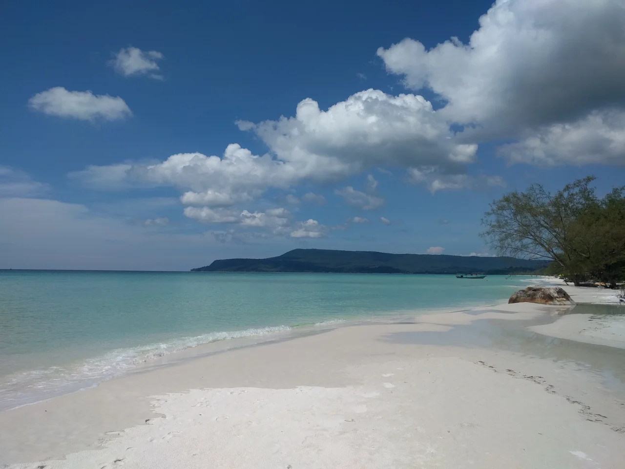

Koh Rong
Wade into the shallows on a moonless night, well away from the generators, and the water answers back. Every step throws off a scatter of cold blue-green sparks that flare and vanish inside a second — bioluminescent plankton, disturbed and briefly furious. Koh Rong has so little electric light that the display can be seen on almost any dark night of the year, which is a polite way of saying the island still has very little of anything. Seventy-eight square kilometres of forested hill, sixty-one kilometres of coastline, fifteen kilometres from end to end, and roughly four thousand people at the 2019 census. The rest is jungle, sand, and a slow, unresolved argument about what happens next.
Four Villages and a Very Long Beach
The island's people are gathered into four settlements, and they could hardly be less alike. Koh Touch, on the southeastern tip, absorbed the first wave of backpackers and now runs on guesthouses, dive shops and evening barbecue smoke. Prek Svay, on the northeast coast, is still mostly a fishing village. Doeum D'keuw is built out over the water on stilts, its walkways threading between houses in a way that has earned it comparisons to Venice — generous, certainly, though the logic of living above the tide is the same in both places. Sok San, on the west, anchors the northern end of Long Set Beach: seven kilometres of white sand running almost unbroken down the sunset side of the island. In total Koh Rong has no fewer than twenty-three beaches and something like forty-three kilometres of them. Most of the year, most of them are empty.
The Crossing
Sihanoukville sits about twenty-five kilometres east, and until recently the trip across was an ordeal with a view. The old ferries were wooden and open, benched down both sides with plastic sheeting rolled up against the rain; passengers climbed onto the roof to sleep off the two hours, and boarding meant walking a single plank from pier to gunwale with your bag on your shoulder. The speedferries that replaced them can make the run in forty minutes when the sea cooperates, at fares the government fixed at twelve dollars one way and twenty-two return. Whether you get forty minutes or two hours still depends on weather, boat and arithmetic — the same companies serve Koh Rong and Koh Rong Sanloem on a single circuit, and they decide the order of the stops based on who wants to go where.
Cameras in the Jungle
For four years this was among the most filmed ground in Southeast Asia. France's Koh-Lanta came in 2012 and again in 2016. Sweden sent Expedition Robinson. In 2015 the American Survivor shot two consecutive seasons here, one of them titled for the island itself. The exception is the season nobody saw. During the 2013 Koh-Lanta shoot the contestant Gérald Babin collapsed, was carried to a local infirmary and airlifted out, and died. In the recriminations that followed, the production's doctor, Thierry Costa, took his own life. Two men died making a programme about surviving on a beach, and the season was never broadcast. The crews went home; the island kept the beaches, and for a while the reputation.
Ninety-Nine Years
In 2008 the government granted the Royal Group, Cambodia's largest conglomerate, a ninety-nine-year lease over Koh Rong and its southern neighbour, along with a proposal for what the company billed as Asia's first environmentally planned resort island. Nearly two decades later that island has still not been built. What arrived instead was smaller and faster: guesthouses multiplying quicker than any system to support them, timber coming off the hillsides for construction and cooking fires, wastewater and rubbish going into the sea because there was nowhere else to put them. A road-building programme worth roughly thirty-five million dollars began carving into the interior in 2020. And in February 2018 the government drew Koh Rong Marine National Park around the whole archipelago — the country's first. Park and lease now occupy the same water. The island is living through the question of whether both can be true at once.
Power Hours
Electricity here has traditionally arrived by generator and departed on a schedule, roughly six to ten in the evening at the older village guesthouses. Fresh water comes down from the interior in streams and reaches the tap carrying the colour of the hillside it crossed. There is no bank machine on the island; a few businesses in Koh Touch will advance you cash and take something near ten percent for the favour, on the sound reasoning that your alternative is a boat. Inland, the ground climbs to 316 metres through forest that hides seasonal waterfalls — loud and full in the wet months, dry gullies by March. Rent a motorbike and the concrete gives out quickly. Walk instead and bring a guide, because the trails drawn on the maps are closer to suggestion than survey.
From the Air
Koh Rong lies at 10.70°N, 103.23°E in the Gulf of Thailand, about 25 km west of Sihanoukville. The island reads unmistakably from the air: 15 km on a northwest–southeast axis, deeply indented on both coasts, with the long white arc of Long Set Beach on the western shore and the near-continuous forest canopy rising to 316 m in the interior. Koh Rong Sanloem sits 4 km to the south with tiny Koh Koun between them. Sihanouk International (VDSV/KOS, elevation 40 ft) is 40 km east and has the region's only substantial scheduled traffic; Dara Sakor International (VDDS/DSY) lies about 40 km northwest on the Koh Kong coast. Best viewing altitude is 4,000–6,000 ft, low enough to separate the individual beaches and reef shelves from open water. Visibility is excellent in the December–April dry season; the May–October southwest monsoon brings low cloud, heavy shower activity and a rough sea state on the western coast.
Nearby Stories
- Dara Sakor International Airport 4.8 km away
- Mayaguez Incident 9.4 km away
- Koh Thmei 18 km away
- Phú Quốc National Park 27 km away
- PMTair Flight 241 27 km away
- Battle of Pailin 218 km away
- U-Tapao: The Airfield Built on a Shipyard 290 km away
- Krue Se Mosque 416 km away