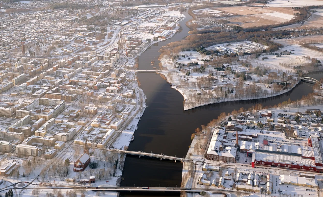

Kokemäenjoki
Every few centuries the Kokemäenjoki fires its harbour. The medieval port at Ulvila silted up and the trade moved to Pori. Pori's own quays went shallow and the shipping moved out to Mäntyluoto. Mäntyluoto was eventually joined by Tahkoluoto, further out still. None of this was mismanagement. The land here is rising out of the Gulf of Bothnia at a rate you can measure in a human lifetime, and the river arrives carrying enough sand and silt to fill in whatever the uplift leaves behind. Satakunta's whole commercial history is the story of a coastline retreating westward and a river refusing to hold still.
One River, Four Hundred Kilometres of Water
The Kokemäenjoki proper runs 121 kilometres, beginning where Lake Liekovesi empties near Sastamala and ending in the sea at Pori. That number badly undersells it. Follow the water upstream through Kulovesi, Pyhäjärvi, Näsijärvi, Ruovesi and on to Ähtärinjärvi and the route stretches to something like 400 kilometres, gathering a catchment of about 27,100 square kilometres - a substantial slice of southwestern Finland, roughly five per cent of it standing water. Mean flow at the mouth is around 238 cubic metres per second, but that average hides everything interesting: low water drops near 52, spring high water averages 600, and the worst recorded floods have pushed past 900. The largest tributary, the Loimijoki, drains 3,140 square kilometres of farmland and contributes more than half the runoff of the lower basin.
The Delta That Keeps Growing
Below Pori the river stops being a river and becomes a fan. The Kokemäenjoki delta is the largest in the Nordic countries, spreading roughly ten kilometres seaward from the city centre through a maze of channels that locals call juovat, wrapping around low islands like Hanhiluoto and Täiluoto. Historically the system has been laying down something on the order of a hundred thousand cubic metres of sediment a year, while the land beneath it rises at the same time. The result is a landscape that is genuinely new - reedbeds, shallow flats and wet meadow that did not exist when Pori was founded. It is designated a nationally valuable landscape area and it is one of the more important bird habitats on the Finnish west coast, which is why the towers at Preiviikinlahti, just south of the delta mouth, stay busy through migration.
Straightening the Argument
People have been renegotiating this river for a long time. Dredging campaigns ran from 1757 into the 1780s to clear obstacles for boats. The first permanent bridge, at Tulkkila, went up in 1893, replacing ferry crossings that had operated since medieval times. In 1932 and 1933 a workforce of around 250 men removed more than 53,000 cubic metres of rock and gravel from the channel, an attempt to stop the ice-jam floods that shut the valley down most winters. Four hydroelectric plants - Tyrvää, Äetsä, Kolsi and Harjavalta - now regulate the flow; Kolsi alone drowned 202 hectares behind its dam. In 1942 Alvar Aalto drew up a development scheme for the whole valley, generally reckoned to be the first regional plan in Finland.
Two Bad Decades
Between roughly 1960 and 1980 the Kokemäenjoki was one of the most badly damaged watercourses in Finland. Pulp mills discharged into it. The chemical works at Äetsä released mercury over decades of operation. The metal smelters at Harjavalta added heavy metals from the other direction. Fish became unsafe to eat and stretches of the river ran effectively dead. The turnaround came fast once the sources closed: water quality improved sharply after two pulp mills shut in 1985, and the recovery has held. Not perfectly - in July 2014 a nickel discharge from Harjavalta put 66 tonnes of metal into the river and killed off freshwater mussel populations downstream, a reminder that a river running through an industrial corridor is never more than one valve away from a bad week.
Restocking
In May 2025 the Kokemäenjoki received one of the larger spring stocking efforts on the Finnish coast: 14,000 two-year-old Atlantic salmon, 18,000 two-year-old sea trout, and more than six million newly hatched migratory whitefish, all raised at the Harjavalta hatchery. Numbers like that are an admission as much as an investment - dammed rivers do not rebuild their own migratory runs, and the fish that once climbed these rapids to spawn cannot do it past four power stations. The Kokemäenjoki-LIFE project has spent years restoring habitat along the banks and in the delta. What emerges is a working compromise: a river that generates electricity, drains 27,100 square kilometres of southwestern Finland, carries the sediment that builds new land at its mouth, and is stocked each spring with the fish it can no longer produce on its own.
From the Air
The Kokemäenjoki reaches the sea at roughly 61.55°N, 21.70°E, west of central Pori. Best viewed at 3,000-5,000 feet, where the whole delta reads at once: the braided channels fanning out over about ten kilometres, the low green islands between them, and the flood embankments running dead straight along the farmland upstream. Follow the river inland and it points you toward Harjavalta and Kokemäki; follow it seaward and it delivers you to Mäntyluoto, Reposaari and the Bothnian Sea. Nearest airport: Pori (EFPO), sitting a couple of kilometres south of the city centre at 45 ft elevation. Tampere-Pirkkala (EFTP) lies about 110 km upstream along the same water system. Spring high water and autumn low sun both make the channel pattern easiest to read from the air.
Nearby Stories
- Kokemäki Castle 12 km away
- Liinmaa Castle 14 km away
- St. Henry's Chapel 41 km away
- Finnish War 45 km away
- Kauhajoki School Shooting 68 km away
- Archipelago Sea 117 km away
- Battle of Bomarsund 162 km away
- Härnösand Cathedral 184 km away