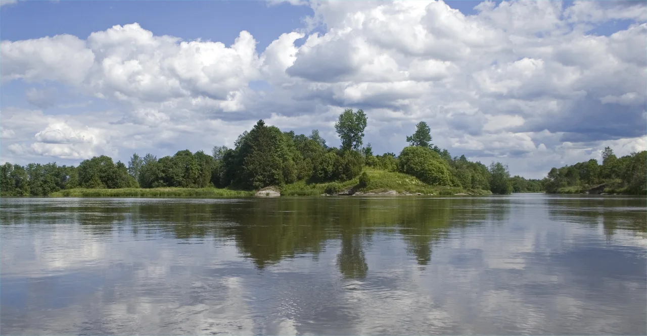

Kokemäki Castle
Almost everything known about Kokemäki Castle comes from the order to demolish it. On 12 July 1367, King Albert of Mecklenburg authorised three men — Dietrich Vieregge, Nils Kettilmundsson and Ernst von Drotzem — to pull the castle down and re-found it somewhere more suitable. That letter, copied into the Black Book of Turku Cathedral, is the only certain documentary reference to a fortress that had run a whole province. The reason given for its destruction is remarkable, and thoroughly unromantic: the people of Satakunta had complained that keeping it was more than they could bear.
Two Castles Too Many
Satakunta had a second castle at the time, Liinmaa in Eurajoki, and between them the two swallowed the province's surplus. Castles in fourteenth-century Finland were not paid for out of royal generosity; they were paid for by the farming households within reach, in grain, in labour, in cartage and in silver. When those households told the king that two fortresses were too many, they were describing years of hauling other people's food up to other people's walls. Albert agreed, and Kokemäki lost. The three men he named were serious figures. Nils Kettilmundsson had been bailiff of Stockholm Castle and was an ancestor of Gustav Vasa; Vieregge was a mercenary captain of Mecklenburg origin; von Drotzem is thought to have commanded Turku Castle, under whose authority Satakunta fell. After the demolition the island passed to Henrik Hartmansson, the bishop of Turku.
The Government on the Rock
Before that, this had been the administrative centre of the Kokemäenkartano castle province — the same kind of institution as the castles at Turku, Häme and Vyborg, all three of which still stand. Kokemäki's does not, which is why it is so easy to underestimate. Construction is generally placed at 1324–25, during the term of Matias Kettilmundinpoika as governor of Finland, though nothing proves it. The 1367 letter describes the castle as instauratum — refortified — and that single word implies an earlier attack serious enough to require rebuilding. The likeliest occasion is 1364, when Albert's forces besieged Turku Castle, then held for Magnus Eriksson. Contemporary accounts suggest the fortress was of limestone with a round tower. That, essentially, is the whole architectural record.
The Island in the Rapids
The site is called Linnaluoto, the castle rock, in the Forsby rapids at the village of Äimälä, about three kilometres downstream from the centre of Kokemäki and a kilometre northwest of the later Kokemäenkartano manor. Whoever chose it understood rivers. From the rock you could watch traffic on the water, both banks, and the still pool below the rapids at once. Two narrow channels cut the island off from the southern shore, with a smaller island, Katavaluoto, caught between them; one theory holds that those channels began as dug moats. The rock belongs to a much older landscape as well. Hiidenniemi, an ancient place of worship, lies on the north bank directly opposite, and a Viking-age burial ground at Äimälä on the south. The rapids that once made the position defensible are gone — the Kokemäenjoki here is harnessed for hydropower now, and the water runs flat and controlled past the stones.
What Was Still Standing
In 1860 the philologist and historian Johan Adolf Lindström wrote that at the beginning of that century you could still find remains of the castle on the island: cellars open to the sky, ramparts, ditches, and — a detail that lingers — garden and herb plants gone wild, still growing where somebody's kitchen garden had been five hundred years earlier. A few years later the ethnologist Henrik August Reinholm walked the site and drew a map. He recorded a roughly rectangular platform about thirty by forty metres, with at least one rampart under two metres high and a ditch along its northern side. On Katavaluoto he found the footings of a round building of brick and grey stone, some eighteen metres around.
Hinges, a Spearhead and Teeth
The only substantial excavation came in 1886, when Hjalmar Appelgren dug the island. He recovered iron hinges, a spearhead, a buckle and human teeth — the last a reminder that a castle is a place people lived and died in, not a plan on a page. Test trenches at the end of the 1970s turned up Iron Age and medieval pottery along with brick rubble, showing that the rock was in use long before any castle stood on it. Researchers have surveyed the island four times since, but nobody has excavated it properly again in nearly a century and a half. What happened next is almost as obscure as what came before. A successor castle called Aborch was established after the demolition, possibly around 1395 and possibly about a kilometre and a half upstream where Kokemäenkartano manor later stood. It was gone by the 1410s. Its location has never been established, and the site of Kokemäki Castle itself is an unmarked island in a working river, holding an entire lost administration under the grass.
From the Air
61.2744° N, 22.3027° E — Linnaluoto island in the Kokemäenjoki at Äimälä, about 3 km downstream (northwest) of central Kokemäki. Pori Airport (EFPO) lies roughly 45 km west-northwest; Tampere-Pirkkala (EFTP) about 65 km east. There is nothing built to spot, so navigate by water: follow the Kokemäenjoki southeast from Nakkila and Harjavalta and look for the point where the river splits around a wooded rock just below the Forsby hydro installation, with a smaller island, Katavaluoto, on the south side. 1,500–2,500 ft AGL is enough — the shape of the channels is the whole story, and it reads best from directly overhead in low sun when the old ditch lines shadow. The Satakunta river plain is flat and featureless in poor visibility; the river itself is the only reliable line feature.
Nearby Stories
- Kokemäenjoki 5.9 km away
- Sastamala 9.6 km away
- Liinmaa Castle 11 km away
- Church of Loimaa Proper 15 km away
- Vaskijärvi Strict Nature Reserve 17 km away
- Hämeenkyrö 22 km away
- Pyhämaa 24 km away
- Villa Mairea 25 km away