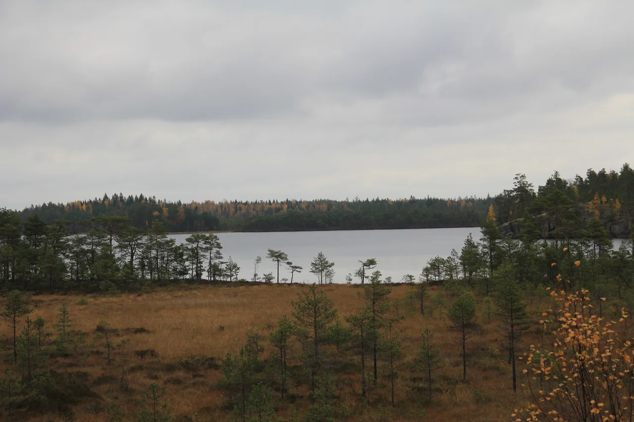

Vaskijärvi Strict Nature Reserve
Finland gives you the right to walk almost anywhere. Jokamiehenoikeus, everyman's right, lets you cross private forest, pitch a tent for a night, pick a bucket of berries and take mushrooms home, all without asking anyone. Against that background, Vaskijärvi is a deliberate exception. Here in Pöytyä, in the interior of Finland Proper, fifteen square kilometres of bog and old forest have been set aside under Finland's strictest conservation category, and the rules invert everything a Finn assumes about being outdoors. Stay on the two marked paths through the reserve during the snow-free season. Do not camp. Do not pick the cranberries. The place is not being protected for you; it is being protected from you.
A Reserve, Not a Park
Finland maintains nineteen strict nature reserves alongside its national parks, and the two categories are doing entirely different jobs. A national park is a conservation area with visitors designed into it: trails, shelters, signage, a certain amount of managed wear. A strict nature reserve exists for science. Its purpose is to keep a piece of landscape as close to its untouched state as anyone can manage, permanently, so that researchers have something honest to measure against. Public access is normally prohibited outright, and where trails do exist they are a narrow concession rather than the point. Vaskijärvi, protected since 1956 and enlarged in 1983, is one of the older entries on that list, and it sits in the most heavily farmed and settled corner of the country, which is precisely why it was worth freezing.
The Lake That Is Not In It
There is a small joke in the name. Vaskijärvi, the lake the reserve is named for, lies on the southeastern boundary and falls outside the protected perimeter. The waters that are inside are smaller and less obvious: Kajavajärvi, Vähä-Valanen and Iso-Valanen. What fills the space between them is peat. Most of it is raised bog, the rain-fed domes typical of southern Finland, but there are patches of aapa mire too, the fen type that properly belongs several hundred kilometres north, and with it a scattering of other northern characteristics that have no business this far south. Islands of old forest stand up out of the wet ground. In a region where nearly every hectare has been drained, logged, farmed or built on at some point in the last four centuries, this combination has become genuinely difficult to find.
Who Lives Behind the Line
Cranes nest in the open bog and capercaillie hold their spring display grounds in the forest, birds that need space and quiet in roughly equal measure. Otters work the waterways. Flying squirrels, the nocturnal gliders whose Finnish populations have driven more than one logging dispute, are present in the older stands, and wolves range through. Some of the reserve's least visible residents may matter most: rare bracket fungi of old-growth forest, including korpiludekääpä, which live on decaying wood that has been left standing and falling for generations. Deadwood is exactly what a managed forest is designed not to have. Protecting it is unglamorous work, and it is a large part of what the fence line here is actually doing.
Walking the Edge
You can still get close. The Kuhankuono trail network, which stitches together the protected areas of the region, runs a circuit of about nineteen kilometres around Vaskijärvi from the parking area at Elijärvenkulma, a full seven-hour day. Campfire sites at Vesirauma and Valastenmaa sit deliberately outside the reserve boundary, where everyman's right applies again and you may light a fire and sleep. A longer weekend route from Yläne and back covers 32.6 kilometres, and the trail continues on to Kurjenrahka National Park for anyone building a multi-day traverse. The experience is unusual in Finnish hiking: for a few kilometres you pass through a landscape on sufferance, with the sides of the path acting as a wall.
The Bargain
It is worth sitting with the trade this represents. A country that has written open access into law, that treats the forest as a commons and the right to sleep under a tree as close to a civil liberty, has decided that a handful of places should be exempt from all of it. Nineteen reserves out of an entire national landscape is not a heavy price. But standing at the boundary sign, told to keep to the path in a nation that otherwise tells you to go where you like, you understand the reasoning more clearly than any amount of interpretive panelling could achieve. Some ground is worth more unwalked.
From the Air
60.8439 N, 22.2511 E, in the municipality of Pöytyä in the interior of Finland Proper, about 55 km north of Turku. From the air the reserve shows as a pale, roughly unbroken sheet of open and forested bog with darker forest islands, distinctly less cut up by drainage ditches and forest roads than everything around it - the ditch pattern stopping at a straight line is the best way to find the boundary. Lake Vaskijärvi on the southeastern edge and the small lakes Kajavajärvi, Vähä-Valanen and Iso-Valanen give positive fixes. Turku Airport (EFTU) lies roughly 50 km to the south; Pori Airport (EFPO) about 65 km northwest. A viewing altitude of 2,000 to 3,500 feet AGL works well. Spring and autumn give the best colour separation; ground fog forms readily over the peat on calm mornings.
Nearby Stories
- Church of Loimaa Proper 7.6 km away
- St. Henry's Chapel 9.9 km away
- Liinmaa Castle 11 km away
- Kankainen Manor 16 km away
- Sastamala 19 km away
- Uusikaupunki Automobile Museum 22 km away
- Battle of Grönvikssund 26 km away
- Halikko Church 30 km away