
Pyhämaa
Two stories explain the name, and the better one is probably false. Pyhämaa means "holy land" in Finnish, and for generations islanders had a satisfying account ready: the place had once been Pahamaa, evil land, a haunt of evil spirits, pirates and criminals, until Isaacus Rothovius, Bishop of Turku, ordered a church raised here in the seventeenth century and the ground was cleansed along with the name. The scholar Veikko Paasio took that account apart. The island was never called Pahamaa, he argued; the word pyhä attached itself to remote places, and Pyhämaa lay a long way from the early settlement centres at Untamala and Kalanti. Pyhämaa could also denote a sacrificial grove. The name first surfaces in a land register of 1540, spelled Pyhema — no demons, no exorcism, just an entry made for the purpose of collecting tax.
Land That Keeps Arriving
Pyhämaa is mostly islands, and several of those islands are no longer islands. The ice sheet that once pressed this coast down melted thousands of years ago, and the bedrock has been rising ever since. Channels shoal. Straits silt up and turn into meadow. Villages that early settlers could only reach by boat — Kammela, Kuivarauma, Pitkäluoto, Kukainen, Ketteli, Kursila, Heinänen, and Edväinen, which people here call Erväne or Ärväine — now sit on continuous ground.
The main island held out longer than the rest. Not until 1891, when a bridge was carried across the Katarauma strait, could anyone reach Pyhämaa dry-shod. When the municipality's books closed for the last time at the end of 1973, they recorded 73.6 square kilometres of land and 848 people living on it.
Angels on a Log Wall
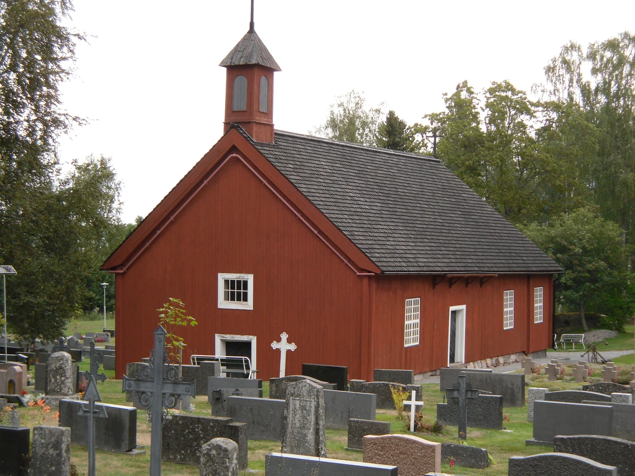
From outside, the old church at Pyhämaa reads as a red-boarded barn with a weathervane on the west gable. It was built between 1647 and 1652 — a wooden long-church, rectangular, closed at the altar end on three sides, with no tower whatever — and it counts among the best-preserved seventeenth-century churches in Finland. The red boarding is a modern modesty, added in the 1960s. Underneath, the walls are logs.
Step through the door and the plainness stops. In 1667 the entire interior was painted in glue-bound distemper, probably under the direction of a master painter named Christian Wilbrandt, and nobody has since scrubbed it away. Scenes from scripture run across the log walls like hung tapestry. Overhead, on the shallow barrel vault, plump angels float inside wreaths of flowers, with garlands and clusters of fruit crowding the spaces between them. The pulpit dates from the 1640s, the pews from the eighteenth century. Tradition on this coast holds that the first church here was raised by Franciscan brothers who left Rauma when the Reformation dissolved their friary.
Demoted, Then Rescued
By 1804 the old church had decayed far enough that a new one was built beside it, close enough that the two share a churchyard. The older building was reduced to a storehouse. Over the following century it lost its sacristy, its weapons porch and its bell tower, all pulled down piecemeal; the new church, meanwhile, acquired its present bell-tower profile in a renovation of 1908.
Then in 1935 somebody looked properly at what had been sitting under the dust, and the old church was restored and brought back into use. It is known as the uhrikirkko — the votive church. Finland kept one of its most complete seventeenth-century painted interiors largely by neglecting it rather than improving it, which is not the usual way heritage survives.
The Refinery That Never Came
Pyhämaa spent centuries arguing about which parish and which municipality it belonged to. It broke free of Laitila to become a parish in its own right in 1639. A chapel community at Rohdainen followed in 1688, displaced Pyhämaa as the parish centre in 1782, and finally separated altogether in 1908 under a new name — Pyhäranta, a coinage credited to a skipper from the village of Hirslahti named Kustaa Aaltonen. More territory arrived from Kalanti in 1942.
The last change was not negotiated. At the start of 1974 Pyhämaa was folded into the town of Uusikaupunki against the wishes of its residents, partly because Neste Oy intended to put its third oil refinery on municipal ground. The refinery was never built. A community that had defended its own boundaries for three hundred years surrendered them to an industrial project that never broke ground. The village carries on regardless, and still runs its own school for grades one to six — twenty-seven pupils in the 2022–23 year.
Where the Road Runs Out
At Pamprinniemi, on the north-western tip, the parish of Pyhämaa maintains a protected nature area with a marked trail four and a half kilometres long. The walk explains the place more efficiently than any archive: low granite scoured smooth, wind-cropped pine, water on three sides, and a horizon running west across the Bothnian Sea without interruption.
Whether the medieval mind read this shore as consecrated ground or simply as the outer edge of the known world, the sensation it produces has not changed much. Paasio was almost certainly right about the etymology. Standing on the last rock with the sea going on and on, you can also see exactly why the other story was the one people preferred to tell.
From the Air
Pyhämaa lies at 60.9517°N, 21.3705°E on the Bothnian Sea coast, roughly 12 km northwest of Uusikaupunki. From 2,000–4,000 feet the geography reads clearly: a maze of low granite skerries and shallow inlets, with the mainland connection at the Katarauma strait bridge showing as a thin line across water. The paired churches — a small wooden one and a stone one of 1804 — stand together near the village centre and make a reliable visual fix. Nearest controlled fields are Turku (EFTU) about 37 nm southeast and Pori (EFPO) about 33 nm north-northeast; Eura (EFEU) lies inland to the east. Expect brisk onshore winds and rapid visibility changes in sea fog from spring into early summer. In winter, pack ice can make the shoreline almost impossible to distinguish from the frozen sea.
Nearby Stories
- Louhisaari Manor 8.4 km away
- Olkiluoto Nuclear Power Plant 12 km away
- Kustavi 12 km away
- Villilä Manor 24 km away
- Vaskijärvi Strict Nature Reserve 26 km away
- Battle of Bomarsund 56 km away
- Kastelholm Castle 83 km away
- 1971 Söderhamn Courthouse Murders 198 km away