
Kustavi
Nine hundred pages, two volumes, six hours. Volter Kilpi's Alastalon salissa spends all of it inside one parlour of roughly fifty square metres, on a single October Thursday in 1866, while a handful of Kustavi farmers and shipowners circle one question: whether to sink their money into building a barque. The novel is regularly named among the finest ever written in Finnish, and it is also famously untranslatable, because Kilpi worked a private style out of dialect and coastal speech that resists any other language. He was born in this parish on 12 December 1874, into a family that had owned ships. The book's slow, tidal argument is really the argument of the place itself: out here, everything of consequence has always come down to the sea, the weather, and who is willing to risk what.
The Librarian Who Kept Coming Back
Kilpi was born Volter Ericsson, and he spent most of his working life indoors among other people's books. More than twenty years went to the University of Helsinki Library. In November 1920 he became the first librarian of Turku's new Finnish-language university, and he died in that city on 13 June 1939. The great Kustavi work came late: Alastalon salissa appeared in 1933, when he was fifty-eight, followed by Pitäjän pienempiä in 1934 and Kirkolle in 1937, a run of books that keeps returning to the same shoreline parish and the same few households. Kustavi has not let go of him either. The local literary society runs a Volter Kilpi week every July, and a marked culture path follows the walk described in Kirkolle, so you can read the sentence and then go stand in the place that produced it.
Land That Is Still Arriving
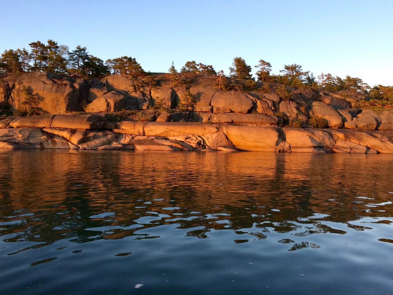
The ice sheet that pressed this coast down melted more than ten thousand years ago, and the bedrock has been springing back ever since. Kustavi is what that looks like in slow motion. Islands that stood apart a few centuries ago are joined now; sounds that boats once rowed through have become lowlands and long shallow bays. The place names have not caught up, so a farm whose name ends in -saari, island, may sit well inland on a rise of juniper and scoured granite. Of the municipality's 770 square kilometres, only 166 are land. Everything else is water, threaded with more than two thousand skerries and islets, and the main islands are stitched to the mainland by a chain of bridges running west from Taivassalo.
Ströömi, and the Road Made of Water
Ströömi is simply "stream," worn smooth by Swedish-speaking mouths, and it is the long straight sound running through the middle of Kustavi. It is also the reason anyone came here at all. A 5.5-metre fairway follows it from the Archipelago Sea out to the Bothnian Sea; the classic small-boat passage from Hanko to Uusikaupunki threads its whole length, and most of the guest harbours hide just off it, tucked behind an island or a headland. The traffic is far older than the buoys. Kustavi sat on the Great Post Route from Stockholm to Turku, inaugurated in 1636, where mail and travellers crossed from Åland by open boat and continued overland. Red poles still mark the land stretch from Rantapuhti in Etelä-Vartsala, though many have gone missing. At Vuosnainen, ferries still leave for Brändö.
A Lantern and a Gun Battery
Two structures out in the open water say what this archipelago was worth to whoever held it. Isokari, about 24 kilometres southwest of Uusikaupunki but within Kustavi's waters, carries a brick lighthouse completed in 1833. Pilot major Gustaf Brodd designed it after the Tolbukhin light near Kronstadt, and Carl Ludvig Engel refined the plans, adding a Greek pediment and columns above the door as though a customs house had been posted out to sea. Its light burns 49.4 metres above the water. Northwest of Ströömi's mouth, on Lypertö, the Russian Empire built the Katanpää batteries between 1915 and 1917 as the northernmost link in the fortress chain guarding the approaches to St Petersburg. Two concrete gun positions remain, with cobbled roads, barracks and a wooden water tower. The place held prisoners from 1931 to 1940 and now belongs to Bothnian Sea National Park.
Nine Hundred and Seventy-Two, Until June
At the end of 2025 Kustavi counted 972 residents, the smallest population of any municipality in Southwest Finland. Then summer arrives and the arithmetic breaks. More than 2,800 holiday cottages line these shores, and the number of people in the municipality swells roughly tenfold. What the summer people find is a parish holding on to some odd inheritances. Maypoles still go up at Etelä-Vartsala, Pohjois-Vartsala and Rahi, a coastal Swedish custom that is rare in Finnish-speaking Finland, and Kustavi is 93 percent Finnish-speaking despite a map covered in Swedish names. Even the name is borrowed. The chapel congregation founded in 1783 was called after Gustav III, then reigning in Stockholm; Kustavi became its own parish in 1865 and its own municipality in 1874. In August, everyone turns out for the salmon market.
From the Air
60.546°N, 21.358°E, at the northern edge of the Archipelago Sea where it opens into the Bothnian Sea. From 3,000 to 5,000 feet the geography reads immediately: the long straight north-south slot of Ströömi splitting the main islands, the bridge chain running west from Taivassalo, and a scatter of two thousand skerries dissolving westward toward Åland. Isokari's lighthouse stands alone out to the northwest with nothing vertical near it, which makes it the best single visual fix in the area. Turku (EFTU) lies about 60 km southeast; Mariehamn (EFMA) is roughly 90 km west across the Skiftet; Pori (EFPO) sits about 105 km north. Summer brings long low light and frequent sea haze. In winter the sounds freeze and the whole pattern of island and water flattens into one white plain, which makes low-level navigation here considerably harder than the chart suggests.
Nearby Stories
- Louhisaari Manor 2.4 km away
- Pyhämaa 16 km away
- Vaskijärvi Strict Nature Reserve 25 km away
- Battle of Bomarsund 29 km away
- Battle of Sandöström 40 km away
- Kastelholm Castle 51 km away
- Archipelago National Park 54 km away
- 1971 Söderhamn Courthouse Murders 205 km away