
Korgen
The drive takes about six minutes. You go in at Knutli in Vefsn Municipality, follow 8,530 metres of lit concrete under the mountain, and come out at Korgen with the Rossaga in front of you. Since 16 September 2005 that has been the ordinary way through, and it is so unremarkable that most drivers never think about the alternative. Roughly 560 metres above the tunnel roof is the road they no longer have to take - a narrow, winding pass where trucks with trailers regularly stuck fast in the snow and where the region was routinely cut in half every winter. That road has a name, one shared with several forced-labour roads scattered across North Norway: Blodveien, the Blood Road.
The Road Above the Tunnel
The Germans built the pass over Korgfjellet during the occupation, replacing a ferry crossing between Elsfjord and Hemnesberget. They did not build it themselves. The work was done by prisoners, and one of the barracks camps that housed them stood at Fagerlimoen, on the edge of Korgen - a satellite camp holding mainly Yugoslav prisoners, men shipped the length of Europe to a plateau where the weather alone could kill you.
The best documented of Norway's Blodveien roads runs by the Saltdalsfjord. Of the roughly nine hundred Yugoslav prisoners who passed through the Botn camp between July 1942 and June 1944, about half died - shot, beaten, starved or worked past the point a body can recover from. Four or five men shared a loaf; the working day ran fourteen hours. Korgen's road earned the same name from the same system. A war memorial stands at Fagerlimoen now, on the ground where the barracks were. The men it remembers built the road that every truck used for sixty years.
A Bend in the Rossaga
The village takes its name from the river, or possibly from the people who were here before the river had a Norwegian name. One explanation traces Korgen to the great bend the Rossaga makes here, connecting it to korge, a ring of woven withies. The other reaches back into Ume Sami country - this is Ume Sami land - and the word Guarguo, meaning stony ground in a lake, or more loosely a shoal or gravel bar in a river. Both readings describe the same thing: water doing something particular at this exact spot, noticed and named.
The Rossaga still splits the village in two, and Korgen crosses it twice. A suspension bridge carries local traffic. A concrete bridge carries the E6. Bjerka lies about 8 kilometres north; Bleikvasslia is 20 kilometres south along County Road 806.
Two Hundred Metres Under the Rock
Three years after the war ended, Norway started digging into the mountain at Vesterli, just outside the village, for reasons that had nothing to do with the German road. Work on the Rossaga hydroelectric development began in 1948 and started generating power in 1955, and the Nedre Rossaga machine hall was placed roughly 200 metres inside solid rock.
It is still working, and working harder than it did. A modern upgrade added a second mountain hall alongside the original and a new Francis turbine; by 2016 the plant was rated at 350 megawatts and producing something in the order of 2,056 gigawatt-hours a year. Statkraft, the state power company, keeps a regional office near the municipal building in the village. For a settlement of well under a thousand people, having a national-scale power station buried in the hill behind the church is a peculiar sort of civic asset - invisible, enormous, and quietly paying for a good deal of what happens above ground.
Nine Hundred People, One Square Kilometre
Korgen is compact to the point of being emphatic: 912 people in 2024 packed into 0.98 square kilometres, a density of 931 per square kilometre. In a municipality with 2.8 people per square kilometre, that concentration makes it the largest urban area in Hemnes, and its administrative centre. It held the same role for the old Korgen Municipality, from 1918 until that municipality was dissolved in 1964.
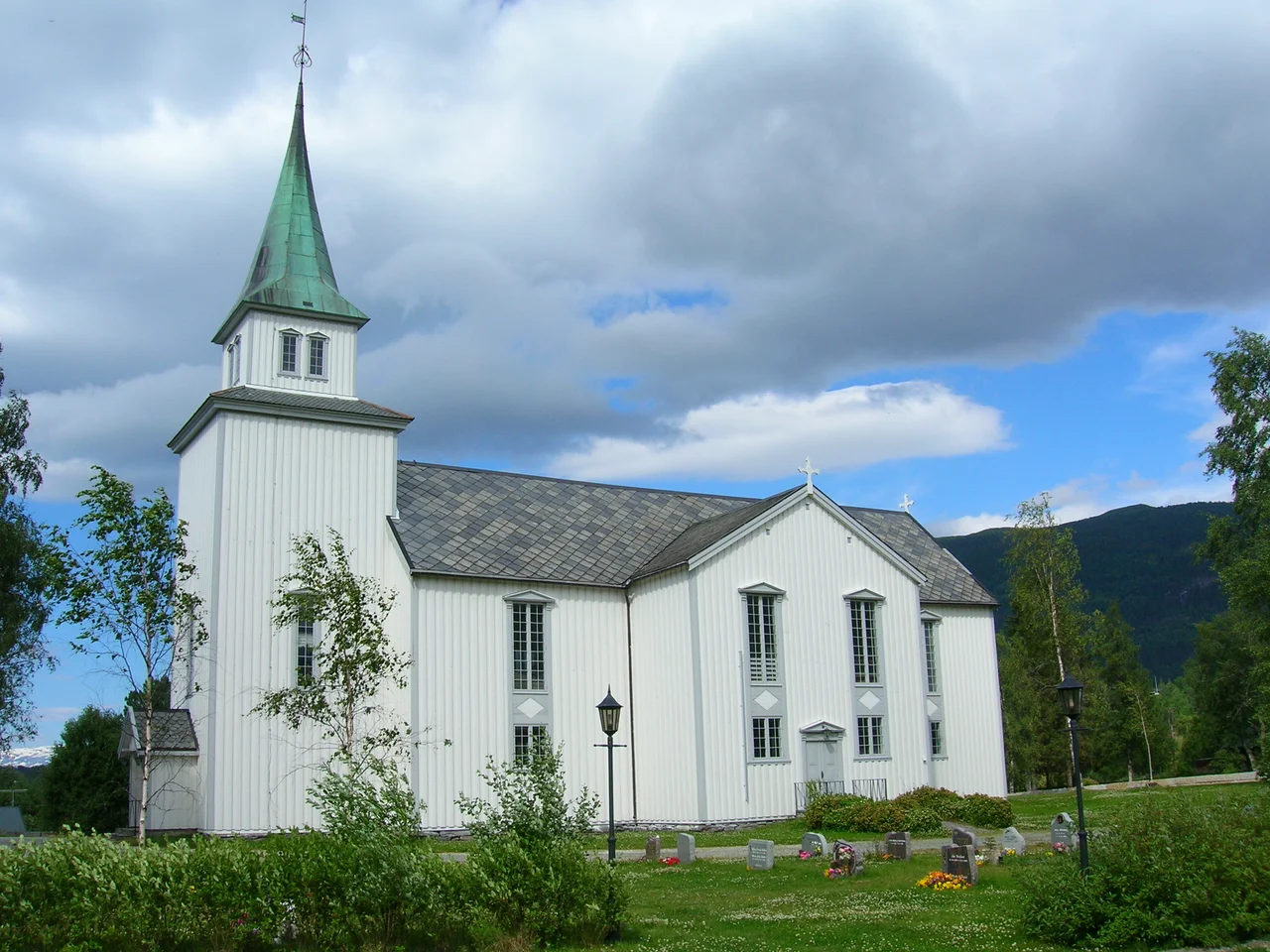
Korgen Church has stood here since 1863 - a cruciform church built of timber, with 450 seats, which is to say room for half the village at once. Korgen Idrettslag, the sports club, was founded in 1935 and still runs skiing, football, orienteering and handball. The mountains do the rest of the boundary-drawing: Korgfjellet, also called Vesterfjellet, to the southwest toward Mosjoen; Klubben to the east; Kangsen to the north toward Mo i Rana.
What the Tunnel Changed
The Korgfjell Tunnel cost around 450 million kroner, took four years to bore, and shortened the E6 by 4 kilometres while cutting ten to twenty minutes off the drive. Those are modest numbers for a project of that size. The real return was measured in winters.
For generations, Korgfjellet was the reason inner Helgeland functioned as two regions rather than one - Korgen on one side, Elsfjord on the other, and a mountain between them that closed when it felt like it. The tunnel ended that argument. What it also did, without anyone deciding it, was retire the Blood Road to the status of a scenic detour. It is still up there. In summer you can drive it, look out over the Luktvatnet country, and see nothing that explains the name.
From the Air
Korgen lies at 66.0764 N, 13.8219 E, in a valley along the river Rossaga. The village is small - 0.98 sq km - but easily located: the E6 highway emerges from the eastern portal of the 8,530 m Korgfjell Tunnel here, and the Rossaga runs through the settlement with two distinct bridge crossings. Korgfjellet, also called Vesterfjellet, rises to the southwest with the old mountain pass road cresting near 560 m; Klubben lies to the east and Kangsen to the north. High terrain dominates the district, with the Okstindan range and Oksskolten at 1,916 m - the highest mountain in North Norway - to the east. Nearest airports are Mo i Rana Airport, Rossvoll (ENRA), roughly 39 km to the northeast, and Mosjoen Airport, Kjaerstad (ENMS), roughly 42 km to the southwest. Recommended viewing altitude is 5,000-7,000 ft for the valley, higher if crossing Korgfjellet. This pass is notorious for winter weather and rapidly forming cloud; treat forecasts for the valley as no guide at all to conditions over the mountain.
Nearby Stories
- Toven Tunnel 9.2 km away
- Joesjö 9.7 km away
- Hattfjelldal Church 17 km away
- Actions in Nordland 19 km away
- Dunderland Valley Bus Crash 26 km away
- Ume River 28 km away
- Operation Musketoon 59 km away
- Træna Lighthouse 65 km away