Lagoa São Paulo Reserve
Fernando Costa meant well. In November 1942, the governor of São Paulo state signed Decree 13.049 creating a 14,200-hectare ecological reserve around seven lagoons in a stretch of forest that was, by then, the last large woodland remaining in the interior of his state. He had watched squatters and land-grabbers pick apart the frontier for years, and the reserve was meant to be a stop. It was not a stop. By the 1950s, five hundred families were living inside the reserve. By the 1980s, bulldozers and excavators had started carving the lower Paraná River into a hydroelectric reservoir. By 1998, a presidential decree formally abolished thirteen thousand hectares of the protected area that the water had already swallowed. What started as the last great forest of interior São Paulo is now a fragment, a scar, and a case study in what happens when the state stops defending the land it claims to protect.
The Pontal
The reserve sat in the Pontal do Paranapanema — a wedge of land at the far western tip of São Paulo state, bounded by the Paranapanema River to the south, the Paraná River to the west, and the state of Mato Grosso do Sul across those waters. This was the last frontier of São Paulo's internal colonization, the place where the Atlantic Forest gave way to the Cerrado-forest mosaic and where settlers, ranchers, and loggers had pushed the native forest back for decades. By the early 1940s, almost all the original forest cover of the interior of the state had been cut. Three large reserves were created in quick succession to try to preserve what remained: the Morro do Diabo Forest Reserve in October 1941, the Lagoa São Paulo Reserve in November 1942, and the Great Pontal Reserve later that same November. Together, those three protected areas covered 297,340 hectares of forest. It was the closest São Paulo had ever come to a meaningful conservation gesture.
The Politics of Neglect
Costa's successor saw the reserves differently. Adhemar de Barros, who followed him as governor, allowed the destruction to continue and was backed by mayors of the region, many of whom had been elected by or were personally connected to the ranching and logging interests that wanted the forest opened. Lagoa São Paulo was the first reserve to be invaded. The Great Pontal Reserve was next, and in 1944 Adhemar de Barros reduced it from 246,840 hectares to 108,900 hectares — more than half the protected area simply signed away. By the 1950s, 500 squatting families had made the Lagoa São Paulo Reserve their home. Jânio Quadros, taking office in 1955, tried to protect what was left. His measures included stronger enforcement and new decrees. When Adhemar de Barros returned for a second term, he repealed most of what Quadros had done — but kept one decree alive, the one that created the Morro do Diabo State Park, which is why that single fragment still exists today as a protected area of meaningful size.
The Water Came
The Companhia Energética de São Paulo, known as CESP, began damming the Paraná River in the 1980s. The Engenheiro Sérgio Motta dam — named for the engineer and politician who had championed its construction — would become one of the largest hydroelectric projects in Brazil, inundating land across two states as its reservoir filled. The flooding swallowed the lagoon complex at the center of the Lagoa São Paulo Reserve. It drowned the municipality of Presidente Epitácio's shoreline and most of Caiuá's. It consumed the Rio do Peixe valley. Law 10.018, signed on July 2, 1998, formally suppressed 13,227 hectares of the Lagoa São Paulo Reserve and 3,211 hectares of the Great Pontal Reserve that had already gone underwater. CESP paid indemnities. Four new protected areas were created in other places — the Rio Ivinhema State Park, the Aguapeí State Park, the Rio do Peixe State Park, and the Cisalpina Private Natural Heritage Reserve — a compensatory package totaling roughly 96,000 hectares. But the reserves that had been lost stayed lost.
What Escaped
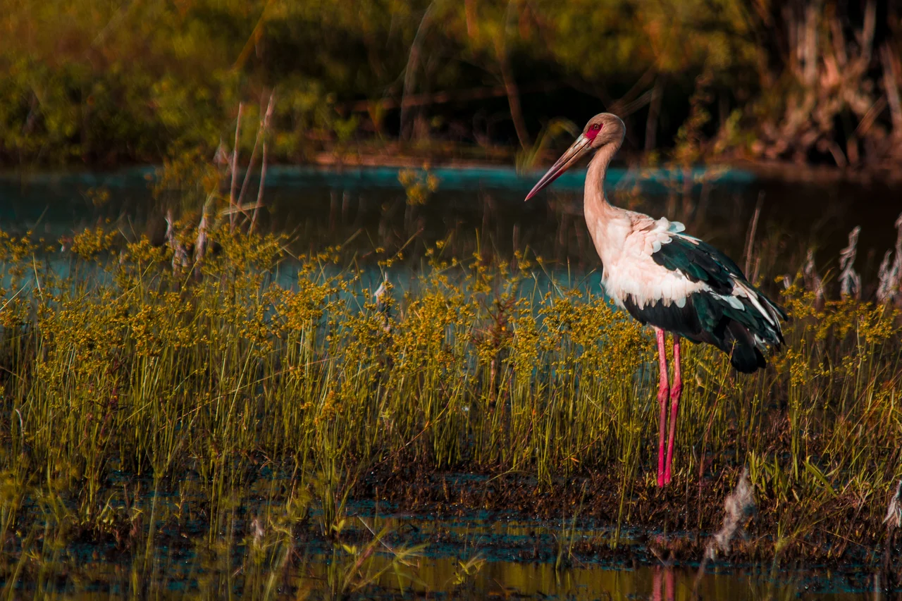
About 3,500 hectares of the original Lagoa São Paulo Reserve escaped the flooding. This remnant should have been protected in practice as it was on paper. As soon as the reservoir filled, hunters moved in. Sport fishermen came next. Then landless rural laborers, then cattle ranchers expanding their grazing areas into the unguarded woodland. By 2003, when surveyors documented what remained, the official reserve had shrunk to 936.97 hectares in Presidente Epitácio — less than seven percent of the original area. Fragments of forest and marsh persisted. Researchers documented 166 bird species still using the habitat, some rare, some endangered in São Paulo state. Archaeologists found something else: 2,000-year-old remains left by the Guarani-Kaiowá people, whose ancestors had lived along these rivers long before any Portuguese settler or São Paulo governor had staked a claim.
A Corridor Still Imagined
By 2007, private-public partnerships were working to restore what could be restored. The reserve was proposed as part of the Trinational Biodiversity Corridor, an ambitious project intended to link conservation units across Brazil, Paraguay, and Argentina in the Upper Paraná ecoregion. If completed, the corridor would reconnect forest patches that had been isolated by development into a working ecological network — the kind of landscape-scale conservation that the original reserves, back in 1942, had been trying to protect. Whether Lagoa São Paulo's remnant eventually joins that corridor depends on political will, funding, and the willingness of people living on the land to cooperate with a vision of forest recovery that their grandparents' generation helped make necessary. The lagoons that gave the reserve its name are mostly underwater now. The forest that made the reserve worth protecting is mostly gone. What remains is a lesson, a warning, and a seedbed.
From the Air
Coordinates: 21.69°S, 51.96°W. Recommended viewing altitude: 3,000-6,000 feet AGL to trace the Paraná River reservoir and identify the small fragments of surviving forest near Presidente Epitácio. Nearest airports: Presidente Prudente (SBDN) approximately 85 km east; general aviation at Presidente Epitácio (SDOY). The Engenheiro Sérgio Motta Dam is a prominent navigation landmark — its straight-line concrete wall contrasts sharply with the natural river channel above the reservoir.
Nearby Stories
- Cisalpina Private Natural Heritage Reserve 25 km away
- Presidente Prudente 51 km away
- Nova Andradina 103 km away
- Birigui 104 km away
- Pompeia, São Paulo 120 km away
- Adamantina Formation 128 km away
- Campo Grande 257 km away