.jpg)
Lake McClure
Hang gliders call it one of the most reliable soaring sites in California. Three hundred and twenty days a year, thermal columns rise off the sun-baked foothill terrain around Lake McClure, carrying pilots on silent loops above a reservoir that stretches across western Mariposa County like a crooked blue finger. The lake sits where the Merced River descends from the high Sierra toward the San Joaquin Valley, and its name honors a man whose most lasting contribution had nothing to do with dams. Wilbur Fiske McClure, California's head engineer, helped survey and lay out the route for the John Muir Trail, that 211-mile path threading the spine of the Sierra Nevada. In 1926, the year the original dam was completed, the reservoir was renamed in his honor.
Two Dams, One Canyon
The original Exchequer Dam was a concrete gravity arch structure completed between 1924 and 1926, impounding the Merced River to create a reservoir of 281,000 acre-feet. It was a respectable piece of engineering for its era, but postwar California was growing faster than anyone had planned for. By the 1960s, the Merced Irrigation District needed far more storage to keep northern Merced County farms watered through the dry months. In 1967, the New Exchequer Dam rose around and above the original, a rock-fill dam faced with reinforced concrete that nearly quadrupled the reservoir's capacity to 1,032,000 acre-feet. The old dam still exists somewhere beneath the lake's surface, entombed in the larger structure's foundations. At the base of New Exchequer sits a hydroelectric plant generating 94.5 megawatts, enough to power roughly 70,000 homes.
An Irrigation Empire
Lake McClure exists because the San Joaquin Valley needs water and the Merced River has it. The Merced Irrigation District operates approximately 800 miles of canals fanning out from the dam across the valley floor, delivering water to farms that grow almonds, sweet potatoes, and cattle feed. It is an irrigation network larger than some states' entire highway systems. Only a small fraction of the reservoir's water goes to municipal drinking supplies, which is why the lake remains open to swimmers, boaters, and water skiers rather than being locked behind the kind of restrictions that govern many California drinking water reservoirs. Six miles downstream, the smaller McSwain Dam creates Lake McSwain, a 9,700 acre-foot regulating reservoir that smooths out the pulses of water released from its larger sibling. McSwain has its own modest hydroelectric plant producing 9 megawatts.
Mercury in the Water
The fishing is good at Lake McClure. Bass, trout, and catfish draw anglers year-round, and the marina offers full services for boats of every size. But the California Office of Environmental Health Hazard Assessment has issued safe eating advisories for fish from both Lake McClure and Lake McSwain due to elevated mercury levels. The mercury is not from modern pollution. It is a legacy of Gold Rush-era hydraulic mining that blasted mercury-laden sediments into rivers throughout the Sierra Nevada foothills more than a century ago. The element settled into river-bottom sediments, where bacteria convert it to methylmercury, a form that accumulates in fish tissue. It is a reminder that California's mining heritage persists in ways the forty-niners never anticipated, tainting waters that look pristine from above.
Riding the Thermals
The hang gliding community discovered Lake McClure's exceptional soaring conditions decades ago and has never left. The surrounding terrain, a mix of exposed grassland and oak-studded foothills, absorbs the Central Valley's intense summer heat and radiates it back as powerful thermals. Pilots launch from ridges above the lake and ride rising columns of warm air in wide circles, sometimes climbing thousands of feet before gliding back down. The claim of 320 soarable days per year is extraordinary even by California standards, making the site a destination for pilots from across the western United States. Beyond the air, the lake itself offers camping, boating, and water skiing across its long, winding arms. The reservoir's shape, dictated by the drowned canyons of the Merced and its tributaries, creates countless quiet coves that feel remote even when the main body of the lake is busy with summer traffic.
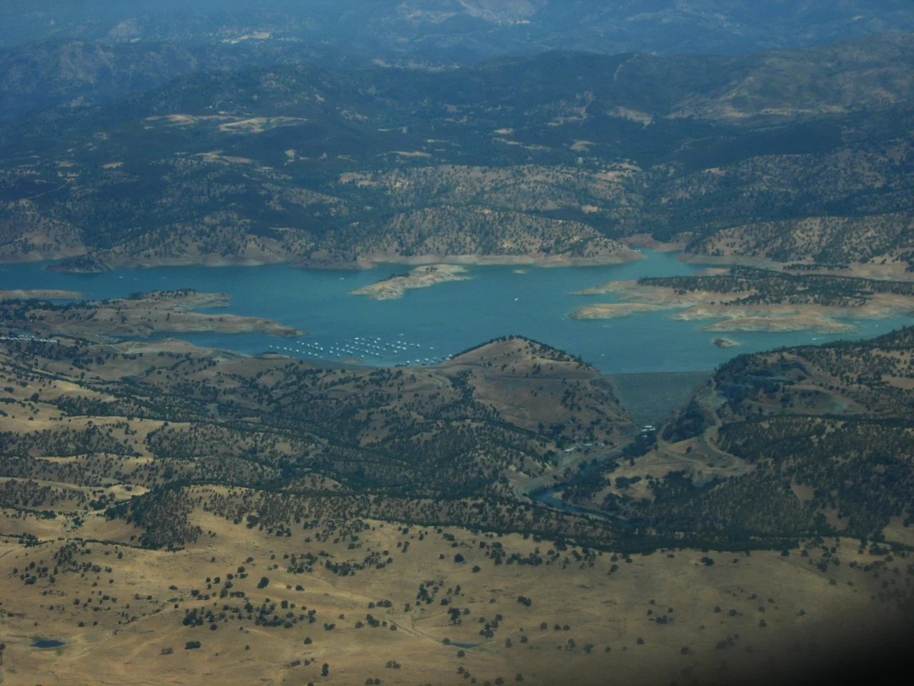
From the Air
Lake McClure is located at 37.64N, 120.28W in western Mariposa County, about 40 miles east of Modesto. The long, branching reservoir is clearly visible from the air, with the New Exchequer Dam at its western end. Best viewed at 3,000-5,000 feet AGL. Nearby airports include Merced Regional Airport (KMCE) approximately 30 nm west and Mariposa-Yosemite Airport (KMPI) about 15 nm east. Watch for hang gliders operating near the lake's ridgelines. Lake McSwain is visible approximately 6 miles downstream from the main dam.
Nearby Stories
- Ferguson Fire 5.9 km away
- Fifteen Minutes at UC Merced 8.5 km away
- Gwen Araujo and the Law She Changed 23 km away
- Coarsegold, California 26 km away
- The Spinach Riot 42 km away
- Indian Grinding Rock State Historic Park 55 km away
- Mount Hamilton (California) 63 km away
- Mono Lake 77 km away