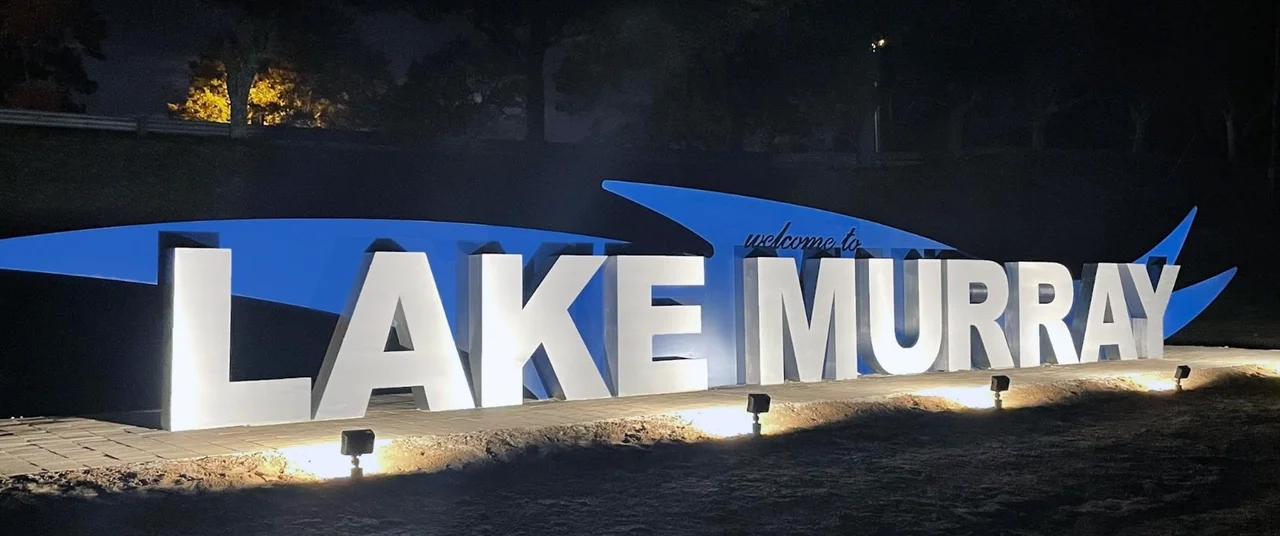

Lake Murray (South Carolina)
Between 1927 and 1930, workers built a dam 1.5 miles long and 213 feet high across the Saluda River in central South Carolina, using nothing more exotic than the red clay soil under their feet. When it was finished, the Saluda Dam was the largest earthen dam in the world. Behind it rose Lake Murray - 41 miles long, 14 miles wide, 50,000 acres - the largest man-made reservoir on Earth at the time of completion. To make room for the water, surveyors first had to move three churches, six schools, and 193 graveyards containing 2,323 graves.
The Dutch Fork
Long before the dam, the lower Saluda River valley was settled in the 1750s by German and Swiss emigrants. Two main communities took root: the Dutch Fork at the meeting of the Broad and Saluda Rivers, and the Saxe-Gotha township. By 1760, the Dutch Fork held 483 settler families. By 1765, an estimated 9,000 Germans and German-Swiss had arrived in South Carolina - roughly 8.4 percent of the province's population. The community kept its language and customs tight. Today, surnames in the area still carry that heritage: Sligh, Dreher, Bouknight, Wessinger, Koon, Frick, Epting, Lindler. Many of these families still hold land originally granted by the King of England. During the American Revolution, while the surrounding English settlements largely sided with the Crown, the Dutch Fork was overwhelmingly Patriot.
T. C. Williams Moves the Dead
On July 8, 1927, the Federal Power Commission granted Lexington Water Power Company a license to build a dam at Dreher Shoals, ten miles west of Columbia. The reservoir and its protective margins would cover about 65,000 acres, but to secure that land - much of it never properly recorded, some still under crown grants from King James II - the company had to purchase 100,000 acres total. The man assigned this task was T. C. Williams, and his job came with a catalog of complications: 1,100 parcels, 5,000 living people, three churches, six schools, and 2,323 graves to be relocated. Some property had passed father-to-son without any legal transfer for generations. Williams negotiated each one. Many of the displaced families took up land along the new shoreline and stayed in their old neighborhoods - a softer dislocation than most reservoir projects produced.
An Engineering First
Construction relied on the native red clay - a material engineers had largely dismissed for major dam work - and on bedrock anchoring the structure to the Piedmont. A three-mile railroad spur was built from the Columbia, Newberry & Laurens Railroad at Irmo to haul construction material. Grading began September 12, 1927; the rail line was operating by November 25. The dam itself rose to 213 feet at its highest point and stretched 1.5 miles end to end. When it impounded in 1930, the resulting reservoir set the world record for largest man-made body of water. The lake's chief engineer, William S. Murray, gave his name to the lake - he had also led the electrification of New Haven Railroad and was a major figure in early 20th century electrical engineering.
Bomb Island and the B-25
Lake Murray today is laced with small islands - Jim Spence Islands, Shull Island, and the islands of Dreher Island State Park, where three different islands now host a state recreation area in the northwest corner. The most famous is Bomb Island, locally called Lunch Island, one of the largest Purple Martin roosting sites in North America. Hundreds of thousands of the birds gather there each summer. Beneath the surface lies another story: during World War II, the lake was used as a bombing practice range. In 2005, a B-25 Mitchell bomber that had crashed during a training mission was salvaged from the lake bottom by the Lake Murray B-25 Rescue Project, led by Dr. Bob Seigler, John Hodge, and Dr. Bill Vartorella. The plane carried a rare 600-pound underside machine-gun turret - believed to be the only one in existence. It now sits at the Southern Museum of Flight in Birmingham, Alabama.
Fish, Fireworks, and the Dreher Walkway
Modern Lake Murray is South Carolina's recreational backyard. Largemouth bass, striped bass, blue and channel catfish, black and white crappie, and redear sunfish all thrive in the water. Public boat landings - Murray's, Jake's, Koon - dot the shoreline. North of Lexington, a walkway runs across the dam itself, with recreational areas on each side and a public beach on the south end. Each year, Spence Island hosts the Drift Jam rock and country concert in early June, fireworks on the Fourth of July, and Reggaetronic in mid-July. The lake sits within an hour's drive of Columbia, South Carolina's capital, making it a weekend escape for hundreds of thousands of residents in the Lexington, Richland, Newberry, and Saluda counties that share its 650 miles of shoreline.
From the Air
Lake Murray sits centered at 34.07N, 81.33W in central South Carolina, about 15 nautical miles west of Columbia. The lake surface is roughly 360 ft MSL. Recommended viewing altitude 3,500-5,500 ft - the irregular shoreline with 650 miles of coves and the 1.5-mile-long Saluda Dam on the eastern end are striking from the air. Bomb Island (Lunch Island) is a notable Purple Martin roost. Primary commercial airport is Columbia Metropolitan (KCAE) southeast of the lake. GA alternatives: Columbia Owens Downtown (KCUB) and Aiken Regional (KAIK). The dam, lake, and surrounding terrain are flat Piedmont - no significant terrain hazards. Watch for low-level VFR traffic and floatplane activity in summer. Lexington and Irmo lie on the lake's southeast and east shores.
Nearby Stories
- Fort Jackson 4.4 km away
- Piedmont Atlantic Megaregion 8.1 km away
- Battle of Mobley's Meeting House 22 km away
- Stallings Island 24 km away
- Battle of Camden 25 km away
- Hix-Blackwell House 26 km away
- Orangeburg Massacre 28 km away
- Graniteville Train Crash: The Night Invisible Death Came to a Mill Town 44 km away