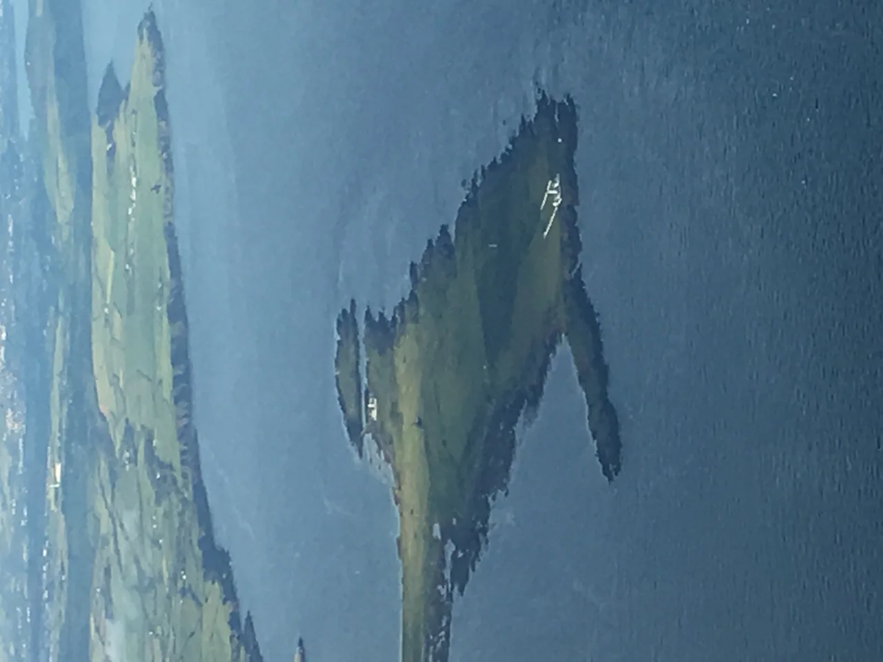

Langness Peninsula
The old Manx name for this peninsula was Oaie Ny Baatyn Marroo, the Graveyard of the Lost Ships, and for centuries it earned the name. Before there was a lighthouse, when fog rolled in off the Irish Sea the only warning to vessels was a party of men on the shore blowing a cow's horn. The sound carried half a mile on a good day. Langness is a long, thin, low rib of rock extending two kilometres south from the Isle of Man's coast, and from the air it looks like the island is sticking out an inquiring foot into the sea. It is the southernmost tip of the Manx mainland, the place where you have run out of land, and the people who built things here have always built them with the wrecks in mind.
An Island That Forgot It Was an Island
Langness was once a true island. The sea ran behind it. Over geological time, longshore drift from the prevailing currents along Castletown Bay heaped sand and shingle into a tombolo, a slender bar of deposited material, until at last the island was tied to the mainland. The little harbour community of Derbyhaven grew up on this isthmus, sheltered on both sides by water. The geology is older than most of what tourists are usually shown. The cliffs on the western shore reveal an unconformity where rocks roughly 480 million years old lie beside rocks some 130 million years younger, a gap of time that simply does not exist in the record. Coastal erosion has cut sea arches into the cliffs. Standing on the headland in March, with the Atlantic ocean swell breaking against rock that pre-dates the first vertebrates, you can feel quite small.
The Potato Grave
In 1832 a ship carrying Irish workers across to the Isle of Man for the potato harvest was lost off Langness with all hands. Thirty-two bodies washed ashore. By Manx custom, anyone found drowned was buried where they came to land, behind the nearest hedge, so the people of the parish dug a communal grave near where the lighthouse now stands and laid the thirty-two men in it together. Nobody knows most of their names. They were day labourers from the west of Ireland, men with families waiting for the wages of one season's work, and the grave is now a turf-covered mound that walkers pass without noticing. It is one of those places on the Manx coast where the history is in the ground rather than on a plaque. A bunch of fresh flowers turns up there from time to time. Nobody is quite sure who leaves them.
Dreswick Point and the Light
Langness Lighthouse, built on Dreswick Point at the southern tip in 1880, finally gave the wreckers their notice. The light is still there, still operating, the white tower visible for miles. Before it was built the toll of vessels lost on these rocks was steady and known: trading brigs out of Liverpool, schooners working into Castletown, fishing smacks blown south of their grounds. The Herring Tower, a stubbier stone daymark from 1811, stands further up the peninsula and once helped fishermen find their way home in daylight. At the peninsula's northern end, joined by a narrow causeway, St Michael's Isle (the locals call it Fort Island) carries the ruins of a small twelfth-century chapel and a stubby Cromwellian fort. The whole walk, from Derbyhaven out to Dreswick Point and back, is about six kilometres of grass, rabbit holes, sea pinks, and views in every direction.
What Lives Here Now
Langness is a serious migration stopover. In spring and autumn, the peninsula hosts wheatears, whinchats, redstarts and the occasional rarity blown off course; in winter, brent geese and purple sandpipers work the shoreline. Bottlenose dolphins and harbour porpoises feed in the waters offshore, and on a calm summer evening from the headland you can sometimes watch them work a shoal southward toward the Calf of Man. The Castletown Golf Course, laid out across the southern tombolo and the peninsula itself, hosted the Duke of York Young Champions Trophy in 2005 and remains one of the more dramatic links courses in the British Isles. A wind off the Irish Sea, a green twenty yards from a 500-million-year-old cliff, a fairway on a sand-bar that used to be open water. It is a strange place to play golf, and a wonderful one.
From the Air
Langness Peninsula projects south from 54.07 degrees north, 4.62 degrees west, at the south-east corner of the Isle of Man. Best viewed at 1,500 to 2,500 feet on an approach from the south, with the lighthouse at Dreswick Point as a clear visual marker and Castletown Bay opening to the west. Nearest airport is Ronaldsway (ICAO: EGNS), about two miles to the north (the airport runway runs almost parallel to the peninsula's base). Strong westerly winds and sea breeze convergence are common; the peninsula often acts as a visual reference point for visual approaches to Ronaldsway.
Nearby Stories
- RAF Jurby Head 14 km away
- German submarine U-246 16 km away
- German submarine U-1051 17 km away
- Kilclief Castle 18 km away
- Ardglass 31 km away
- St Bees Lighthouse 44 km away
- Trwyn Du Lighthouse 54 km away
- Seascale Lifeboat Station 61 km away