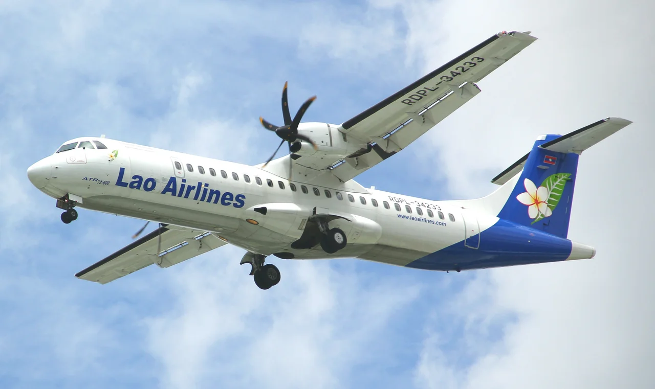
_from_Lao_Airlines_(9786869653)_(cropped).jpg)
Lao Airlines Flight 301
The flight had already turned back once. Weather over Pakse International Airport was deteriorating fast on the afternoon of 16 October 2013, and the crew of Lao Airlines Flight 301 had executed a go-around on their first approach — a sensible, practiced response to poor visibility. They circled into the downwind leg and set up to try again. They never landed. The ATR 72-600 struck trees on the riverbank and plunged into the Mekong River less than six kilometres from the runway. All 49 people on board — 44 passengers and five crew — died. It was the deadliest accident in Lao aviation history, and the first fatal crash anywhere in the world involving the ATR 72-600 variant.
Forty-Nine Lives, Eleven Nations
The passenger manifest read like a small cross-section of the region. Of the 44 people in the cabin, 16 were Lao nationals. Among the dead were at least two children from Australia. Crew from Laos and Cambodia sat in the cockpit: Captain Yong Som, a 57-year-old Cambodian pilot with 5,600 total flying hours — 3,200 of them on the ATR-72 — and First Officer Soulisack Houvanthong, a 22-year-old Lao co-pilot with around 400 hours of experience. Victims came from eleven countries in all. The fast, deep current of the Mekong made recovery agonizing. Fifty divers from Thailand were brought in to assist. By 23 October, a week after the crash, 44 of the 49 victims had been recovered. Some were found 19 kilometres downstream. Twenty-seven had been identified. The wreckage itself was lifted from the river on 22 October.
What the Flight Recorders Revealed
The official accident report, released by Laos's Aircraft Accident Investigation Committee in November 2014, concluded that the probable cause was the flight crew's failure to properly execute the published missed approach procedure. The weather had changed abruptly, forcing a go-around from the first attempt. On the second approach, the crew initiated the correct lateral turn but failed to follow the required vertical profile — the missed approach altitude had been set at 600 feet, and the aircraft's systems entered altitude capture mode. When the pilots recognized they were dangerously low, the pilot flying overcorrected. The nose pitched up sharply to 33 degrees. The aircraft struck trees. The fuselage hit the riverbank and was deflected into the Mekong. The sequence lasted seconds. Investigators found no mechanical failure in the aircraft. The chain of events was a convergence of deteriorating weather, a hasty setup, and a missed procedural step at the worst possible moment.
The River That Held Its Secrets
The Mekong near Pakse runs wide, swift, and deep — qualities that give the river its grandeur and made the search for victims a prolonged ordeal. Rescue teams faced a river that does not readily yield what it takes. The current carried wreckage and the people inside it far downstream, complicating identification and adding to the grief of families waiting for news. For days after the crash, uncertainty about the full casualty count persisted, because not everyone had been found. The Lao government, Lao Airlines, and Thailand's rescue divers worked together across those difficult weeks. Each recovery brought some closure; the five victims never accounted for did not.
A Marker in Lao Aviation History
Laos is a mountainous, landlocked country where short domestic flights connect cities that would otherwise require long overland journeys. The Vientiane–Pakse route, about 650 kilometres as the crow flies, is one of the country's most travelled air corridors. Flight 301 was a routine sector — an afternoon hop on a modern turboprop that had been in service only a short time. Its loss prompted a reexamination of crew training standards, approach procedure compliance, and the handling of deteriorating weather on instrument approaches across the region. The ATR 72-600, which had entered service in 2009, had maintained a clean safety record until this accident. The investigation's findings fed into broader conversations about cockpit resource management and the pressures — real and perceived — that can lead crews to press on when caution counsels otherwise.
From the Air
The crash site lies in the Mekong River at approximately 15.15°N, 105.73°E, roughly 6 km southeast of Pakse International Airport (ICAO: VLPS). From the air at 3,000–5,000 feet, the wide brown curve of the Mekong is the dominant feature — the river here splits around low sandbars before flowing south toward Cambodia. The airport's single runway is visible just north of the city. Recommended viewing altitude: 3,000–4,000 feet for river detail. Nearby airports: VLPS (Pakse, ~6 km), VLVT (Vientiane/Wattay, ~640 km north).
Nearby Stories
- Paksong 7.6 km away
- Tadlo 13 km away
- Vat Phou 21 km away
- Ubon Royal Thai Air Force Base 27 km away
- Sam Phan Bok 45 km away
- Khao Phra Wihan National Park 69 km away
- Amnat Charoen 70 km away
- Virachey National Park 112 km away