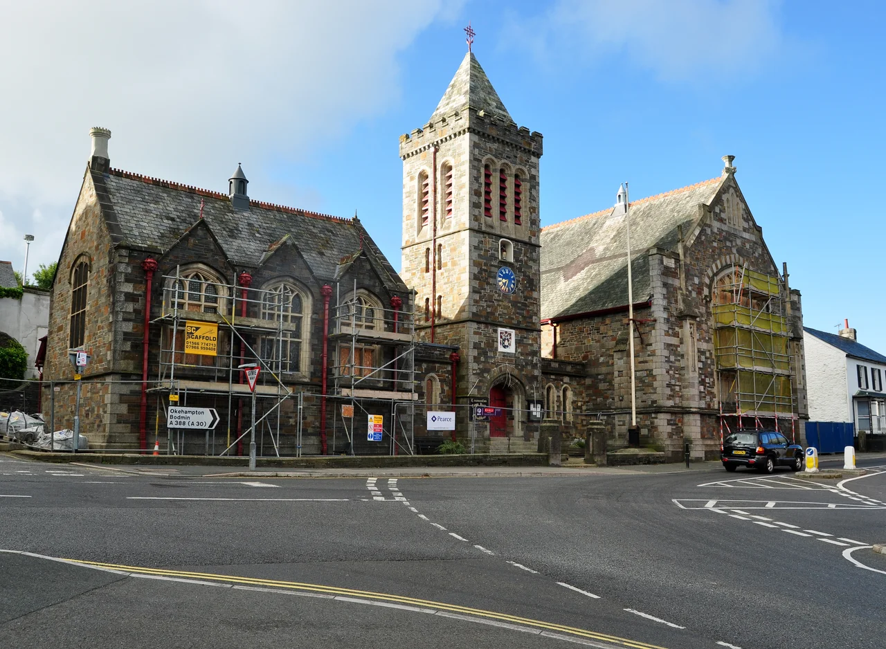

Launceston, Cornwall
Cross the River Tamar from Devon at Polson Bridge and the first town in Cornwall is Launceston, set on a steep hill above the small River Kensey. On top of the hill is a Norman motte-and-bailey castle, built by William the Conqueror's half-brother. Below it, an arch of the original town wall - the South Gate - still spans the road. Launceston is the only town in Cornwall with a surviving medieval wall, and it served as the county town for more than seven centuries before Bodmin took over in 1838. The town's motto, granted for its Royalist stubbornness in the 1640s, is Royale et Loyale. Most Cornish towns argue about their identity. Launceston has always known what it is.
Two Names for One Town
Launceston has answered to two names for most of its history. The Cornish name, Lannstevan, means "church enclosure of St Stephen" - the lan element is common Brittonic for a sacred enclosure - and refers to the original Saxon-era monastery at St Stephen's, on the northern edge of the modern town. The Saxon name Dunheved, probably meaning "hill summit," was attached to the new settlement around the Norman castle, three-quarters of a mile to the south-east. For nine hundred years both names coexisted. The borough was legally known as "Dunheved, otherwise Launceston" until it was abolished in 1974. Even now, road signs still use the older name occasionally; the Dunheved Bridge carries the A30 over the Tamar; the Dunheved Cross stands in the town. Launceston is one of the few English towns with a Saxon-Cornish double identity still legible on its street signs.
The Conqueror's Half-Brother
Launceston Castle was built shortly after 1066 by Robert, Count of Mortain - the half-brother of William the Conqueror - to control the strategic crossing of the Tamar and dominate the surrounding country. The motte still rises sixty feet above the town, the keep on top still substantially intact. From its battlements you can see most of north-east Cornwall. The Domesday Book of 1086 records that Robert held the manor directly: land for ten ploughs, one villein, thirteen smallholders with four ploughs, two mills paying forty shillings, and forty acres of pasture. The manor was valued at four pounds, down from twenty before the Conquest. The transfer of the main market from St Stephen's to Dunheved is also recorded; Robert was building a new town next to his castle and starving the old one. The earliest known Cornish mint had been at St Stephen's during the reign of Aethelred the Unready; Robert moved it down to Dunheved too. Launceston was the caput - the head place - of the feudal barony and of the entire Earldom of Cornwall until Lostwithiel took over in the thirteenth century.
Royale et Loyale
In the English Civil War of the 1640s, Launceston declared firmly for Charles I. The Prince of Wales, later Charles II, stopped in the town for a few days on his way to join the Cavalier army further west. In 1643, Parliamentarian forces under Major General James Chudleigh advanced to take the town. The Royalist commander Ralph Hopton, 1st Baron Hopton, set up on the summit of Beacon Hill, the steep rise overlooking the town. The Parliamentarians took the foot of the hill but could not push to the top. Hopton counter-attacked downhill and, despite fierce fighting and the arrival of Parliamentary reinforcements, drove Chudleigh's troops back. The town's coat of arms - three circular towers in pyramidal form, mounted with cannon - and its motto Royale et Loyale date from this period. The first municipal badge in English history was granted to the borough on 26 March 1906. The Civil War story is also the one place in Launceston's history where the town imprisoned one of its own kind: Sir Richard Grenville, 1st Baronet, was committed to Launceston Prison by Prince Charles for refusing Hopton's orders. He had already quarrelled with Lord Goring.
The Man Who Predicted Neptune
On 23 September 1846, the German astronomer Johann Galle pointed his telescope at the coordinates a young Cambridge mathematician had calculated and saw a new planet. It was Neptune. The mathematician was John Couch Adams, born in Laneast just outside Launceston in 1819, who had used only mathematics - and his observations of perturbations in Uranus's orbit - to predict the planet's existence and position. He was famously slow to publish; the Frenchman Urbain Le Verrier independently made the same calculation, and the discovery is now usually credited to both men. Adams lived a quiet, devout life and refused a knighthood. His grave is in Cambridge, but the village schoolmaster's son who could find a planet with arithmetic remains one of the more startling things ever produced by a small Cornish parish. Other people from the town have travelled a long way too. Philip Gidley King, born here in 1758, became the third Governor of New South Wales. James Ruse, born in 1759, was transported on the First Fleet for burglary, and became one of the first successful farmers in colonial Australia. Charles Causley, born here in 1917, became one of the great twentieth-century English poets, and is buried in St Thomas's churchyard. Sir Roger Moore went to Launceston College.
What's Worth Stopping For
Lawrence House on Castle Street, a Grade II* listed Georgian townhouse, holds the town museum. St Mary Magdalene's Church was largely rebuilt between 1511 and 1524 by Sir Henry Trecarrel as a memorial to his infant son, who died while being bathed. The granite carvings on the exterior were originally cut for the mansion Trecarrel was building at Lezant and never finished; they are some of the most elaborate granite carving in England. The tower is fourteenth century, from an earlier church. The Roman Catholic Church of Cuthbert Mayne, on St Stephen's Hill, was built in 1911 in a blend of Byzantine and Romanesque to commemorate the Catholic priest executed in Launceston in 1577. The South Gate, with its two arches, is the only remaining piece of the medieval town wall. The Launceston Steam Railway, a 1ft 11.5in narrow-gauge heritage line, runs west along the Kensey valley toward Newmills for two and a half miles in summer. The town is not on the national rail network any more - the GWR Plymouth branch closed in 1952, the LSWR North Cornwall line in 1966 - but the A30 dual carriageway runs past to the south, carrying most of Cornwall's incoming traffic. Launceston was the gate, and is still a gate, even if most of the people passing through now don't know they have gone through it.
From the Air
Launceston sits at 50.635N, 4.354W on the eastern edge of Cornwall, one mile west of the River Tamar that forms the county boundary with Devon. From altitude the Norman castle motte is unmistakable, rising about 60 ft above the town centre with the keep still intact. The town is built on a hill with the River Kensey winding around its northern foot; Newport sits in the lower flood plain to the north. The A30 dual carriageway runs along the south. Bodmin Moor lies 10-20 km west. Plymouth (with mainline rail and Plymouth Airport closed) is 27 miles south-east. Cornwall Airport Newquay (EGHQ) is about 50 km west, Bodmin Airfield (EGLA) about 25 km west-south-west. Best photographed at 2,500-4,000 ft to show the relationship between castle, town, and the Tamar crossing into Devon.
Nearby Stories
- Clovelly 1.5 km away
- Castle Drogo 4.4 km away
- Cornwall Railway Viaducts 6.3 km away
- Trerice 11 km away
- Berry Pomeroy Castle 16 km away
- HMHS Glenart Castle 18 km away
- Padstow 20 km away
- Exmoor 21 km away