
Exmoor
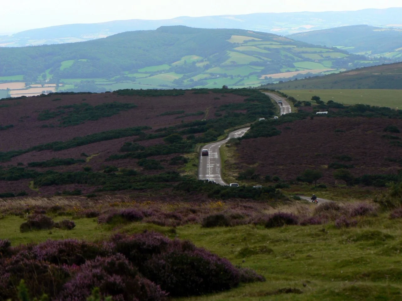
Look up over Exmoor on a clear night and the stars feel close enough to disturb. In 2011 the International Dark-Sky Association declared this 692-square-kilometre stretch of West Somerset and North Devon Europe's first International Dark Sky Reserve. The accolade was deserved. Outside the small villages clustered along the valleys, there is essentially no light here. The Milky Way reads as a riverbed across the sky. Below, the moor itself runs to the edge of the Bristol Channel, where Britain's highest mainland sea cliff drops 318 metres to the water at Great Hangman.
A landscape named for its rocks
Geologists have a period called Devonian, the era between 419 and 359 million years ago when fish first developed proper jaws and forests began to fill the planet. The period was named for these hills. The rocks here were the first of that age to be properly studied and described, so the era took the name of the county. Exmoor's sedimentary stack of gritstones, sandstones, slates, shales, limestones, siltstones, and mudstones makes up what geologists call the Exmoor Group. Britain was a desert when much of it formed; the Hangman Sandstone preserves freshwater deposits laid down in arid conditions. None of this was scraped clean by ice ages, because the glaciers never reached this far. The result is one of the oldest landforms in the British Isles, a plateau that has weathered without being remade for a very long time.
The royal forest
Exmoor was officially a royal forest from at least the Domesday Book of 1086, when foresters named Dodo, Almer, and Godric were recorded at Withypool, then the forest's capital. The status meant the king reserved hunting rights and appointed wardens to manage the land. William of Wrotham held the office in the early 13th century. William de Botreaux, 3rd Baron Botreaux, was appointed warden for life in 1435 by Richard, Duke of York. In 1660 and 1661 James Butler, 1st Duke of Ormonde, was Keeper of Exmoor Forest. The last warden before the forest was sold off in 1818 was an Acland. The royal forest, surveyed at 18,810 acres between 1815 and 1818, was then divided up. A quarter of it, 10,262 acres, went to John Knight in 1818 for £50,000. Knight built the only house in the forest, at Simonsbath, and set about converting royal hunting ground into agricultural land. Exmoor Parish today is essentially Knight's purchase.
Ponies that may be older than England
Wild horses still graze the moor. Exmoor ponies are a landrace, not a breed, which means they evolved through environmental pressure rather than selective breeding. They may be the closest surviving relatives of Europe's truly wild horses, and they are among the oldest pony types in the world. In 1818 Sir Thomas Acland, the last forest warden, took thirty ponies and established the Acland Herd, now called the Anchor Herd. Direct descendants still range the moor. The breed nearly disappeared in the Second World War, when the moor became a military training ground and only fifty ponies survived. They are still endangered, with roughly 390 breeding females in the UK. Each autumn they are rounded up, marked, and checked. Watch a herd graze a hillside in low light and you are watching something close to a prehistoric scene, set down in the wrong century.
The Emperor and the Beast
Exmoor has its monsters, real and rumored. The real one was the Emperor of Exmoor, a red stag who roamed the moor until October 2010 when he was shot. He was reportedly Britain's largest known wild land animal at the time. The rumored one is the Beast of Exmoor, a large cat reported repeatedly since the 1970s and infamously since 1983 when a South Molton farmer claimed to have lost over a hundred sheep in three months to violent throat injuries. Royal Marines Commandos were briefly deployed to watch for the creature from covert observation posts. After six months of no sightings, the deployment ended. A skull found by a Devon farmer in 2006 was identified as a puma by the British Big Cats Society. The Department for Environment, Food and Rural Affairs disagrees: 'Based on the evidence, Defra does not believe that there are big cats living in the wild in England.' Red deer, on the other hand, are very real and very visible at dawn on quiet hillsides.
Walks, coast, and silence
The South West Coast Path, at 1,014 kilometres the longest National Trail in England and Wales, begins at Minehead and runs along all 55 kilometres of Exmoor's coast. Inland, the Two Moors Way crosses both Dartmoor and Exmoor between Ivybridge in South Devon and Lynmouth on the North Devon coast. The Coleridge Way follows Samuel Taylor Coleridge's walks from his cottage at Nether Stowey out to Lynmouth, the route he and Wordsworth took on long night walks that made the locals suspect they were French spies. (A government agent investigated, decided they were 'mere poets,' and went home.) Tarr Steps, a prehistoric clapper bridge of stone slabs weighing up to five tonnes each, crosses the River Barle. Above the moor, on the right summer evening, the dark sky reserve does its work. Most of England has lost the stars. Here, you can still find them.
From the Air
Exmoor National Park covers a roughly triangular area centred near 51.18N, 3.76W in West Somerset and North Devon. Dunkery Beacon at 519 metres is the highest point in Somerset and a useful visual reference. The 55 km of coast forms a sharp line where the moor meets the Bristol Channel. Best viewed at 2,000 to 4,000 feet AGL when valleys, ridgelines, and the coastal cliffs are all legible together. Exeter Airport (EGTE) lies 30 nm south, RAF Chivenor (EGDC) 15 nm west of Lynmouth. The escarpment generates orographic cloud in southwesterlies. After dark, the sky here is the darkest in southern England.
Nearby Stories
- Steep Holm 4 km away
- 1940 Norton Fitzwarren Rail Crash 4.7 km away
- Moreton House, Bideford 5.6 km away
- Murders of Kate Bushell and Lyn Bryant 12 km away
- North Cornwall Railway 14 km away
- Siege of Lyme Regis 18 km away
- Llandow Air Disaster 19 km away
- Whiteford Lighthouse 36 km away