.jpg)
Steep Holm
Late in the spring, on a tiny island five miles offshore from Weston-super-Mare, a flowering plant bursts into deep magenta blooms that should not be here. Paeonia mascula - the wild peony - grows nowhere else in Britain. Legend says the monks of a medieval priory brought it from Asia Minor for its medicinal use. The monks have been gone for seven and a half centuries. The peonies remain, defending their tiny patch of Carboniferous limestone against the Severn winds and the fungus botrytis. They are the strangest thing about Steep Holm, which is saying something for an island where Romans built signal stations, Vikings hid before raids, Augustinian canons prayed, Victorian artillery commanded the channel, and Indian Army mule trains hauled six-inch guns up cliffs in 1941.
An Island Built by Tides
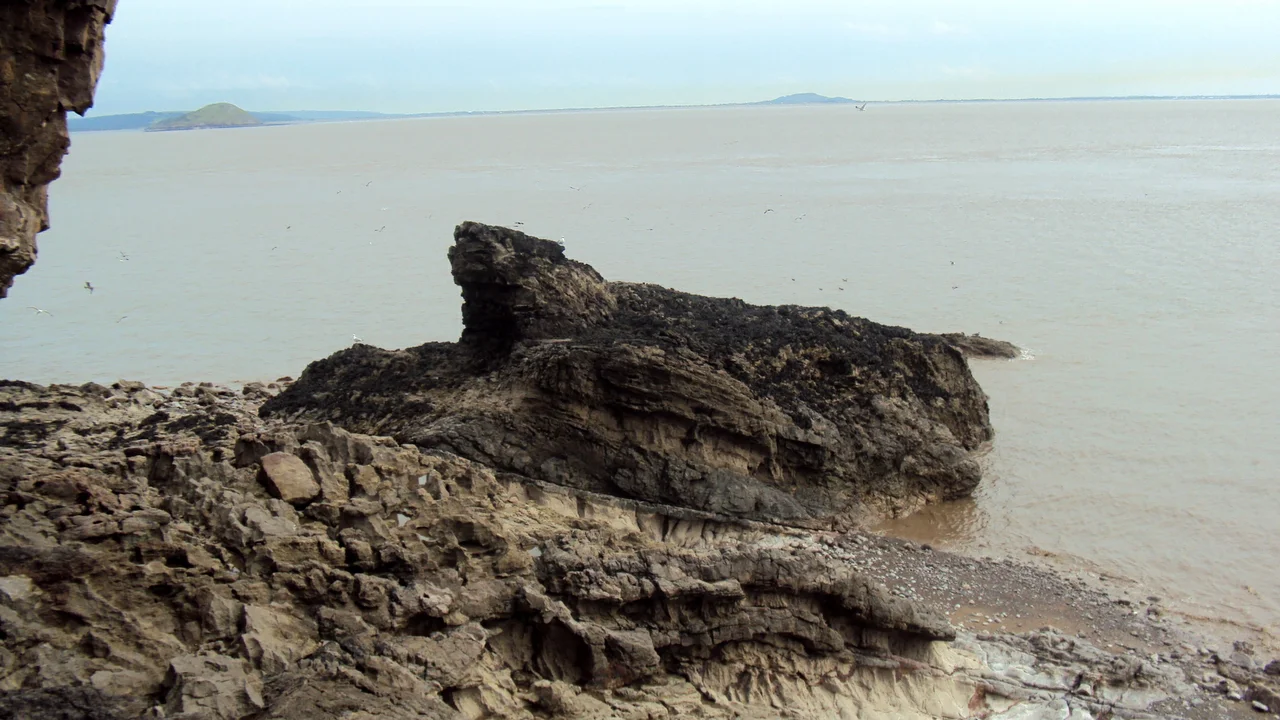
Steep Holm rises 78 metres out of the Bristol Channel, a chunk of Carboniferous Limestone roughly 49 acres at high tide and 63 acres at low. The Severn Estuary's tidal range of 43 feet here - second only to the Bay of Fundy in eastern Canada - means the island grows and shrinks by the hour. Caves penetrate its cliffs at two distinct heights: those in the present tidal zone still produce stalactites under the water table, while others sit high above, ancient sea-line ghosts left over from a different ocean. Around the island, pot holes plunge up to 60 metres into the seabed - probably the collapsed remnants of cave systems older than memory. The soil on top, where it exists at all, is only 6 to 12 inches deep, stained red by iron in the underlying rock and made of grains so fine they could pass through a fingernail.
Saints, Pirates and Peonies
Human activity reaches back at least to the Mesolithic, with worked flints and red deer vertebrae found in Five Johns' Cave. The Romans came here too: a probable signal station or watchtower commanded the channel approaches in the 2nd century AD, and finds include an amphora made in southern Spain between 90 and 140 AD, brooches in the La Tène Celtic style, and Roman coins from the reigns of Claudius Gothicus and Tetricus I. According to legend - first written down by John Leland in the 16th century - Saint Gildas, author of the great 6th-century lament De Excidio et Conquestu Britanniae, lived as a hermit on Steep Holm. He had come over from neighbouring Flat Holm where his friend Saint Cadoc kept a hermitage. Gildas left, the story goes, when pirates from Orkney sailed in and carried off his servant and his furniture. The Vikings used the island as a base in 914, raiding from there into Watchet and Porlock. Five centuries later, the priory's monks may have planted the wild peonies that still bloom each May.
The Palmerston Fort
In the 1860s, Steep Holm became a fortress. Queen Victoria and Prince Albert had returned from France worried about the strength of the French Navy, and the Royal Commission on the Defence of the United Kingdom under Lord Palmerston recommended a chain of coastal defences. Construction began on Steep Holm in 1865 and finished in 1869. Ten 7-inch rifled muzzle-loading guns were spread between six concrete batteries with names like Summit, Laboratory, Garden and Tombstone - this last named for a Blue Lias memorial stone from the medieval priory that had been incorporated into an armoury when builders found it in 1867. A water tank beneath the barracks holds 49,000 imperial gallons of rainwater. The barracks themselves still stand, Grade II listed. In 1898, test firing by HMS Arrogant on Rudder Rock battery showed the fixed Victorian emplacements would not survive a modern naval bombardment. The military left ten years later.
Mules, Searchlights and a Cable Railway
World War II brought the soldiers back. In 1940 and 1941 the Indian Army Service Corps refortified the island - hauling Mark VII 6-inch breech-loading guns, stripped from World War I naval vessels, up the cliffs using mules. Lewis machine guns went in for anti-aircraft defence. Royal Pioneer Corps engineers built a new jetty and connected it to the plateau with a cable-operated winched switchback railway using prefabricated 60 cm gauge lines captured from the Germans in the previous war. Sheep were imported to feed the soldiers. After a case of typhoid fever, drinking water was shipped from South Wales. Underwater telegraph cables connected the Steep Holm batteries to the guns at Brean Down across the channel - much of that cable was stolen for scrap after the war ended. The 1927 first test of the RAE Larynx, an early pilotless aircraft designed as a guided anti-ship weapon, took place just off Steep Holm. The future of warfare passed overhead while the medieval priory crumbled below.
A Trust and a Boat
Since 1976 the island has belonged to the Kenneth Allsop Memorial Trust, a charity formed in memory of the broadcaster and naturalist. They run day-long boat trips from Weston-super-Mare and have converted one of the barrack blocks into visitor facilities. Steep Holm has been a Site of Special Scientific Interest since 1952. Herring gulls and lesser black-backed gulls breed in vast numbers. There are slowworms - the only reptile - and golden samphire growing along the cliffs, and alexanders along the paths, and wild leeks. There was a small population of muntjac deer at one point. Across the channel, just visible on clear days, is Flat Holm, technically Welsh territory and home to Gildas's friend Saint Cadoc fifteen centuries earlier. The two islands have been arguing about which is which - one English, one Welsh - longer than either has had a name.
From the Air
Steep Holm sits at 51.3397°N, 3.1097°W in the Bristol Channel, roughly 5 miles offshore from Weston-super-Mare and visible as a distinct limestone hump from cruising altitude. The island is a recognisable visual landmark, especially in clear weather. Flat Holm (its Welsh counterpart) lies 2 miles to the north-west. Nearest airport is Cardiff (EGFF), about 12 miles west; Bristol (EGGD) lies 15 miles east. The Bristol Channel's huge tidal range means the island visibly grows and shrinks between tides - a striking visual at low altitude. Best photographed in clear weather; the surrounding water is notoriously brown with Severn sediment, providing high contrast against the island's pale limestone cliffs and grass plateau.
Nearby Stories
- Berkeley Castle 1 km away
- Tower Colliery 5.9 km away
- Battle of Sedgemoor 5.9 km away
- Royal Victoria Park 7.1 km away
- Ewenny Priory 8.9 km away
- Crumlin Viaduct 10 km away
- Stourhead 11 km away
- Exmoor 16 km away