.jpg)
Letcher County, Kentucky
On March 9, 1976, in the community of Oven Fork, a coal dust and methane explosion at the Scotia Mine killed fifteen men. Rescue crews went in. Two days later a second explosion killed eleven more - mostly the rescuers themselves. The two blasts became one of the deadliest mining accidents in U.S. history and forced Congress to pass the Federal Mine Safety and Health Act of 1977. Letcher County, Kentucky, sits in the far southeastern corner of the state, hemmed in by Pine Mountain to the south and Black Mountain to the southeast. Its 2020 population was 21,548. Its history is the history of coal: what it gave the county, what it took, and how the people who remained have continued to choose this place anyway.
Pioneers, Then Coal
The first permanent settlement in what would become Letcher County was at the mouth of Pert Creek in modern-day Whitesburg in 1803 - founding families named Caudill, Dixon, Stamper, Collier, Lewis, Whitaker, Wright, Craft, Brown, Halcomb, Holbrook, Bentley. They were followed by the Maggard, Banks, Day, Fields, Morgan, Blair, Frazier, Hogg, Combs, and Mullins families. The county was formed in 1842, Kentucky's 95th, named for then-governor Robert P. Letcher. Its seat, originally called Summit City, was renamed Whitesburg the same year in honor of John D. White, who introduced the enactment bill. For sixty years the economy ran on timber. Then coal companies arrived in the early 1900s and rebuilt the place around themselves - company houses, company stores, rail lines into every hollow. By the 1920s coal had become Letcher County's whole self-understanding.
Night Comes to the Cumberlands
In 1963 a Whitesburg attorney named Harry M. Caudill published a book called Night Comes to the Cumberlands: A Biography of a Depressed Area. It was a furious, unsparing account of what coal extraction had done to eastern Kentucky - the broken land, the broken miners, the absentee corporations that took the wealth and left the consequences. The book became a national conversation. President Kennedy's administration cited it; CBS sent Charles Kuralt to make the 1964 documentary Christmas in Appalachia, which prompted a flood of donated clothes and money from American viewers shocked by what they saw. Caudill's diagnosis was bitter and his solutions controversial. Some of what he wrote about eugenics was indefensible. But the part of his book that demanded America look at what was happening in these hollows still echoes. The community radio station WMMT-FM, owned by the Whitesburg arts collective Appalshop, has been broadcasting since 1985 - a direct descendant of the cultural attention Caudill's work helped create.
Scotia, Floods, and the Judge
Disaster has a way of recurring here. The 1976 Scotia Mine explosions killed twenty-six men and changed federal mine safety law. In July and August 2022, days of relentless rain set off catastrophic flooding across eastern Kentucky. Forty-five people died across the region; three of those deaths were in Letcher County. Homes built up the narrow hollows where flood water could not escape were washed away. Some communities have still not fully rebuilt. On September 19, 2024, then-county sheriff Shawn Michael Stines was arrested for shooting and killing District Judge Kevin R. Mullins in the judge's chambers in the Letcher County courthouse. The killing happened during the workday, in front of witnesses. The case was a shock to a county that knew Mullins as the man who handled juvenile cases and misdemeanors with patience. The trial is ongoing. The county continues.
What Else Has Come Out of Here
Francis Gary Powers, the CIA U-2 pilot whose plane was shot down over the Soviet Union in 1960 - touching off one of the Cold War's defining crises - was from Letcher County. So was Kenny Baker, the fiddler who played twenty-five years with Bill Monroe and the Blue Grass Boys, helping define the sound of bluegrass. Country singers Martha Carson, Jean Chapel, Lee Sexton, and Gary Stewart all came from these hollows. Sheila Wellstone, who died with her husband Senator Paul Wellstone in a 2002 plane crash, was raised here. Jim Webb wrote poetry from a Whitesburg cabin until his death in 2018. The Mountain Eagle, Whitesburg's weekly newspaper since 1907, has won national press awards for fearless coverage of the coal industry; the Gish family owned and edited it for decades. The county has produced sheriff scandals and federal pilots and bluegrass legends in roughly equal measure. It is a small place that has insisted on being interesting.
Geography, Now and After
Pine Mountain runs 125 miles down Letcher County's southern border, dividing it from Harlan County and Virginia. Black Mountain rises to 4,145 feet in the southeastern corner - Kentucky's highest point. The North Fork Kentucky River begins inside the county and flows northwest through Whitesburg. The Cumberland River's Poor Fork starts on Pine Mountain and runs south. Bad Branch Falls plunges sixty feet through a sandstone gorge that Kentucky has preserved as a state nature area. Fishpond Lake near Jenkins, a 28.8-acre artificial lake built as part of an early-2000s tourism push, is now the county's only large still water. Coal still ships out, but in smaller volumes. The narrow, twisting roads that snake up every hollow lead to communities trying to figure out what eastern Kentucky becomes when the seam runs out. The people who stayed are still working on the answer.
From the Air
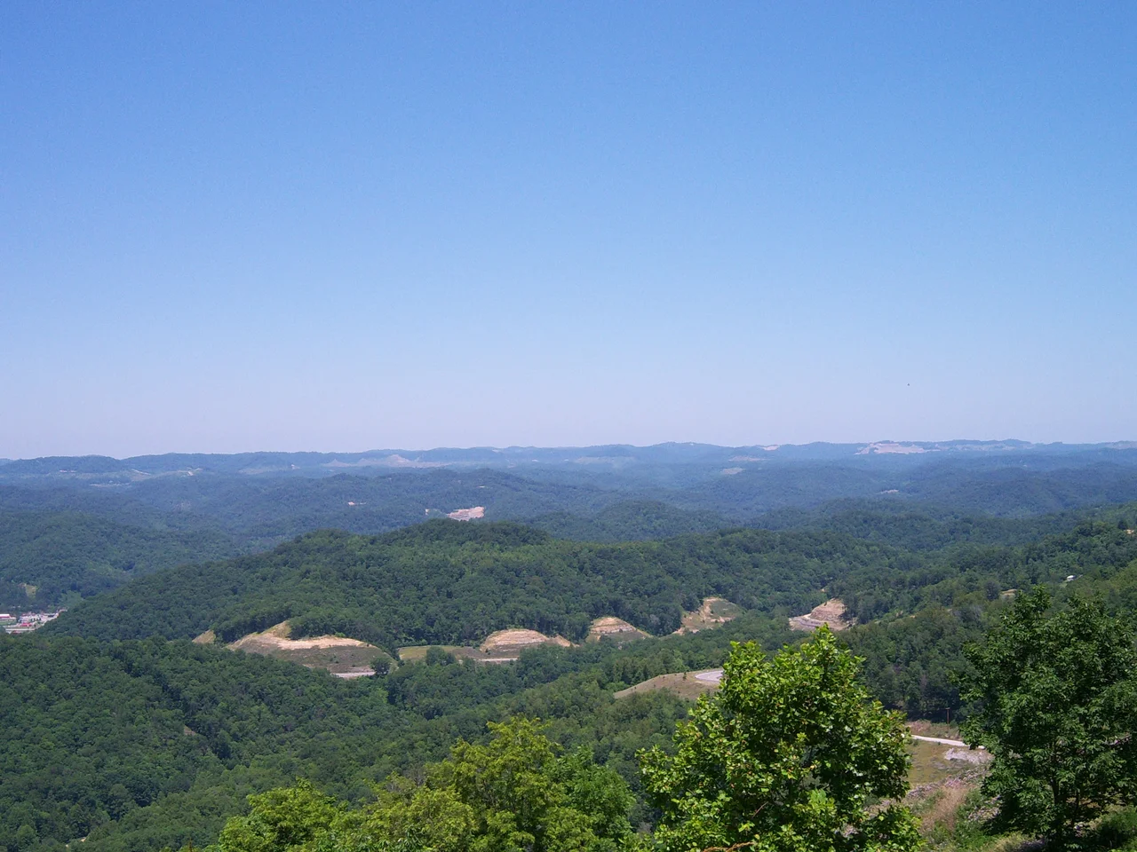
Centered near 37.12°N, 82.85°W in far southeastern Kentucky, bordering Virginia. From cruising altitude Letcher County appears as a tangle of high ridges separated by deep, narrow hollows, with the long, straight ridge of Pine Mountain forming the southern boundary and Black Mountain rising in the southeastern corner. Whitesburg sits along the North Fork Kentucky River. Bad Branch Falls cuts a sharp dark cleft through Pine Mountain south of Whitesburg. Nearby airports: K0KY (Whitesburg-Letcher County) is the local field; KPBX (Pike County, Pikeville) lies about 20 nm east-northeast; KTYS (Knoxville, TN) is about 90 nm southwest; KLEX (Lexington, KY) is about 110 nm northwest. Recommended viewing altitude 5,000-10,000 ft AGL for ridge-and-valley appreciation. Strip-mining scars are visible on many ridge tops.
Nearby Stories
- Big Stone Gap, Virginia 5.4 km away
- 2002 Appalachian School of Law shooting 19 km away
- Big Sandy Expedition 20 km away
- Matewan Historic District 22 km away
- Abingdon, Virginia 34 km away
- Cumberland Gap 47 km away
- The Kentucky Meat Shower: When Flesh Fell From a Clear Sky 84 km away
- Fraterville Mine Disaster 133 km away