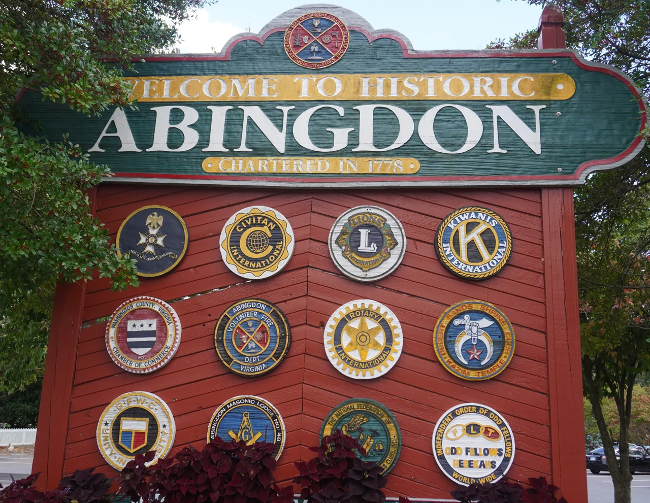

Abingdon, Virginia
Thomas Walker called the tract Wolf Hill in 1748 because the wolves around it had eaten so many of his hunting dogs. By 1774 a settler named Joseph Black had built a stockade on the same ground, and called it Black's Fort. In 1776 it became the seat of the brand-new Washington County - among the very first counties in America named for George Washington, who at that moment was still a general fighting a war he might lose. Two years later the Commonwealth of Virginia incorporated the place as Abingdon. The wolves are gone. The county seat has been the county seat for two hundred and fifty years.
At the Intersection of Two Trails
Abingdon sits at the crossing of two ancient paths the indigenous nations had followed for centuries through the Great Appalachian Valley - routes the buffalo had walked before them, between the Middle and North Forks of the Holston River. That intersection was the entire reason the town existed. By the late 1700s, settlers like Joseph Black, Samuel Briggs, and James Piper had bought up land from Walker's Loyal Land Company. By 1773 there were enough Scots-Irish Presbyterians to ordain Charles Cummings as the first settled pastor west of the Allegheny Mountains. The post office opened on August 20, 1792 - one of only ten in Virginia at the time, and the first established west of the Eastern Continental Divide.
The Overmountain Muster
On September 24, 1780, militia from the western settlements gathered at the Abingdon Muster Grounds before riding south through the gaps to confront Major Patrick Ferguson's loyalist forces. That march ended at Kings Mountain, South Carolina, on October 7, with one of the most lopsided patriot victories of the Revolution. The northern end of the Overmountain Victory National Historic Trail still begins where those men formed up. Abingdon was also the boyhood home of Joseph E. Johnston, who in another war fought a different side - he commanded Confederate armies against Sherman in 1864 - and the birthplace of three Virginia governors: Wyndham Robertson, David Campbell, and John B. Floyd.
Paying in Hams
Robert Porterfield came home to Abingdon in 1933 with a problem and a solution. The country was broke. Actors were unemployed. Farmers had food but no cash. He opened the Barter Theatre on June 10, 1933, with a simple admission policy: a ham, a chicken, a jar of preserves, or a pail of milk would get you in. The first season the company gained over three hundred pounds collectively from eating the gate. In 1940 a young man named Gregory Peck - not yet a star - worked at the Barter for room and board, appearing in five plays. The Virginia Highlands Festival that Porterfield founded, first held in 1949, still fills the town for sixteen days every summer. The Barter, designated the State Theatre of Virginia in 1946, is the longest-running professional Equity theater in the United States.
Trail's End
The Virginia Creeper Trail - a former railroad line converted into a 34.3-mile path for walkers, cyclists, and horses - terminates in downtown Abingdon. It climbs gently from the town through Damascus and up to Whitetop Mountain, near where it meets the Appalachian Trail. The trailhead is a few blocks from the Barter, which is a few blocks from the Martha Washington Inn, which is a few blocks from the cemetery where Charles Cummings preached over the first congregation. The whole town is walkable, and walking it is largely how it works. The 8,375 people of the 2020 census live in a county seat that has been doing exactly this - hosting travelers passing through the gap - since 1778.
From the Air
Abingdon sits at 36.71 N, 81.98 W in the Great Appalachian Valley of southwest Virginia, between the Middle and North Forks of the Holston River, at about 2,070 feet elevation. Iron Mountain rises to the south, Clinch Mountain to the north. Nearest airport is Virginia Highlands (KVJI) right at the town; Tri-Cities Regional (KTRI) is 17 nm southwest. Recommended viewing altitude 3,500 to 5,500 feet MSL. The Creeper Trail traces a former rail line southeast toward Damascus and Whitetop Mountain.
Nearby Stories
- Wise County, Virginia 6.2 km away
- Sycamore Shoals 16 km away
- David Crockett Birthplace State Park 21 km away
- Tazewell County, Virginia 24 km away
- Big Stone Gap, Virginia 28 km away
- Buchanan County, Virginia 40 km away
- Moravian Falls, North Carolina 47 km away
- Wytheville Raid 54 km away