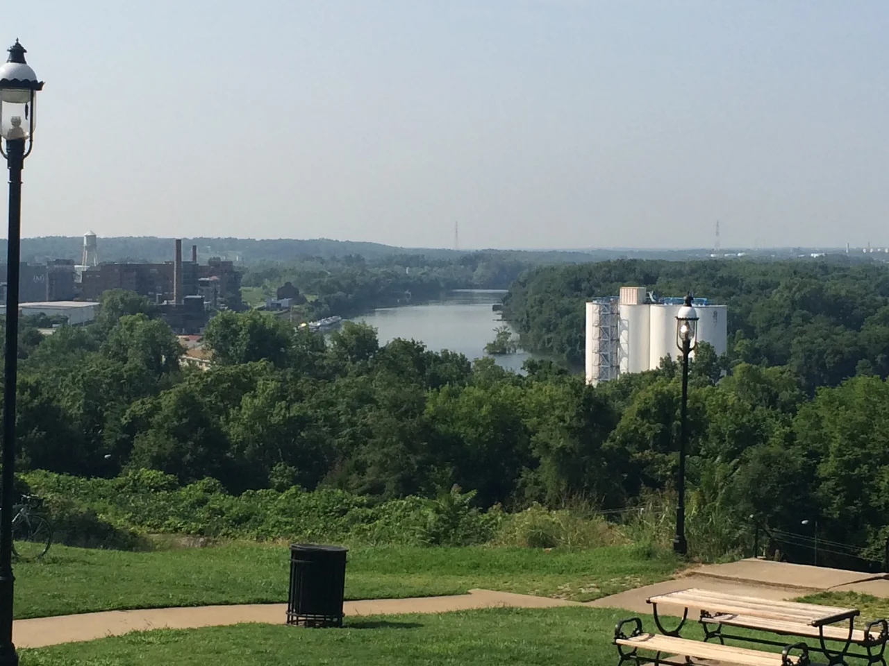

Libby Hill, Richmond
The story goes that William Byrd II stood on this hill in 1737, looked west down the James River as it curled away beneath him, and decided the prospect resembled the view from Richmond Hill in London - the bend in the Thames, the wooded slopes falling toward the water. He named his new town accordingly. Whether the story is exactly true is one of those questions Richmond historians have argued for two centuries, but the view itself is unarguable. Stand at the western edge of Libby Hill Park, look out past the Lucky Strike building toward downtown, and you can still see what Byrd saw - or what he claimed to see. Locals call it 'The View That Named Richmond,' and a plaque in the park makes the case. The neighborhood that grew up here, on the southeastern spur of Church Hill, is small and entirely contained within the St. John's Church Historic District. It is one of the city's quietest historic precincts.
The Old Houses
Homes have stood on Libby Hill since at least 1796. The prominent early residents included Governor George W. Smith - who died in the 1811 Richmond theater fire - and Colonel George Mayo Carrington. Neither of their houses survives. The oldest surviving building is the Gentry-Strokes-Crew house at 2718 North 27th Street, built in 1839 by John Gentry and altered many times since. The Saunders House nearby went up the same year, contemporaneous with the Libby House at the corner of Main and 29th that gave the neighborhood its name. The house at 11 1/2 North 29th Street has what Richmond's preeminent twentieth-century architectural historian, Mary Wingfield Scott, called 'one of the most beautiful iron verandahs in Richmond' - the kind of detail that makes a neighborhood matter to the people who study it. From the hill you can see other landmarks: the Lucky Strike tobacco building (now lofts), the Armitage Manufacturing Company building, Rockett's Landing where the steamships used to dock, and Manchester across the river.
The Monument
Because Libby Hill commanded the view westward toward the river and the city, and because it sat above the ground where the Confederate Navy Yard had operated during the war, Richmond's monument-builders saw it as a place to remember the Confederacy. A memorial to Robert E. Lee was originally planned for Libby Hill before it was relocated to Monument Avenue across town. With Lee's statue gone elsewhere, the Confederate Soldiers' and Sailors' Monument Association formed in 1889 to put a memorial to all Confederate Soldiers and Sailors on the hill. The chair was David C. Richardson, a future Richmond mayor. They chose a design based on Pompey's Pillar in Alexandria, Egypt - a 13-block granite column, one block per Confederate state, with a bronze figure of a private standing on top. It was unveiled on May 30, 1894, at a total cost of over $30,000, with future Richmond mayor Carlton McCarthy as the orator. The monument stood for 126 years.
What Came Down, What Stayed
The monument came down on July 8, 2020, after a summer of public demand following the murder of George Floyd. The city removed it. What remains in Libby Hill Park is a small landscape of fountains, paths, a park house, the plaque describing the view that named Richmond - and other monuments to ordinary public servants. There is a bench for Sergeant John Henry Taylor, who served in the Richmond Police Department for over 25 years before retiring in 2009; it was placed by the Church Hill Crime Watch to honor what they called his 'above and beyond care and concern for the safety of every person living on Church Hill and the surrounding areas.' There is a memorial to Officer Thomas 'Mongo' McMahon, who served for over 20 years and was shot and killed in the line of duty after a car chase. Two officers who walked these streets. The park kept them while the larger monument went away.
The Hill as Stage
In September 2015 Richmond hosted the UCI Road World Championships, the most prestigious annual event in road cycling. The course wound through the city, and one of its signature features was the steep, winding cobblestone path that climbs through Libby Hill Park. Watch footage of the race and you'll see the leaders rising out of the saddle on that climb, pedaling up past the spot where Byrd allegedly stood, past the ghosts of the Confederate Navy Yard, past the plaques to two policemen, past where a column with a bronze private had recently been, with the river view that named the city falling away behind them. The neighborhood that grew up around this single piece of geography is small enough to walk through in an hour. The view that named the city is still here, looking out over a Richmond that keeps changing while standing on the same bend in the same river.
From the Air
Coordinates 37.5275 N, 77.4169 W, on the southeastern spur of Church Hill east of downtown Richmond, overlooking the James River. Best viewed from 1,500-2,500 ft AGL. From altitude, look for the prominent bluff just east of downtown rising above the river bend, with the Lucky Strike building (now lofts) visible below. The cobblestone climb used in the 2015 UCI Road World Championships course is the steep curving street that winds up the hill's western face. Richmond International Airport (KRIC) is 4 miles east; the modern downtown skyline is visible from the park looking west - the same general view that allegedly inspired Richmond's name.
Nearby Stories
- Kings Dominion 8.4 km away
- Battle of Hatcher's Run 9.7 km away
- Francisco's Fight 14 km away
- Piney Grove at Southall's Plantation 17 km away
- Jamestown Settlement 19 km away
- Battle of Amelia Springs 22 km away
- Menokin 29 km away
- Highland (James Monroe House) 42 km away