.jpg)
Limingen
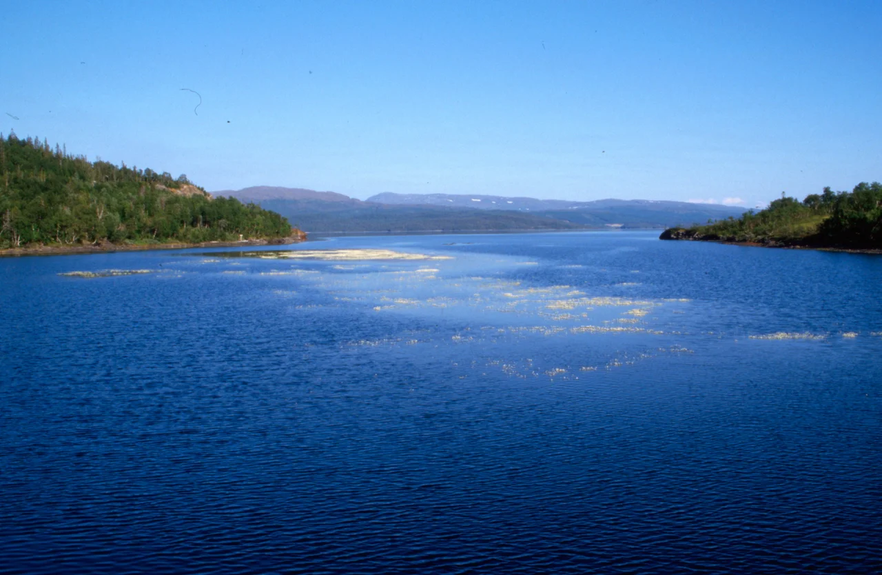
Stand on the east shore of Limingen and Sweden is a ten-minute walk away — 725 metres of ground, and then a different country. That proximity is the first surprise. The second is what the lake does with its water. Limingen does not have an outlet in the ordinary sense of a river leaving a lake and finding the sea. It empties from both ends, through tunnels bored in rock, into two separate power systems running in opposite directions, one of which ends up on the Swedish side of that border. Norway's eighth-largest lake has been rewired.
Lyjmede
In Southern Sámi the lake is Lyjmede, and the country around it is Saepmie. Most of the water lies in Røyrvik Municipality, whose co-official Sámi name Raarvihke was approved in 2014, with the southern end reaching into Lierne. Røyrvik has 423 residents — the third smallest municipal population in Norway, after Modalen and Utsira — spread across 1,585 square kilometres, and farming and reindeer husbandry have always been livelihoods here. These are not decorative facts appended to a lake description. The lake is the middle of somewhere, not the edge of nowhere; the naming, the herding and the border have all been going on a great deal longer than the turbines.
Ninety-Three Square Kilometres, and Deep
The numbers are worth laying out properly. Limingen covers about 93 square kilometres, stretches 25 kilometres at its longest and 6 at its widest, and sits 418 metres above sea level. It reaches 192 metres at the deepest point and averages 87 metres, which is the striking figure — this is not a shallow upland pan but a genuinely deep trough, holding roughly 8.1 cubic kilometres of water. It ranks eighth among Norwegian lakes by area and third in Trøndelag, behind Tunnsjøen and Snåsavatnet. Tunnsjøen, the larger neighbour, lies just to the south, and the two are now connected by more than geography.
A Lake Plumbed in Three Directions
Water arrives at the north end from the lake Vektaren by way of the Røyrvikelva river, through a dam. From there it leaves the lake by tunnel to the Røyrvikfoss Power Station at the village of Røyrvik. At the far southern end, near the small village of Limingen in Lierne, another tunnel carries water off to Tunnsjøen through the Tunnsjø Power Station, and onward to the Linvasselv Power Station across the border in Sweden. Dams control the level at both ends. The result is a lake that functions as a battery: charged by snowmelt and rain, discharged on demand down two different staircases of falling water. The surface can move through as much as ten vertical metres in the process.
The Tideline That Isn't
Ten metres of drawdown leaves a mark you cannot miss. When the reservoir is low, a wide band of bare stone and gravel stands exposed between the waterline and the vegetation, a false tideline in a lake more than 400 metres above any actual tide. It is the signature of regulated water all over Norway, and once you learn to read it you see it on half the lakes in the mountains. Under the surface, Arctic char and brown trout hold on — char in the cold deep water, trout closer to the inflows and shallows. A lake that averages 87 metres deep has a great deal of stable cold water in it no matter what the dams are doing at the surface.
A Border You Can See Across
The 725 metres to Sweden matter more than a line on a map suggests. This is the Scandinavian interior, and the border here was surveyed across country that Sámi families and their reindeer had been crossing with the seasons long before either state drew it. The engineers who came in the twentieth century worked to a different geography again — theirs runs by gradient and catchment, which is how water from a Norwegian lake ends up turning a turbine on the Swedish side. Limingen sits where all three overlap: a national frontier, a reindeer landscape, and a hydroelectric network that treats the whole watershed as a single machine. From the air none of that shows. You see a long dark blade of water lying north to south between the mountains, with the trees stopping short of the shore.
From the Air
Limingen lies at 64.7833°N, 13.5833°E, with a surface elevation of 418 m (1,371 ft) and surrounding terrain rising well above it. The lake is 25 km long north-to-south and up to 6 km wide, making it one of the best visual fixes in inland Trøndelag — visible from cruising altitude in clear air and unmistakable from 4,000–8,000 ft AGL. The Swedish border runs roughly 725 m east of the eastern shore. Use the village of Røyrvik at the north end and the larger lake Tunnsjøen immediately south as confirming references. Nearest airports: Namsos Airport, Høknesøra (ENNM) to the west, Mosjøen Airport, Kjærstad (ENMS) to the northwest, and Vilhelmina (ESNV) across the border in Sweden; Trondheim Airport Værnes (ENVA) is the nearest major field. Note that the shoreline shifts seasonally by up to 10 vertical metres of regulation, so charted water edges are approximate. Ice cover is normal through winter and into spring, and December daylight lasts only a few hours.
Nearby Stories
- Stora Blåsjön 6.9 km away
- Namsskogan Familiepark 8.4 km away
- Jetnamsklumpen 12 km away
- Majavatn 16 km away
- Wideroe Flight 710 58 km away
- Wideroe Flight 744 62 km away
- Namsos Campaign 98 km away
- Lapplandsleden 116 km away