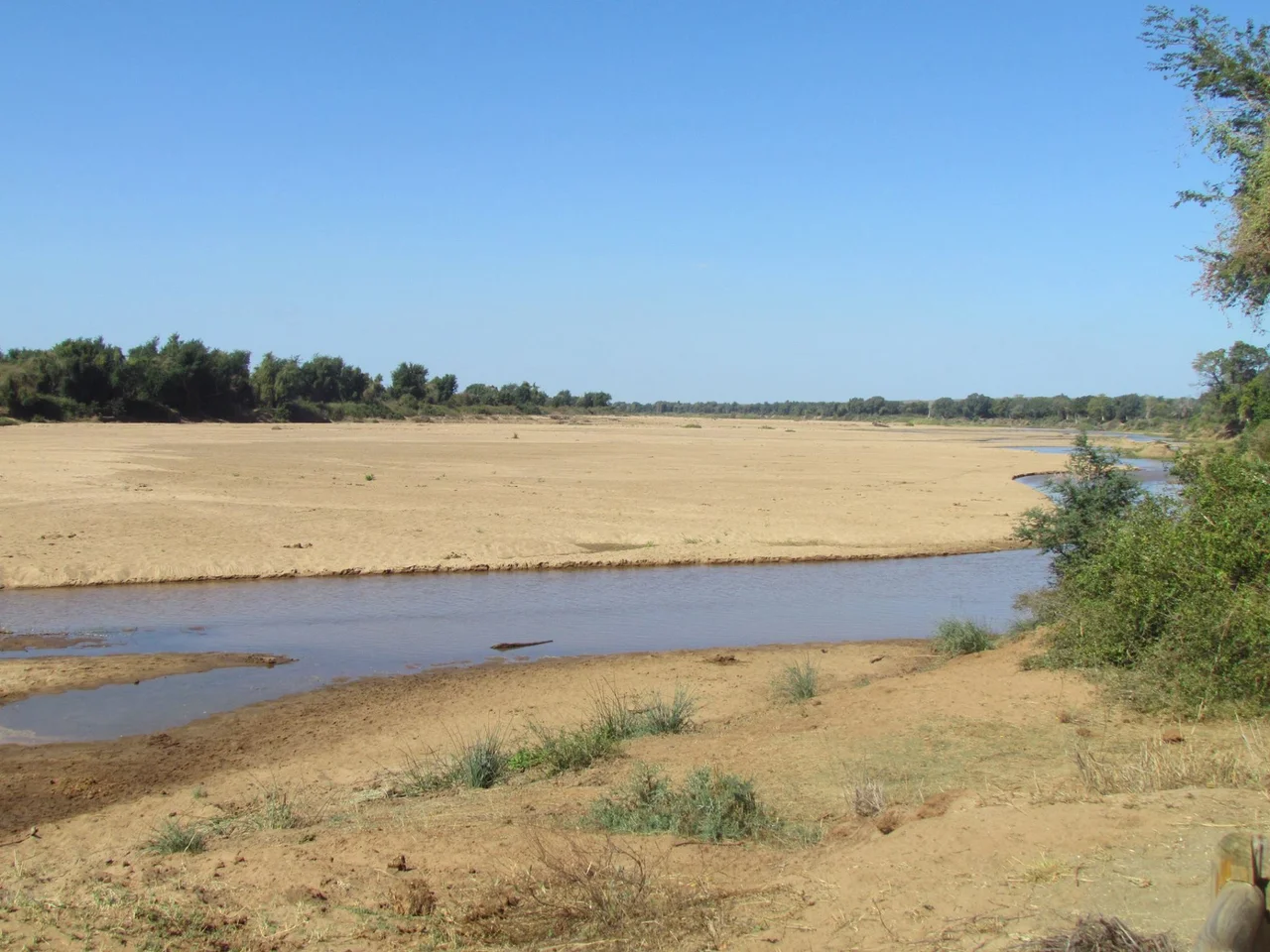

Limpopo River
Every child who has heard how the elephant got its trunk has, without knowing it, stood on the banks of this river. Rudyard Kipling set that just-so story on "the great grey-green, greasy Limpopo River, all set about with fever-trees," and the description has clung to the real water ever since. The Limpopo earns it. This is no clear mountain torrent but a sluggish, silt-thick flow that loops more than 1,700 kilometres in a great arc across southern Africa, heavy and unhurried, drawing borders between nations and hiding crocodiles in its murk exactly as Kipling promised.
A River with Many Names
The name Limpopo descends from Rivombo, a band of Tsonga settlers led by a leader called Hosi Rivombo who put down roots in the mountainous country nearby. To the Venda people the river is the Vhembe, a name now carried by a South African district municipality and once proposed — and voted down — as the name of an entire province. Rivers this large gather names the way they gather silt. The first European to glimpse it was Vasco da Gama, who anchored off its mouth in 1498 and, in the manner of his age, christened it the Rio do Espírito Santo, the River of the Holy Spirit, without ever learning what those who lived there already called it.
The Border Drawn in Water
For roughly 640 kilometres the Limpopo does the work of fences and treaties, separating South Africa from Botswana and Zimbabwe along its great northern bend. The river proper is born where two streams meet — the Marico and the Crocodile — and from that confluence it zigzags north, swings east, then bends finally toward the Indian Ocean and the Mozambican coast. It gathers tributaries as it goes: the Olifants, the "Elephant River," alone delivers more than a billion cubic metres of water a year. Along the way it skirts the eastern edge of Kruger National Park, where Crook's Corner marks the spot a person can stand in one country and look across the water at two others.
Deep Time and Old Bones
The Limpopo is older and stranger than it looks. Once, in the distant geological past, the upper Zambezi drained into it, until the slow buckling of the African crust lifted the land and stole those waters away to the north — a wholesale rerouting of a continent's drainage written into the rock. Human history here runs nearly as deep: in the Makapan Valley near Mokopane lie Australopithecus fossils some 3.5 million years old, traces of ancestors who walked this basin long before it had a name in any language. Above the dry uplands the river drains the Waterberg massif before reaching the fertile lowlands downstream. Rainfall is fickle and seasonal — in dry years the upper river runs for forty days or less — yet roughly fourteen million people now live within its basin, their lives tuned to the river's uncertain moods, its silt feeding their fields and its floods, when they come, threatening everything.
Sharks, Crocodiles and Floods
Kipling's crocodile was no invention. The Limpopo holds its densest population of hippos between the Mokolo and Mogalakwena rivers, and Nile crocodiles patrol its length — a population that swelled dramatically in 2013 when flood gates at a riverside crocodile farm gave way and released thousands into the wild. Stranger still, a bull shark was once hauled out hundreds of kilometres upstream, near the Luvuvhu confluence, in 1950; these sharks tolerate fresh water and will swim far inland. The river's power turns deadly in the rains. In February 2000, a cyclone dumped catastrophic rainfall across the basin, and the lower Limpopo burst into the floods that devastated Mozambique, a reminder that the slow grey-green water can rise without warning.
From the Air
The Limpopo's great arc is a defining navigational feature of southern Africa, traceable from the air for hundreds of kilometres as it separates South Africa from Botswana and Zimbabwe. The given coordinates (24.19°S, 26.87°E) lie along its upper course near the Botswana border; the river runs east to its mouth near Xai-Xai, Mozambique, on the Indian Ocean. Its broad, silt-laden channel and fringing fever-trees make it easy to follow even in haze. Relevant airports include Polokwane International (ICAO: FAPP) in Limpopo Province, Gaborone's Sir Seretse Khama (FBSK) in Botswana, and Maputo (FQMA) in Mozambique near the coast. Recommended viewing altitude 4,000–8,000 ft AGL; expect dry-season clarity in winter and dramatic flooding, lightning and reduced visibility during the summer rains.
Nearby Stories
- Matsieng Footprints 27 km away
- Marakele National Park 31 km away
- Waterberg Biosphere 47 km away
- Oppikoppi 56 km away
- Three Dikgosi Monument 70 km away
- Tswaing crater 127 km away
- Mapungubwe National Park 302 km away
- Botswana 332 km away