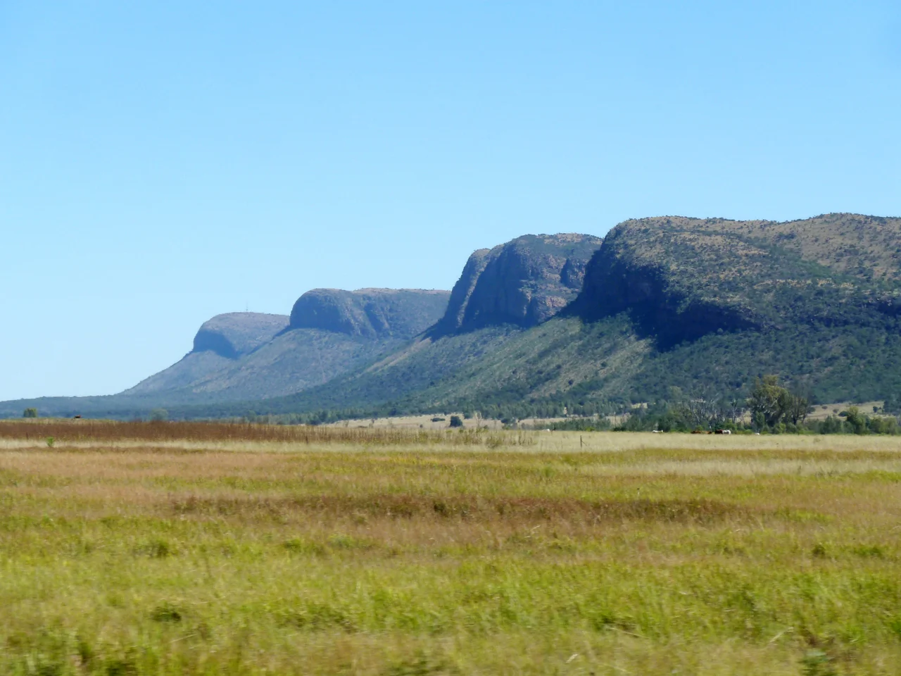

Waterberg Biosphere
Some landscapes announce themselves with a single dramatic peak. The Waterberg does the opposite: it spreads. Across roughly 654,000 hectares of northern Limpopo it rolls out a maze of flat-topped mesas, sheer red cliffs and dry bushveld, cut over hundreds of millions of years by rivers that have long since carved the rock into buttes and hidden gorges. Most peaks rise only modestly above the plains, yet the sandstone faces can stand 550 metres tall, glowing in bands of yellow and rust. The Tswana called it Thaba Meetse — "the mountain of water" — and in 2001 it became the first place in South Africa's far north to be named a UNESCO Biosphere Reserve.
Rock Older Than Almost Everything
To read the Waterberg's geology is to scroll back nearly to the beginning. Its foundation is the Kaapvaal craton, a fragment of some of the oldest crust on Earth, formed as a primordial island roughly 2.7 billion years ago. Molten rock later forced its way upward through that ancient base, carrying vanadium and platinum in a formation geologists call the Bushveld Igneous Complex — one of the great mineral riches of the planet. For a billion years rivers laid down sediment that hardened into the cross-bedded sandstone seen in the cliffs today. Then, around 250 million years ago, the craton helped tear the supercontinent Gondwana apart into the continents we know. The quiet mesas of the Waterberg are the worn survivors of all of it.
Hands on the Cliff Walls
The same sandstone that makes the cliffs holds the Waterberg's older story. Porous rock trapped groundwater and the overhangs offered natural shelter, drawing people here across the depths of prehistory — and at Makapansgat, forty kilometres off, the bones of Australopithecus africanus push the human thread back millions of years. On cliff faces above the Palala River, the San left rock paintings that have survived the centuries, including depictions of rhino and antelope at sites in the Lapalala Wilderness. Among these heights grows the fever tree, which the San are said to have believed could carry messages to the dead. One painted overhang served as a place of ceremony long before written history, and the images remain where their makers left them.
Cliffs, Crocodiles and a Rare Mercy
The Waterberg is fundamentally a dry deciduous forest, but it folds many smaller worlds inside itself — high plateau savanna, shaded cliff gardens, and the green riparian corridors that trace each river. Porcupines shelter in cliffside caves; paperbark false-thorns cling to the rock with bark peeling from their trunks. Leopard, hyena and lion move through the bush, while the white-backed vulture and black-headed oriole work the air and the trees. Down in the riparian zones, where every stream eventually drains east toward the Limpopo and the Indian Ocean, Nile crocodiles and hippos rule the water. And there is an unusual gift here: with relatively few water-dwelling insects, the Waterberg is considered almost free of malaria — a rare reprieve in this part of Africa.
Letting the Land Come Back
For much of the twentieth century the Waterberg paid the price of cattle. Overgrazing wrecked its grasslands and hollowed out its wildlife by the mid-1900s, until landowners began to grasp that the bush was worth more restored than ruined. The shift toward eco-tourism made the case in money as well as principle: bring back the grass, drop the fences, and the antelope, white rhino, giraffe and hippo follow — and so do visitors. Today the reserve cradles some of the most important conservation land in the country. Marakele National Park guards its western edge, its name meaning "place of sanctuary" in Tswana, and its cliffs hold what is considered the largest Cape vulture colony in the world. The Lapalala Wilderness, the biosphere's largest private reserve, has become a stronghold for rhino in a country where they are hunted hard.
From the Air
The Waterberg massif sits at roughly 23.75°S, 27.85°E in northern Limpopo Province, north of the town of Vaalwater and rising from the surrounding bushveld plains. From the air it reads as a sprawling, dissected plateau of flat-topped mesas and red sandstone escarpments rather than a single peak, with Marakele National Park on its western flank. Polokwane International Airport (ICAO: FAPP) lies to the east and serves the province; Johannesburg's O.R. Tambo (FAOR) and Lanseria (FALA) handle wider regional traffic to the south. Recommended viewing altitude 5,000–9,000 ft AGL to take in the full extent of the plateau and its cliff lines. Be alert for terrain and mountain-induced turbulence near the escarpment edges; winter brings clear, dry visibility while summer afternoons can build strong thunderstorms over the high ground.
Nearby Stories
- 2024 Mmamatlakala Bus Crash 19 km away
- Marakele National Park 48 km away
- Limpopo River 57 km away
- Makapansgat 72 km away
- Oppikoppi 122 km away
- Soutpansberg 155 km away
- Mapungubwe National Park 196 km away
- Makgadikgadi Pan 405 km away