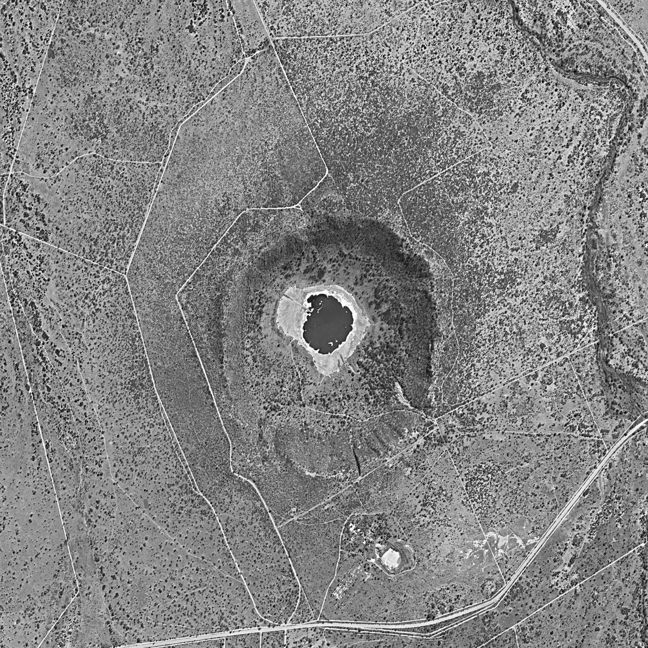

Tswaing crater
You can walk down into the place where the sky struck the earth. A short trail through bushveld north of Pretoria descends along a forested rim, and then the ground opens into a near-perfect bowl more than a kilometer across, cradling a small green lake at its center. The Tswana word Tswaing means "place of salt," and the salt is the whole reason humans have come here for a hundred thousand years. But the bowl itself was carved in an instant, when a chunk of rock from space arrived at cosmic speed and detonated against the ancient granite below.
The Day the Sky Fell
Roughly 220,000 years ago, in the Pleistocene, a stony meteorite estimated at 30 to 50 meters across, the size of a small office building, plunged into what is now Gauteng. It never reached the ground intact. The energy of the impact vaporized the incoming rock almost entirely and blasted out a crater about 1.13 kilometers wide and around 100 meters deep. The bowl was punched straight through the hard Nebo granite of the Bushveld Igneous Complex, the same vast ancient intrusion that holds much of the world's platinum. What remains today is one of the best-preserved impact craters anywhere on Earth, young and crisp enough that its shape is still unmistakable from the air.
A Hundred Thousand Years of Visitors
Long before anyone understood what had made the crater, people understood what it offered. Stone tools scattered around the rim show that hunter-gatherers were visiting as far back as 100,000 years ago, drawn by game and by the salt that gathers in the crater lake. Fed by springs, groundwater, and rain with no outlet, the water concentrates carbonates and sodium chloride into a natural brine. Tswana and Sotho people harvested that salt by filtering and boiling it down between roughly 1200 and 1800, trading a mineral as precious as any metal. The crater was a larder long before it was a curiosity.
Salt, Soda, and a Long Argument
Industry eventually came for the brine too. From 1912 to 1956 a company pumped water from the crater floor to extract soda and salt, leaving the ruins of a small works beside the lake. All the while geologists argued about how the bowl had formed. One camp insisted it was a volcanic vent; another, beginning with a 1930s proposal, suspected an impact. The debate ran for decades until 1990, when scientists pulled a core from a borehole drilled into the crater floor and found the unmistakable signatures of a hypervelocity strike. The volcano theory was finally laid to rest.
A Crater You Can Touch
Tswaing is rare among impact sites for being so accessible and so human in scale. Enclosed by a nature reserve of nearly 2,000 hectares and cared for since 1996 by the Ditsong museums, it lets ordinary visitors do something extraordinary: descend on foot into a wound made by the cosmos. A memorial near the rim honors Eugene Shoemaker, the geologist who proved that such craters are born of impact rather than eruption. South Africa has nominated Tswaing for consideration as a World Heritage Site, and standing at the bottom, looking up at the encircling rim, it is easy to see why this small salty lake matters so much.
From the Air
Tswaing crater sits at about 25.41 S, 28.08 E, roughly 40 kilometers north-northwest of Pretoria and just north of Soshanguve. From the air it is strikingly obvious: a circular bowl about 1.1 kilometers across with a pale, often greenish salt lake at its center, set against flat bushveld. The Hartebeesthoek Radio Astronomy Observatory lies to the west. Wonderboom Airport (FAWB) is the nearest field, with Lanseria (FALA) and O.R. Tambo (FAOR) within easy reach to the south. Recommended viewing altitude 2,500 to 4,000 feet AGL for the best circular profile; clearest in the dry winter months when haze is minimal.
Nearby Stories
- Premier Mine 3.9 km away
- Pelindaba 15 km away
- Royal Bafokeng Nation 20 km away
- Zonderwater POW camp 34 km away
- Oppikoppi 40 km away
- Bushveld Igneous Complex 83 km away
- TauTona Mine 84 km away
- Marakele National Park 90 km away