.jpg)
Llys Rhosyr
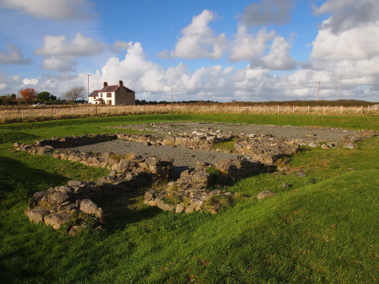
The local people had always known. They called the field cae'r llys - the field of the court - and they could point out the low ridges in the grass where walls had once been. Henry Rowlands, vicar and antiquarian, mentioned it as early as the 18th century: sand drifts had occasionally exposed sections of stonework, then buried them again. But for six centuries after the last prince of independent Gwynedd died, nothing was excavated. The court of Llys Rhosyr - one of the seats of the Welsh princes, the place from which they governed the commote of Menai - lay under turf and sand on the edge of a village called Newborough, waiting. The dig finally began in 1992.
What Llys Means
The Welsh word llys originally meant nothing more grand than an enclosed open-air space. Over time it took on the meaning of a place where legal proceedings were held, and then expanded again to mean a royal court - the residence and administrative centre of a Welsh ruler. Medieval Wales was governed not by feudal estates but by an older system of commotes and cantrefs, each cantref containing several commotes, each commote with its own court where the prince's officials judged disputes and collected dues. Llys Rhosyr was the court of the commote of Menai, in the cantref of Rhosyr. It stood at the heart of the prince of Gwynedd's southern Anglesey lands - the rich agricultural belt that fed the dynasty - and it complemented the more famous court at Aberffraw, on the western coast of the island.
Stone, Wood, and Silverware
Excavations by the Gwynedd Archaeological Trust from 1992 onwards revealed an enclosed complex that may originally have covered as much as 450 metres in one dimension. The trust uncovered only about a quarter of the walls but enough to establish the layout: a main surrounding wall, foundations and lower courses of at least three large buildings - probably a great hall, a chamber for the prince's private quarters, and storage barns. The buildings had been raised in stone and wood, the standard royal-residence construction of the period. Artefacts from the dig confirmed the high status of the inhabitants. Imported pottery. Silverware. Lead fishing weights from the strait close by. This was not a remote frontier post; it was a working seat of government, supplied with the kind of goods only wealth and connections could bring to a corner of north Wales.
Why It Was Buried
The court fell with the principality. Edward I of England's conquest of Wales in 1282 to 1283 ended the independent rule of the princes of Gwynedd, and the entire administrative system collapsed within a generation. Edward then evicted the people of Llanfaes, on the eastern side of Anglesey, from their town to make room for his new fortified borough at Beaumaris. The Welsh exiles were relocated to a planted town established beside the old royal court - that town was Newborough, chartered in 1303. The court itself was abandoned. Without maintenance the buildings decayed, and the same shifting sands that have always plagued this part of Anglesey - the same dunes that today make up Newborough Warren - began to drift across the site. Within a century or two, the great hall of the princes of Gwynedd was hidden under grass.
Llys Llewelyn, Rebuilt
The site opened to the public for the first time in 1995, just three years after the dig began. In 2023, Cadw - the Welsh Government's historic environment agency - bought the site outright, and it is now a scheduled monument under permanent state protection. There is also a second life for the buildings. In 2012, the Heritage Lottery Fund awarded a grant to St Fagans National Museum of History in Cardiff to reconstruct the great hall and chamber of Llys Rhosyr in full size. The reconstruction - rechristened Llys Llewelyn after Llewelyn the Great or Llewelyn ap Gruffydd, the last sovereign prince - was based directly on the two most thoroughly excavated buildings at Rhosyr. The hall has nine-metre walls. Visitors can now stand inside it. The original sits empty and roofless on its sandy ridge near Newborough, where you can walk around the foundations and try to picture what stood there when the princes of Gwynedd still ruled their own country.
From the Air
Coordinates 53.162°N, 4.366°W on the southern coast of Anglesey, on the outskirts of the village of Newborough. RAF Valley (EGOV) lies 18 km northwest, and Caernarfon Airport (EGCK) sits 10 km southeast across the Menai Strait. The site is a small enclosed archaeological excavation on flat ground between the village and the edge of Newborough Forest. The forest, beach, and Ynys Llanddwyn lie immediately to the south and southwest. Best viewed at 1,500 to 3,000 feet, with the great dune system of Newborough Warren forming the most striking feature in the foreground.
Nearby Stories
- Wakestock 1.7 km away
- Trefriw 3.8 km away
- Irish Sea 8.7 km away
- Irish Sea Bridge 20 km away
- East–West Interconnector 30 km away
- Machynlleth 36 km away
- HMS Tyler 41 km away
- New Brighton Lifeboat Station 54 km away