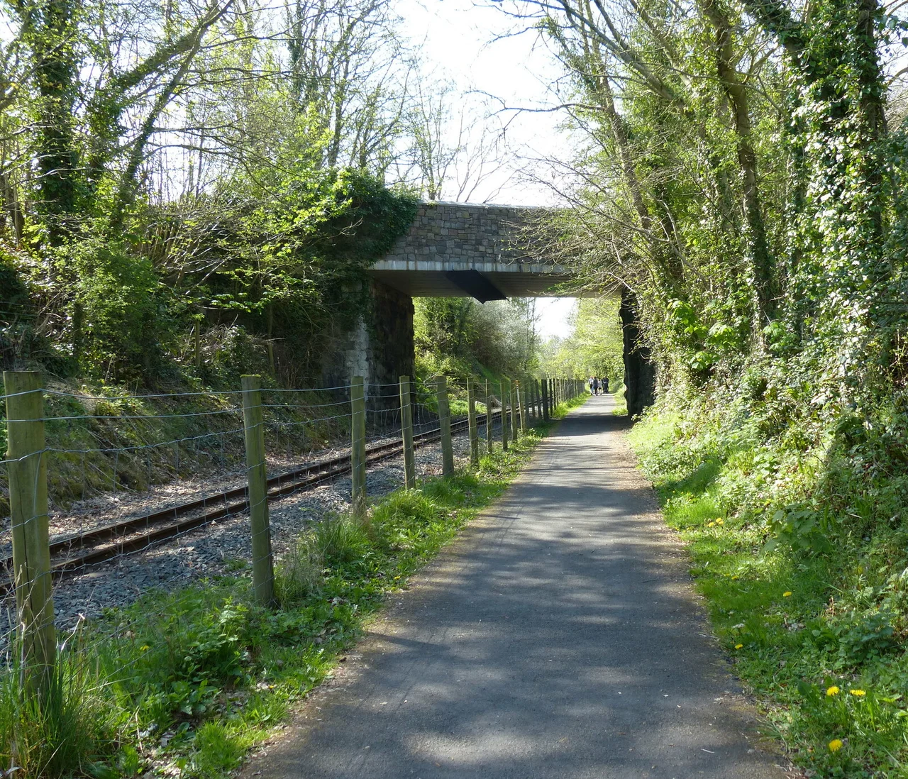

Lôn Eifion
The trains stopped running through Caernarfon in 1964, and the rails came up. For decades the corridor sat quiet - twenty kilometres of perfectly graded earthworks slicing south from the old county town through farmland and woodland toward the coast at Afon Wen. Then, with the kind of pragmatic afterthought the British do well, somebody pointed out that what made an excellent railway also makes an excellent cycle path. Lôn Eifion is the result: a flat, almost effortless ride along the bones of the Caernarvonshire Railway, part of a 400-kilometre Welsh National Cycle Route called Lôn Las Cymru.
The Slate That Built the Track
Running alongside the Lôn Eifion for some of its distance is an even older corridor - the trackbed of the Nantlle Tramway, opened in the 1820s. Horse-drawn trams once hauled slate down this route from the great Penrhyn and Dyffryn Nantlle quarries to the port at Caernarfon, where it was loaded onto ships and exported to roof half the houses of Victorian Britain. The Caernarvonshire Railway came later, taking over and extending the route under the LNWR and then the London Midland and Scottish. The line connected at Afon Wen with the Cambrian Coast Line, which still runs south from there toward Aberystwyth. When passenger services died in the Beeching cuts of the 1960s, the whole network was rolled up. What remains underfoot when you cycle Lôn Eifion is the literal cradle of the Welsh slate trade, paved and signed for leisure.
Caernarfon to Llanwnda: Sharing the Tracks
The northern end of the route is Caernarfon itself - the medieval walled town with Edward I's castle still glowering down on the harbour. The first stretch of Lôn Eifion runs alongside an active railway, the Welsh Highland Railway, a narrow-gauge heritage line that has been gradually rebuilt over decades and now steams all the way to Porthmadog. Cyclists and trains share the same green corridor as far as Llanwnda Station, where the heritage railway swings away east into Snowdonia. Llanwnda was once a real station on the Caernarvonshire Railway; today, after the Penygroes bypass changed the layout, the old station site is a roundabout. The railway cottages built for station staff still stand alongside the route, a quiet reminder of a working community gone domestic.
Through Groeslon to the Open Country
From Llanwnda the path crosses the A487/A499 roundabout and dives south through the village of Groeslon, passing the Tafarn Pennionyn before slipping behind Inigo Jones Slate Works - a working slate fabrication business that still produces gravestones, fireplaces, and architectural details from local stone. Beyond Groeslon the route opens into farmland, with views west across the rolling fields toward the coast and the dramatic peaks of Yr Eifl, the three-summited mountain locals call The Rivals. The Lon Eifion crosses the road again via a footbridge, dives into woodland, and then runs through quiet pasture down toward the village of Bryncir. The grade is gentle throughout - this was a railway, and railways do not climb steeply. A child can cycle it. Most people, in fact, do.
Where the Trail Ends
At Bryncir, the cycle path leaves the old railway corridor and heads westerly up through a farm and onto single-track road, eventually dropping south into Criccieth - a small coastal town with its own ruined castle perched on a rocky headland. Walkers, rather than cyclists, can pick up a different historic route from near Bryncir: the Lôn Goed, an old droving and supply path that runs west to the coast at Afon Wen through avenues of mature trees. Lôn Eifion is twenty kilometres of essentially flat, traffic-free cycling through a corner of Wales that hides in plain sight - Snowdonia tourists rush past it on their way to Snowdon, but the corridor itself is one of the easiest and most rewarding rides in Wales. The trains that built it are long gone. The path they left behind has outlived them.
From the Air
The Lôn Eifion corridor runs roughly north-south along approximately 53.10° to 53.15°N, 4.27°W, from Caernarfon down to Bryncir. Caernarfon Airport (EGCK) sits at the northern end of the route. From the air, the cycle path is visible as a thin straight line cutting through farmland west of the A487 road, with the Welsh Highland Railway track running parallel for the first section. The Llyn Peninsula stretches to the southwest, the Snowdonia mountains rise dramatically to the east, and Caernarfon Bay opens out to the west. Best viewed at 1,500 to 3,000 feet on a clear day.
Nearby Stories
- Wakestock 1.7 km away
- Trefriw 3.8 km away
- Irish Sea 8.7 km away
- Irish Sea Bridge 20 km away
- East–West Interconnector 30 km away
- Machynlleth 36 km away
- HMS Tyler 41 km away
- New Brighton Lifeboat Station 54 km away