
Lossiemouth
It is a small place, about eight thousand people, two long sandy beaches divided by a winding river, and a harbour that no longer does much fishing. From the same bench on the foreshore you can watch herring gulls fight over chips and watch a Eurofighter Typhoon climb out of RAF Lossiemouth at full afterburner, headed north over the Norwegian Sea to meet whatever Russian aircraft are currently probing British airspace. Lossiemouth is a quiet town that lives on the edge of one of NATO's busiest air-policing missions.
Gregory Place
Walk to the foot of Macduff Street, opposite the park, and look for a row of low cottages. There is a faint plaque by one of the doors. Inside, in 1866, was born James Ramsay MacDonald, the man who would become Britain's first Labour prime minister. He was illegitimate; MacDonald was his father's name, Ramsay was his mother's. He grew up here, then left for Bristol and London, helping found the Labour Party in 1900 with Keir Hardie and Arthur Henderson. Once he had money he built his mother a house at 17 Moray Street, two short blocks inland - both buildings are private residences today, no tours. MacDonald became prime minister in 1924 and again from 1929 to 1935. The Depression broke him politically; reviled by his own party as a traitor after he led a National Government dominated by Conservatives, he died on an ocean cruise in 1937, his body returned for funeral at Westminster Abbey.
The QRA
On the western edge of town is RAF Lossiemouth, the only operational Royal Air Force station left in Scotland. Four squadrons of Typhoon FGR4 fighters live there - Numbers 1, 2, 6 and 9 - and at any moment, day or night, a pair of them is sitting at the Quick Reaction Alert dispersal with engines warm, pilots within reach, ready to be airborne in minutes. Russian Tupolev Tu-95 'Bear' bombers - giant turboprop aircraft little changed since the 1950s - regularly cross the Norwegian and North Seas towards British airspace. The Lossiemouth Typhoons intercept them while still in international airspace, fly alongside while the Russians proceed on whatever course they had in mind, and then escort them home. It is theatre as much as warning, but the theatre is the point. The town pubs hear the jets at unsocial hours and have long since stopped looking up.
The Two Beaches
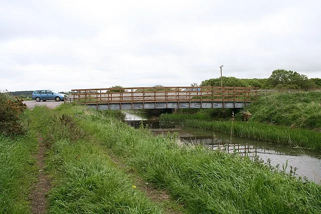
Lossiemouth has a beach on each side of town. East Beach is the better one for walking - a long sandy spit reached by a footbridge across the River Lossie from Church Street. The Spynie Canal meets the river here, a drainage channel finished in 1811 that was never quite navigable. West Beach runs out to Covesea Skerries Lighthouse, the white tower built by Alan Stevenson in 1846 after sixteen ships went down in a single storm. Beyond the lighthouse, Hopeman and Burghead sit further along the coast - Burghead with its Pictish well and its annual fire festival, Hopeman with its harbour built to ship out local sandstone. Inland, narrow lanes climb through gentle country to Duffus Castle, the leaning ruin on its boggy mound, and Gordonstoun, the school in the woods. Bus 32 runs hourly from Elgin to all of these places - but, frustratingly, not from Lossiemouth itself. You need a bike, or a car.
Beyond the Harbour
The fishing industry that built Lossiemouth has mostly gone. The small harbour, finished in stages through the eighteenth and nineteenth centuries, is now mainly a marina. The Lossiemouth Fisheries and Community Museum holds the town memory - including the original Stevenson lens from Covesea Skerries. Two golf courses sit on the dunes. Lossiemouth FC plays in the Highland League, the fifth tier of Scottish football, with home games at Grant Park. The Steamboat and the Brander Arms are the pubs of choice. There are no distilleries in Lossiemouth itself, but the great whisky country of Speyside begins barely twenty miles inland - the heart of Scotch single malt country, with more distilleries per square mile than anywhere else on earth. This unassuming little town stands at the meeting point of three Scotlands: Pictish, royal, and military. Most days it just feels like a quiet seaside village with louder than usual neighbours.
From the Air
Lossiemouth sits at 57.72 N, 3.28 W, on the south shore of the Moray Firth at the mouth of the River Lossie. RAF Lossiemouth (EGQS) is on the immediate western edge of town - its two runways, 23/05 and 28/10, are visible from the air as the dominant feature of the local landscape. Inverness Airport (EGPE) lies 30 nautical miles west. Watch for Typhoon climb-outs over the firth and Poseidon MRA1 maritime patrol aircraft transitioning to the North Atlantic. The town itself is best seen from low altitudes - the harbour, the East Beach spit, the long sweep of West Beach toward Covesea Skerries Lighthouse.
Nearby Stories
- Cardhu Distillery 1.5 km away
- Clynelish Distillery 1.8 km away
- Hilton of Cadboll Chapel 3.1 km away
- Huntly Castle 3.4 km away
- Findlater Castle 6.3 km away
- Culloden Viaduct 12 km away
- Helmsdale 23 km away
- HMS Exmouth (H02) 39 km away