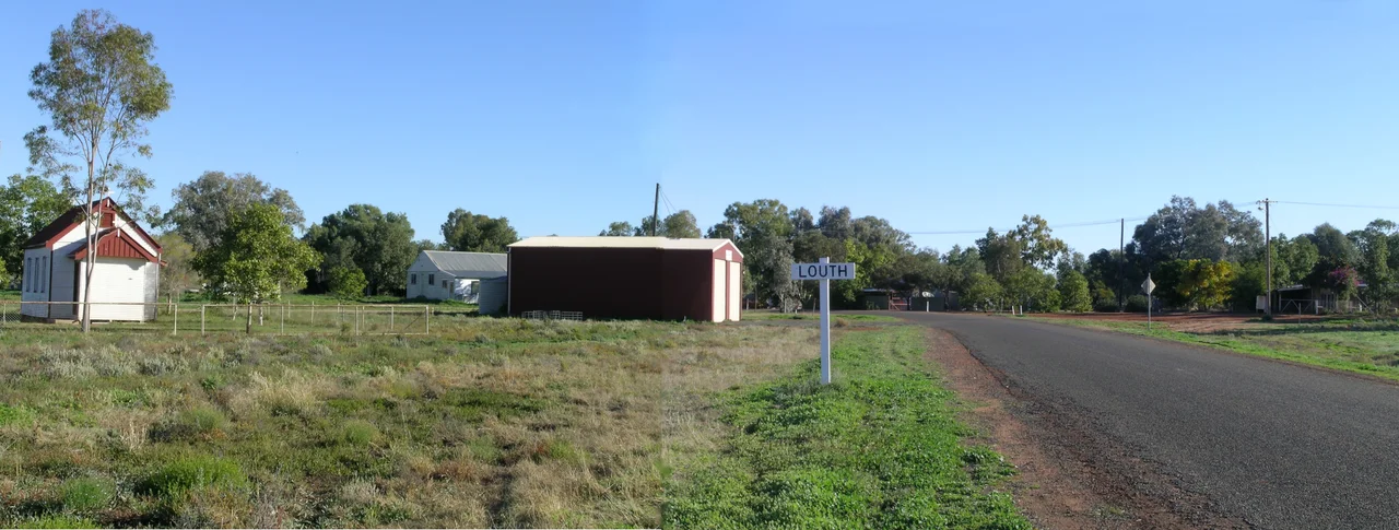

Louth, New South Wales
Once a year, for about three minutes, the dead are sent a signal. On the evening of 19 August, the anniversary of Mary Mathews' death, the setting sun strikes a seven-metre granite Celtic cross standing on the cemetery hill above Louth and throws a bright reflection down toward the town. Her husband Thomas built the monument that way on purpose, and locals have marked the spots where you can stand to catch the brief flare of light. It is one of the most touching things in the Australian outback: a love letter engineered into stone, still being delivered more than a century and a half after it was sealed.
A Pub on a Busy River
Louth exists because of thirst and timing. In 1859 Thomas Andrew Mathews, an Irish immigrant from County Louth, built a pub on the eastern bank of the Darling to serve the river trade then surging past. For a brief, improbable moment it boomed. The village swelled to three hotels, a cordial factory, three bakeries, two butchers, a post office, three churches, a Chinese market garden, a general store and a police station - a full small town stitched into the riverbank. The Darling was a highway then, paddle steamers hauling wool out and supplies in, and Louth was a place worth stopping. Today the permanent population hovers around two dozen, and Shindy's Inn is pub, post office, shop and café all at once.
The Cross on the Hill
Mary Mathews, born Mary Devine, died on 19 August 1869, the first of Thomas's four wives, just forty-two years old. To mark her grave Thomas raised something the like of which the outback had never seen: a polished Celtic cross of grey granite flecked with gold, quarried in Victoria and hauled hundreds of kilometres up the river he had built his fortune beside. Seven metres tall, it dominates the low cemetery hill and can be seen from the town below. In a treeless landscape of red earth and silver-grey saltbush, the gleaming stone is a startling sight - extravagant, devotional, and utterly out of scale with the dusty village it watches over.
Aimed at the Setting Sun
The cross is not merely large; it is aimed. Mathews had its polished face oriented so that on the evening of Mary's death anniversary the lowering sun would catch the granite and throw a reflection back toward the town and the spot where their home, The Retreat, once stood. Local accounts credit one of the Darling's riverboat captains with helping fix the alignment - the same navigational know-how that steered steamers by the stars, turned instead to steering sunlight toward a grave. The effect lasts only about three minutes, once a year, and visitors still come to stand on the marked spots and watch the stone light up. For a husband to grieve is ordinary. To grieve with surveying instruments, to bind a memory to the mechanics of the solar year so it would repeat faithfully without him, is something rarer - a feat of engineering in the service of love.
The Races and the River
Louth has one other claim on the calendar. Each August the Louth Races draw thousands of people down red dirt roads to a village of two dozen, filling the riverbank with horses, hats and dust for a single roaring weekend before the silence returns. It is the same instinct that built the town in the first place: in country this empty, you gather while you can. The river that made Louth still defines it. Stations like Trilby, 25 kilometres downstream, carry on the pastoral life along the Darling's banks, and travellers on the long outback river run still pull in at Shindy's Inn for a cold drink and a wall of fading photographs. Between race days and anniversaries, Louth keeps its quiet vigil on the Darling - a near-ghost town anchored by a pub, a river, and a cross that still keeps its appointment with the sun.
From the Air
Louth sits at 30.51 degrees S, 145.12 degrees E on the eastern bank of the Darling River in far western New South Wales, 99 km southwest of Bourke and 132 km northwest of Cobar. From the air the village is a small cluster against the unmistakable serpentine line of the Darling, whose dark, tree-lined channel snakes through pale plains and is the dominant navigation feature for a hundred kilometres in any direction. The cemetery hill and its granite cross sit just outside town. The nearest sealed airport is Bourke (ICAO YBKE); Cobar (YCBA) lies to the southeast, with Broken Hill (YBHI) the larger regional field further south. Skies are typically clear and visibility long; recommended viewing altitude is 2,500-5,000 feet AGL to follow the river bends. Heat and dust can reduce contrast in summer afternoons - the best light, fittingly, is near sunset.
Nearby Stories
- Gundabooka National Park 16 km away
- Bourke 40 km away
- Mount Drysdale, New South Wales 56 km away
- Mount Grenfell 66 km away
- London Chartered Bank of Australia Building, Bourke 90 km away
- Paroo-Darling National Park 101 km away
- Royal Mail Hotel, Hungerford 138 km away
- White Cliffs, New South Wales 140 km away