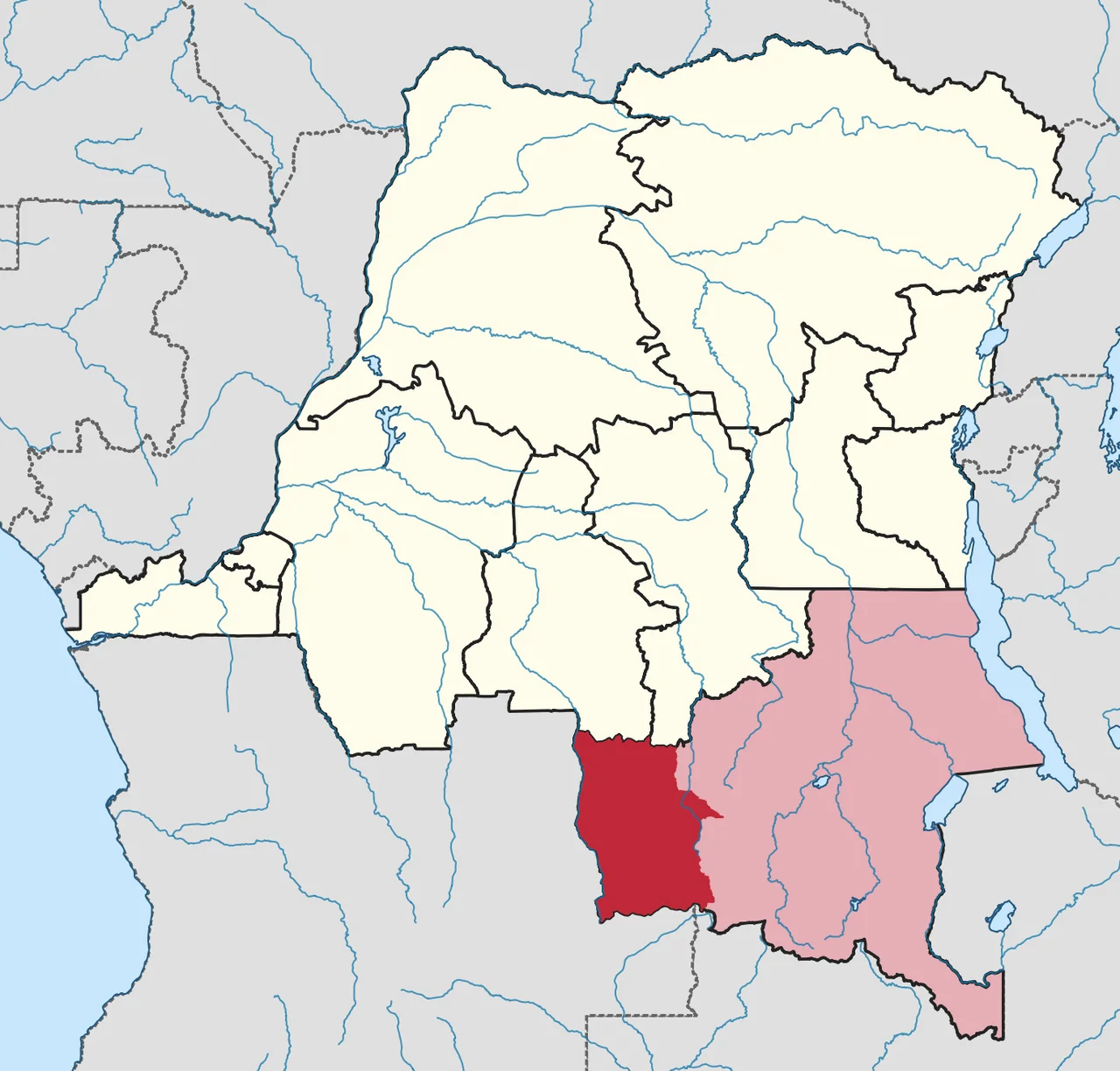
Lualaba District
The Lualaba District is a good lens for looking at how colonial and post-colonial administrators draw lines on maps and what happens to the lines afterward. The name appears for the first time on a Congo Free State map of 1888 and keeps reappearing - dissolved, reconstituted, shrunk, redrawn, reborn - all the way up to 2015, when the current Lualaba Province was finally carved out from the Lualaba and Kolwezi districts. In between, the district has been a vice-government general, a province of Katanga under a different name, and part of a short-lived secession. Its river gave it its name. Its copper made other people want it. Its borders moved according to their calculations.
The Congo Free State Draws A Line
Under the decree of 16 April 1887 the Congo Free State - King Leopold II's private colony, run with the brutality now documented in rubber-terror archives - was divided into administrative districts, each headed by a district commissioner with deputies. The decree of 1 August 1888 created eleven districts. The eastern part of the colony was split three ways: Aruwimi-Uele in the north, Stanley Falls in the center, Lualaba in the south, with headquarters at Lusambo. An 1895 map shows the first Lualaba District bounded by British possessions to the south and east, Stanley Falls District to the northeast, and Kasai District to the west. It was one of the largest administrative units in the colony. It was also mostly drawn on paper - Europeans at the time had visited a fraction of it. The people who lived there, millions of them, had not been consulted about any of this.
Into Katanga, And Out Again
In 1908 Belgium annexed the Congo Free State from Leopold, reorganizing it as the Belgian Congo. Parts of Stanley Falls and Lualaba were combined in 1910 to form Katanga, a vice-government general that would later become one of the most powerful and profitable provinces in colonial Africa. The original Lualaba District vanished in that consolidation. Then in 1933 the Belgians reorganized again. The Congo's provinces were renamed after their capitals. Elisabethville Province - Katanga - was divided into three districts: Lualaba in the west, Tanganika and Haut-Katanga in the east. The revived Lualaba District now held more than half the population and land area of Katanga. Its administrative center was Jadotville - the industrial town we know today as Likasi. Its name came from the Lualaba River, which rises in the south and flows north into Tanganika District. By 1955 the district had been substantially reduced again, its northern part split off as Haut-Lomami and part of its east transferred to Luapula-Moero.
Secession And Reconquest
On 11 July 1960, a few days after Congolese independence, the province of Katanga seceded under Moïse Tshombe and declared itself a separate state. What followed - the Katanga Crisis - drew in UN forces and mercenaries, killed Secretary-General Dag Hammarskjöld in a plane crash near Ndola, and reshaped international peacekeeping for a generation. In November 1961 the northern part of Katanga was reconquered by the national government and turned into Nord-Katanga. On 21 January 1963 the rest was reconquered and divided into Lualaba and Katanga Oriental. For a few years Lualaba was not a district at all but a province in its own right. Then, on 28 December 1966, Nord-Katanga, Lualaba, and Katanga Oriental were merged back into Katanga. Lualaba returned to being a district within a larger province. Its borders survived, but its autonomy did not.
2015: The Map Redrawn Again
The 2005 Congolese constitution promised to carve the country's large provinces into smaller ones, bringing government closer to the governed. It took a decade, but in 2015 the plan was executed. The old Katanga Province was broken into four: Haut-Katanga, Haut-Lomami, Tanganyika, and Lualaba. The new Lualaba Province was assembled from the Lualaba and Kolwezi districts. Kolwezi became the provincial capital - the same town whose tailings dumps hold the world's largest uncovered reserves of cobalt. The district, as an administrative unit, was gone. But its name and its geography carried forward. Stand today on the Lualaba River where it crosses the provincial highway, and you are standing in a place that has been called six different things by six different governments in 130 years. The river has not moved. Nothing about that has made the lives of the people beside it simpler.
From the Air
Located at about 10.72°S, 25.47°E, centered on Kolwezi and the Katanga copper belt of the southern DRC. Principal airports: Kolwezi (ICAO: FZQM) and Lubumbashi International (FZQA) further southeast. Elevation 1,200-1,500 m on the Katanga plateau. From cruise altitude the former district's footprint is marked by the distinctive reddish-grey open-pit mines of the copper-cobalt belt, the braided upper reaches of the Lualaba River flowing north, and the miombo woodlands that still dominate where mining has not reached.
Nearby Stories
- Haut-Lomami District 44 km away
- Shinkolobwe 61 km away
- Sakeji School 80 km away
- Likasi 87 km away
- Kalene Hill 104 km away
- Lumwana 110 km away
- Upemba National Park 163 km away
- Lomami Province 474 km away