
Lurgan
The straight line is the giveaway. Walk Lurgan's main street from the railway station northward and you walk along a thoroughfare designed by an English plantation lord in 1610: long, wide, and ruler-straight in a country where most older streets curve. William Brownlow had been granted the land by King James I and he laid out the town to suit himself. Four hundred years later, the streets he drew are still recognisable on any map of the place. The town that grew up on them ran on linen and lawn-bowling and ginger ale, and now runs on supermarkets and motorways, but the original grid still gives Lurgan its rare, almost American sense of openness.
Brownlow's Town
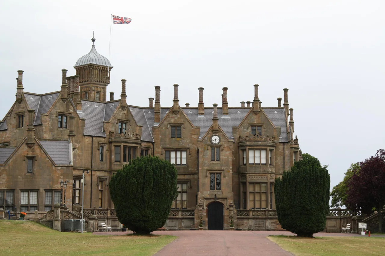
Lurgan is one of the most legibly Plantation-era towns in Ulster. The original layout was drawn up around 1610 by William Brownlow, who had been granted 1,500 acres in the area as part of the Plantation of Ulster, a confiscation of Irish land for resettlement by English and Scottish Protestants. Brownlow's family built first a fortified house and then, in the 1830s, the much grander Brownlow House on a rise above the town. Designed by William Henry Playfair in an Elizabethan Revival style, with conical turrets, a domed central tower, and Scottish freestone imported for its construction, Brownlow House looks more like a small Scottish castle than anything else in Northern Ireland. The Brownlows lost the house to debt in the 1890s. It was bought by Lurgan businessmen for the use of the Royal Black Institution, a loyal order founded in 1797. The institution still owns and uses the building.
The Linen Town
Throughout the 18th and 19th centuries Lurgan was one of the great linen-weaving towns of Ulster. Cottage looms in the back rooms of the workers' houses gave way, gradually, to power-loom factories along the streams. The Linenhall in the town centre was a market hall where farmers and weavers brought their finished cloth to be sold. By 1900, Lurgan had over 1,800 power looms operating in factories and bleach works, and the industry employed a substantial fraction of the town's working population. The linen industry declined slowly through the 20th century and almost completely after the 1970s. Today the surviving mill buildings have been converted into apartments, business parks, or simply allowed to crumble at the edges of the town.
The Park That Was Built To Beat Belfast
Lurgan Park, on the south side of the town, is the largest urban park in Northern Ireland and the second largest in Ireland after Phoenix Park in Dublin. It was created in 1893 on the grounds of the Brownlow estate. The park covers 110 hectares of lakes, gardens, sports pitches, and woodland, and it hosts the Ulster Bowling Championships every summer on its outstanding bowling greens. There is a popular Saturday morning Parkrun. There is a children's play area, a model railway, and a programme of summer concerts in the bandstand. The park was a deliberate piece of municipal one-upmanship; Lurgan in the 1890s was rich and proud and wanted a park to rival anything Belfast could provide. The town got it. Belfast never quite caught up.
Craigavon, The New City
In the late 1960s, the Northern Ireland government announced plans for a new city to be built between Lurgan and Portadown, eight miles to the southwest. The idea was that the existing towns and a new central district would form a single planned conurbation along the M1 motorway corridor, with shared services and modernist housing estates. It was a confident, optimistic plan. It did not quite work. Craigavon city centre was built in the 1970s with a covered shopping centre, a large artificial lake, and miles of pedestrian walkways, but the population never grew as fast as planners had hoped. Industries closed; the central area decayed; the Troubles arrived. By the 1980s Craigavon was a punchline. Lurgan, paradoxically, has emerged better. The Plantation grid was already too well-established to be replaced; the town simply absorbed the new motorway connections and kept being itself.
Catholic And Protestant Streets
Lurgan, like much of the Lurgan-Portadown belt, was during the Troubles one of the most deeply divided towns in Northern Ireland. Catholic and Protestant neighbourhoods lay close together, and the murders, riots, and bombings of the 1970s through the 1990s were concentrated in the streets between them. The civil rights lawyer Rosemary Nelson, who was killed by a loyalist car bomb in March 1999, lived and practised in Lurgan. The town has worked hard since the 1998 Good Friday Agreement to integrate, with public art, shared civic events, and joint education projects. The streets still tell the story to anyone who reads kerb-paint: green-white-orange here, red-white-blue there. The town centre, with its long, straight, William Brownlow main street, is shared by everyone.
Famous Sons, Famous Sausages
Lurgan's most internationally famous export is probably the actor Liam Neeson, who was born in nearby Ballymena and attended St Patrick's College there before later connections to the town. The boxer Eamonn Loughran, the footballer Aaron Hughes, and the snooker player Mark Allen all grew up in the town. The composer Frank McCullough was born here. And there is one other product that Lurgan is locally famous for: Mash Direct, Sausage Co. and other Northern Ireland food manufacturers have factories nearby, and the breakfast trade keeps a lot of the town going. Population 38,198 at the 2021 census. A town of straight streets, a big park, an old mill, and a story that begins with one English lord and a sheet of paper in 1610.
From the Air
Lurgan sits at 54.46°N, 6.33°W, about 18 miles southwest of Belfast and just south of Lough Neagh. From altitude the town's grid-pattern street layout is recognisable, with Lurgan Park as a large green rectangle on the south side. The M1 motorway runs immediately south of the town. Best viewed at 3,000-5,000 ft. Nearest airports: Belfast International (EGAA) about 15 nm northeast, Dublin (EIDW) about 70 nm south. Lough Neagh is visible to the north as the largest lake in the British Isles.
Nearby Stories
- 1990 British Army Gazelle shootdown 2 km away
- Slieve Gullion 4.7 km away
- Cootehill 11 km away
- Carrickfergus 12 km away
- Castledawson 13 km away
- Gortin 14 km away
- Castlewellan 16 km away
- German submarine U-1051 67 km away