,_December_2009.JPG)
Castlewellan
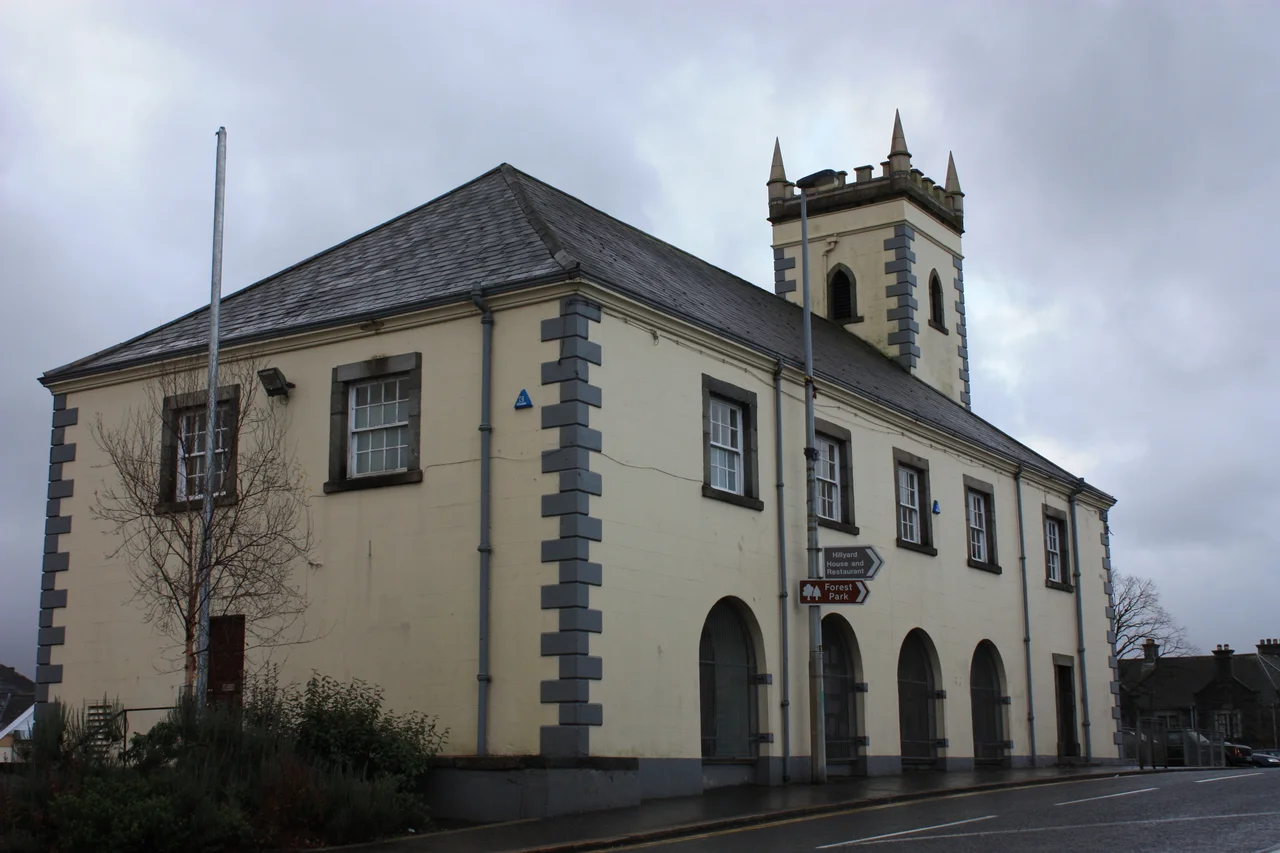
A French architect once stood in this corner of County Down and drew something Ireland had never seen before: a town built around two squares, lined with chestnuts, joined by a main street wider than any market town had any business being. The Annesley family commissioned it. Castlewellan still wears the plan. Between the Mourne Mountains to the south and Slieve Croob to the north, the chestnut canopies thicken in summer and thin to lace in winter, and beneath them the limestone of the old market house has stood since 1764 - now sheltering library shelves where butchers once weighed meat.
Two Squares, One Idea
Most Irish towns grew the way water flows: along whatever crooked path the road took, with houses elbowing each other for frontage. Castlewellan refused that geography. The plan distributes the town between an upper square and a lower square, the broad main street linking them like the bar of a dumbbell. Chestnut trees soften every edge. The market house from 1764, with its arched ground floor where stalls once spread their goods, anchors the upper square. The Annesleys had bought the land from the Maginness family, the previous holders of what would become Castlewellan Forest Park, and they imported European ideas about town-making. The result is an Irish town that feels almost Continental, a place where geometry and trees do most of the architectural work.
The Arboretum Begun in 1740
Northwest of the town squares, the Annesley grounds opened toward Castlewellan Lake. Beginning in 1740, decades before the castle itself rose, gardeners started planting trees gathered from Spain, Mexico, Wales, and farther. The arboretum grew slowly, as arboretums must. By the mid-twentieth century it had become a study collection of global flora rooted in County Down soil. In the 1960s, park director John Keown noticed something odd in one of the cypresses - a single mutant form of Leyland Cypress that held its golden colour year-round. He named it after the place. Castlewellan Gold is now planted in gardens across the temperate world, a Northern Irish hedge that began as one freak seedling on the Annesley estate.
The Longest Maze in the World
Between 2000 and 2001, volunteers planted yew and beech in a spiralling pattern across the forest park, creating the Peace Maze. Until 2007 it held the title of longest permanent hedge maze on Earth. The name was deliberate. Castlewellan had lived through the Troubles - a January 1980 land mine attack near the town killed three Ulster Defence Regiment soldiers, one Catholic, two Protestant - and the community wanted something that would outlast that memory. The maze invites visitors to lose their way and find it again, a small choreographed puzzle inside a forest that already feels like one. The castle at its centre, a Scottish baronial pile finished in 1856, watches over both.
Soma and the Modern Town
Castlewellan today has a population just under three thousand and a quietly active cultural life. The Soma Festival, running annually since 2013, fills the squares each summer with live music, food stalls, and family events. The town's GAC club draws crowds to its pitch on weekends, the lake hosts the Queen's Regatta in rowing season, and the forest park is a year-round backdrop for hill walkers and archers. Greer Garson, the Academy Award winning actress, grew up here - she was born in East Ham, London, in 1904 but was raised in Castlewellan. So was the writer Séamus Ó Néill, born in 1910. The chestnut trees keep doing what chestnut trees do - flowering in May, dropping conkers in October, and standing in their two long rows as the French architect intended.
Stones Older Than the Town
Two miles southwest, the Drumena Cashel still encloses the footprint of an Early Christian farmstead, its stone wall hiding an Iron Age souterrain that runs underground in a cool dark curve. To the north, the Legannany Dolmen balances its capstone on three legs above the slopes of Slieve Croob, looking from certain angles like a great stone tripod waiting to walk. Goward Dolmen, closer to Hilltown, has had its huge granite cap slip from its original perch but stands anyway. The town centre is younger than the chestnut planting plan, and the planting plan is younger than the dolmens - all of it stacked across the same few square miles of County Down.
From the Air
Castlewellan sits at 54.27N, 5.93W, in the foothills between the Mourne Mountains and Slieve Croob. Best viewed at 2,500 to 4,000 feet from the southwest, with the two squares visible as distinct openings in the town fabric and Castlewellan Lake glinting to the north. Nearest aerodromes: Belfast City (EGAC) about 27 nm north, Belfast International (EGAA) about 35 nm northwest, Newtownards (EGAD) about 22 nm northeast. Mourne terrain rises sharply south - Slieve Donard at 850 m is only 6 nm distant. Watch for orographic cloud and rapid weather changes off the Irish Sea.
Nearby Stories
- Newry 6 km away
- Comber 7.2 km away
- Castlebellingham 8.1 km away
- Lough Neagh 15 km away
- Pasages (steam trawler) 25 km away
- Calf of Man 35 km away
- German submarine U-1024 38 km away
- Mornington 41 km away