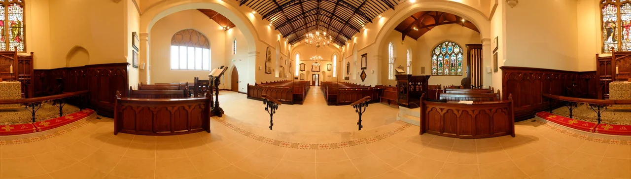

Comber
On Easter Sunday morning 1912, the man who knew exactly how the Titanic had been built was last seen on the bridge of the sinking ship, throwing deck chairs to passengers in the water. Thomas Andrews was 39, the chief naval architect of Harland and Wolff, and the son of a wealthy Comber linen-and-grain family. He had grown up in this small Ulster market town between Belfast and Strangford Lough. The town remembers him with a memorial hall, a school named for him, and a Titanic audio trail that winds through the streets where he learned to count rivets. Comber is the kind of place that produces a Thomas Andrews and then carries on selling early potatoes and pipe-band trophies as if nothing had happened.
Where the Rivers Meet
The name 'Comber' comes from the Irish 'an Comar,' meaning the confluence - in this case of the Glen River and the Enler River, which join at the centre of town and then run east into Strangford Lough. A settlement grew here in the early 1600s during the Plantation of Ulster, when Lowland Scots arrived under James Hamilton's land grants. The original village sat further south, at a townland called Cattogs, and was a small port for traders and fishermen. By the 1700s the focus had shifted to higher ground around the present Square, where mills could harness the water. The Andrews family - linen-spinners and grain merchants - built much of the new town. By 1841 there were 1,400 people living here. The Enler still floods occasionally, requiring a long flood wall through the town centre that has held the water back since.
The Man on the Bridge
Thomas Andrews was born in 1873 in Ardara House, half a mile from Comber's Square. He apprenticed at Harland and Wolff in Belfast at fifteen, rose to managing director by his thirties, and personally supervised the design of every major White Star liner, including Olympic, Titanic, and Britannic. He sailed on Titanic's maiden voyage to monitor her sea trials, sketching design improvements in his notebook. When the ship struck ice on the night of April 14, 1912, Andrews toured the damaged forward compartments and told Captain Smith the truth: the ship would sink in two hours, and there were not enough lifeboats. He spent the next two hours helping passengers into the boats that did exist. He died with the ship. Comber's Square contains a memorial to the Comber dead of Titanic; the Andrews Memorial Hall, built by public subscription, still stands as the assembly hall of the primary school named for him.
The Earlies and the Geese
There is a particular potato that ripens here in late May and early June - small, waxy, sweet, grown in the deep estuarine silt of the Ards Peninsula. It is called the Comber Earlies, and in 2012 it became the first Northern Irish food product to receive EU Protected Geographical Indication status, joining the same legal category as Parma ham and Champagne. The Earlies have an annual festival in June that fills the public square. A few miles south, at Castle Espie on the shore of Strangford Lough, the Wildfowl and Wetlands Trust runs a wetland reserve that serves as the early-winter staging ground for almost the entire Nearctic population of pale-bellied brent geese - tens of thousands of them, blown in from Arctic Canada via Iceland, fueling up on eelgrass before continuing south. The geese have been arriving here longer than anyone has been growing potatoes.
Gillespie's Column and a Difficult History
Rising 55 feet above the centre of Comber's Square is a stone column with a statue of Major-General Sir Robert Rollo Gillespie on top. Gillespie was born in Comber in 1766 and killed in 1814 storming a Gurkha fort at Kalunga in northern India - one of many British officers who died expanding the East India Company's territory. His last words, carved on the plinth, were 'One shot more for the honour of Down.' Fifty Masonic lodges turned out for the unveiling on St John's Day 1845, a crowd estimated at 25,000 to 30,000 - probably the largest Masonic gathering in Irish history. A century and a third later, on 17 February 1978, the Provisional IRA placed an incendiary bomb at the La Mon House Hotel three miles outside Comber, during a function for the Irish Collie Club. Twelve civilians were killed. It remains one of the worst attacks of the Troubles, and Comber lives with both monuments - the Victorian column and the modern memorial - within an evening's walk.
The Greenway
The Belfast and County Down Railway ran trains from Belfast to Comber from 1850 until 1950, when it was closed by a postwar transport board that judged road traffic the future. The track bed sat empty for half a century, slowly being reclaimed by hawthorn and bramble. Then, beginning in the early 2000s, a coalition of local activists and councils paved it as the Comber Greenway, a seven-mile traffic-free cycle and walking path that now runs all the way from Belfast's Dee Street, past the Stormont parliament buildings, under the silhouette of Scrabo Tower, and into central Comber. It is the busiest greenway in Northern Ireland. Cyclists arriving thirsty find independent cafes and family bakeries on the Square, where the Andrews mills used to grind. The trains, the linen, the whiskey distilling - all closed long ago. The early potatoes, the geese, the column, and the trail remain.
From the Air
Located at 54.54°N, 5.74°W in north-east County Down, 8 nautical miles south-east of central Belfast, at the northern tip of Strangford Lough. From the air, look south for Strangford Lough opening out as a roughly 50-square-mile sea inlet dotted with drumlin islands - one of the great wildfowl reserves of Europe. Scrabo Tower, a Victorian folly on a 540-foot drumlin two miles north-east of Comber, is the prominent landmark. The Comber Greenway runs west-north-west along the old rail bed toward Belfast. Belfast City Airport (EGAC) is 5 nautical miles north-west; Belfast International (EGAA) is 17 nautical miles west-north-west. Recommended viewing altitude: 2,000-4,000 feet for the dramatic geometry of Strangford Lough and the patchwork of the Ards Peninsula.
Nearby Stories
- Larne 1.2 km away
- Ahoghill 3.5 km away
- Castleskreen 4.9 km away
- Lough Neagh 6.1 km away
- Kingsmill Massacre 14 km away
- Pasages (steam trawler) 23 km away
- Ballantrae Lifeboat Station 34 km away
- St Patrick's Isle 39 km away