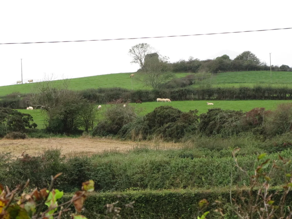

Castleskreen
The drumlin is a kind of geological signature - a low, smooth hill of glacial till left behind when the last ice sheet retreated about 13,000 years ago. South Down is full of them. Most are unremarkable. The one in the townland of Castleskreen, just south of Downpatrick, is different. People started building on it perhaps as early as the first millennium AD. They put up a ringfort. They abandoned it. They came back and built again. In the fifteenth century, someone added a tower house. When the Archaeological Survey of Northern Ireland excavated the mound in 1951 and 1958, they found layer after layer of intermittent human occupation reaching back through more than a thousand years.
The Townland
Castleskreen covers about 336 acres of farmland south of Downpatrick in County Down, in the civil parish of Bright and the historic barony of Lecale Upper. To the east lies the townland of Islandbane. Erenagh sits to the north, Corbally and Ballydonnell to the west, Ballynewport to the south. The townland system is one of the oldest layers of Irish geography still in active legal use - boundaries that were drawn in the medieval Gaelic period, written into Anglo-Norman charters, copied into Plantation surveys, and survive today on maps and in property deeds. To know a townland name in Ireland is to know a piece of land older than most of the buildings standing on it.
What's in the Name
The name Castleskreen has wandered. In the fourteenth century the site was apparently called Grenecastell - "green castle." Ecclesiastical documents from 1306 mention a Capella de Grencastell, and a 1408 reference uses the Latin Capella St Finiani de Viride Castro, "the chapel of St Finian of Greencastle." The chapel may have replaced an earlier abbey of Carrick, in neighbouring Erenagh, said to have been destroyed by the Norman conquistador John de Courcy around 1180. By the mid-sixteenth century the name had drifted: Castlecryn in 1549, Castlecrinne in 1649, Castle Creen around 1659. Linguists suggest the underlying Irish form is Caisteal Críon, meaning "old or decayed castle." The spelling with the extra "s" - Castlescreen - first appears in 1661. The name's wandering tells you something about how Irish placenames were filtered through generations of English-speaking record-keepers.
The Rath
The earliest occupation of the Castleskreen drumlin was a ringfort - the kind of circular earthwork settlement that dotted early medieval Ireland by the tens of thousands. The 1951 and 1958 excavations identified what archaeologists called Phase 1: a rath without any obvious surrounding bank or ditch, though a timber palisade may have once stood around it. The most striking feature was a large artificially excavated hollow in the southern half of the enclosure - a depression that the archaeologists interpreted as a possible livestock watering reservoir. The entrance was constructed as a sunken hollow-way revetted with dry stone. Pottery fragments included souterrain ware - a type of coarse pottery characteristic of early medieval northern Ireland. Animal bones suggested the usual cattle, sheep, pig economy of the period. The site was probably abandoned before the end of the twelfth century, then sat empty for two or three hundred years before being reused.
The Tower House
In the fifteenth century, on top of the long-abandoned rath, someone built a tower house. Tower houses were the standard fortified dwellings of late medieval Ireland - small stone keeps with vaulted ground floors, narrow windows, and chambers stacked above for the lord and his household. Castleskreen's tower survives only as ruined masonry, but enough remains to identify a square turret with corbelled vaulting and the shafts of garderobes (medieval latrines). The masonry style matches other County Down tower houses such as Kilclief Castle. Around the tower, the older rath enclosure was refortified with a clay bank faced with stone. Whether the surrounding enclosure was actually in use at the same time as the tower remains uncertain. The archaeology suggests, oddly, that the tower may have stood somewhat in isolation.
What the Excavation Found
The 1951 and 1958 digs were undertaken with the explicit aim of recovering the full ground plan of the tower house and clarifying its relationship to the surrounding enclosure. Those aims were not fully achieved - the excavation was limited in extent - but the soil studies done by Bruce Proudfoot opened up something more interesting: a stratigraphy of intermittent occupation. Layers of human and animal activity were separated by periods of abandonment long enough for distinct soil profiles to develop. Iron deposits had formed at certain interfaces, characteristic of gleying - the chemical process that happens when waterlogged soil sits undisturbed. The hearths, stake-holes, paving stones and domestic debris told the story of people who had lived here, left, and sometimes come back. One small bronze object - possibly the escutcheon of a bowl, possibly a brooch - was found inside the enclosure. Pollen analysis showed that the surrounding woodland had been partially cleared during periods of use.
A Drumlin Reads Itself
Stand on the rise at Castleskreen today and you can still read the basic shape of what was here. The circular outline of the rath. The masonry stump of the late medieval tower. The central depression that may have watered cattle a thousand years ago. To the north, the field still called Church Park, where the nineteenth-century historian James O'Laverty recorded local memory of the ruined abbey of Carrick. To the east, beyond the townland boundary, the road runs toward Downpatrick and the cathedral that traditionally marks the grave of St Patrick. Castleskreen is not a major site. It is not signposted. But it is the kind of place that, with a bit of attention, lets you see a millennium of Irish rural occupation layered into a single low County Down hill.
From the Air
Located at 54.29°N, 5.74°W in County Down, on a drumlin south of Downpatrick. Recommended viewing altitude 1,000-2,000 ft AGL to take in the circular earthwork of the rath, the tower house ruin at its northwest, and the patchwork of drumlin field-systems that characterise this part of County Down. Belfast City (EGAC) is about 20 nm north-northwest; Belfast International (EGAA) about 25 nm northwest. The Mourne Mountains rise dramatically to the southwest. Best viewed in low winter sun, when the earthworks throw long shadows against the surrounding fields.
Nearby Stories
- Newry 6 km away
- Comber 7.2 km away
- Castlebellingham 8.1 km away
- Lough Neagh 15 km away
- Pasages (steam trawler) 25 km away
- Calf of Man 35 km away
- German submarine U-1024 38 km away
- Mornington 41 km away