
Larne
On 26 May 1315, three hundred Scottish ships came over the horizon and made for the small harbour the Irish then called Olderfleet. Edward Bruce, brother of King Robert, came ashore with more than five thousand battle-hardened soldiers fresh from Bannockburn the previous year, and the three-year Bruce invasion of Ireland began. The place that received him was already an ancient port. Today it is Larne, the busiest ferry terminal in Northern Ireland, where a P&O ship still leaves for Scotland six times a day.
The Descendants of Lathar
The Irish name Latharna means 'the descendants of Lathar', a pre-Christian dynasty so old that historians cannot agree whether Lathar was a real man or a founding legend. Flints found in this area have been dated to around 6000 BC, the Middle Stone Age, which puts Larne among the very earliest places of human settlement on the island of Ireland. Celts, Vikings, Normans, Tudors, and finally the Victorians all left layers here, but only the Victorians left the layer most visitors still see. Until the nineteenth century Larne was one of dozens of small ports lining Belfast Lough. The man who changed that was James Chaine, a shipping entrepreneur and Member of Parliament who, in the second half of the nineteenth century, built up the harbour facilities, financed the railway, and locked in the trade link with Scotland that has defined the town ever since.
A Tower for a Buried Man
James Chaine died in 1885 at the age of forty-four. His town remembered him with a monument unlike anything else in Northern Ireland: a 28-metre stone replica of an Irish round tower, completed in 1888, standing as a slim pencil with a conical cap on the headland north of the harbour. In 1899 the tower was adopted as a working lighthouse, fitted with a light to help shipping steer clear of Hunter's Rock, the half-submerged hazard five miles out in Belfast Lough that had wrecked the State of Louisiana in 1878 when its warning buoy was dislodged. The wreck still sits in fifteen to twenty-five metres of water and is now a popular dive site. Chaine himself lies near the foot of his own tower, buried upright in a fenced mound at the north end of the town park, so that he could spend eternity facing the sea his ships had crossed.
Olderfleet and the Bruces
Down by the harbour stands the ruin of Olderfleet Castle, a tower-house built in 1612 with no real signs of having been a dwelling. It seems to have been a fortified warehouse and watchtower, the last in a line of fortifications that had stood here for centuries. The medieval Olderfleet was the strongpoint Edward Bruce stormed in 1315, and from this beach his troops swept south through Ulster, eventually crowning him High King of Ireland. The campaign ran for three years before disease, famine, and the better-organised forces of the Anglo-Irish lords caught up with him at the Battle of Faughart in County Louth in 1318. Edward Bruce was killed there. Robert Bruce went on to win at Bannockburn-shaped Scotland; Edward Bruce was the brother who almost won Ireland, and Larne is where it started.
Two Hours to Scotland
Today the trade with Scotland that James Chaine built still defines the town. P&O Ferries sail from Cairnryan near Stranraer six times a day, a two-hour crossing that brings cars, trucks, and passengers into the harbour at the foot of the Chaine Monument. Look out from the dockside on a clear afternoon and you can see the Mull of Kintyre on the horizon, less than twenty miles away. The trade has shaped the speech too. The Ulster Scots dialect, that distinctive Scottish-tinged English spoken across much of Antrim and Down, took root in places like Larne when settlers came across this same channel four centuries ago. One of those settlers' graveyards still lies a few miles south at Ballycarry, where many of the first Scots Ulster plantation families are buried.
Glens and Gobbins
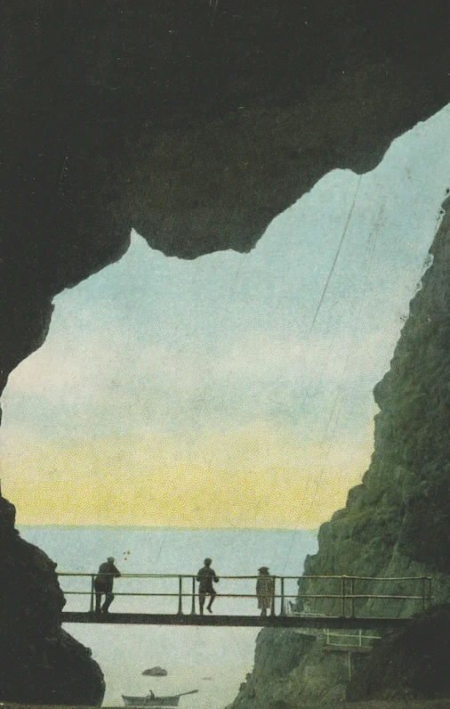
The town itself can look drab on a wet Tuesday, but its setting is anything but. Just south, the Islandmagee peninsula encloses Larne Lough and ends in spectacular cliffs at The Gobbins, where a Victorian-era cliff path - rebuilt in modern form - swings out over the sea like an Ulster version of an Italian via ferrata. North along the coast, the nine Glens of Antrim begin: Glenarm village, the entrance to Glenarm Castle with its 1636 stronghold of the Earls of Antrim, the Madman's Window cut by glacial boulders, then Carnlough at the foot of Glencloy, with its Harbourview Hotel founded in 1848 by the great-grandmother of Winston Churchill. Further north still are the Antrim Glens that most tour buses race through on their way to the Giant's Causeway. Larne offers a quieter approach to the same country, beginning at the harbour where everything has always begun.
An Older Industry
Larne FC, the town's professional football club, currently plays in the top tier of Northern Irish football, the NIFL Premiership, at Inver Park, a 2,500-capacity ground half a mile from the harbour. Their recent rise from the lower leagues into the championship has given the town a sporting story that it had not had in decades. Larne Grammar School, founded in 1886, has turned out British and Irish Lions, motorcycle world champions, Paralympic gold medalists, and Chief Constables. The town is unglamorous, and proud of being unglamorous. It has always worked. Eight hundred years ago that meant landing armies. Now it means landing freight. The North Channel, with its grey water and white wake, has not lost its job.
From the Air
Larne sits at 54.852 N, 5.813 W, on the western shore of Larne Lough at the mouth of Belfast Lough's northern arm. Best viewed from 2,000 to 3,500 feet. From above, look for the long enclosed Larne Lough running south, the harbour and Chaine Monument on the northern headland, the Islandmagee peninsula across the water with Ballylumford power station at its tip, and the line of the A8 dual carriageway running southwest toward Belfast. Nearest airports: Belfast International (EGAA) about 16 nm southwest, Belfast City (EGAC) about 15 nm south. P&O Ferries cross from Cairnryan, with the Mull of Kintyre and Prestwick (EGPK) on the Scottish side about 35 nm to the northeast.
Nearby Stories
- Ulster Folk and Transport Museums 1.9 km away
- Carrick-a-Rede Rope Bridge 4.9 km away
- Lough Neagh 7 km away
- Ahoghill 7.6 km away
- Ailsa Craig 12 km away
- Mull of Kintyre 13 km away
- Portpatrick Lifeboat Station 14 km away
- Pasages (steam trawler) 25 km away