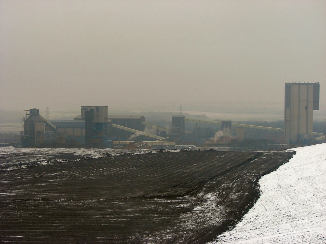

Maltby Main Colliery
Before there was a workforce, there were the houses. Maltby Main Colliery was sunk far enough from the existing village of Maltby that the colliery company had to build somewhere for the miners to live. The result, opened around the same time as the pit, was Maltby Model Village: an estate of 400 houses laid out in the deliberate, planned way characteristic of early-twentieth-century company-built communities. The houses are still there. The pit they were built for is gone, demolished in 2014, a year after the last coal came up the shaft.
Sinking the Shafts
The first shafts at Maltby Main were sunk in 1910, with first coal produced in 1912 and all faces in production by 1914. The colliery sat in a wooded patch off Tickhill Road on the eastern edge of Maltby, opened by the Maltby Main Colliery Company, itself a subsidiary of the Sheepbridge Iron and Coal Company. The South Yorkshire coalfield was, by then, one of the great productive provinces of the British coal industry, and Maltby Main was part of a generation of deep mines built to work seams that earlier shallower pits could not reach. A single unidentified body was recovered from the workings during the sinking, buried in the local graveyard as 'The Unknown Miner.' He has remained anonymous ever since.
Going Deeper, Going Down
Through the 1950s the two main shafts were progressively deepened, giving horizontal access first to the Barnsley seam and then to the new Swallow Wood seam below it. By 1969 the Barnsley seam was considered worked out, and production moved entirely onto Swallow Wood. In 1981 the colliery embarked on an £18 million project to reach the Parkgate seam, with the first Parkgate coal at the surface within a year. By the late 1980s the mine was a thousand metres deep: No. 2 shaft 984 m, No. 3 shaft 991 m, between them capable of winding 1,500 tonnes an hour. The 1984-85 miners' strike brought mass picketing, with crowds outside the gate attempting to stop building contractors from working at the pit. Like every other British colliery, Maltby Main was reshaped by that strike's outcome; nationalised when the National Coal Board ran it, sold to RJB Mining and then UK Coal in 1994, sold again in 2007 to Hargreaves Services for £21.5 million.
The Geology That Beat Them
South Yorkshire's deep coal seams sit beneath layers of Magnesian Limestone, fractured ground, and gas-charged strata. The deeper a mine goes, the harder these problems become. By late 2012 Hargreaves Services had concluded that the underground conditions at Maltby Main were too dangerous to keep working. The Parkgate seam was nearly exhausted; the Silkstone seam below had been the next planned target, but reaching it would have required working through ground the engineers no longer trusted. Five hundred and forty employees received redundancy notices. In December 2012 Hargreaves formally announced the closure. The mine shut in 2013. Sometimes mines close for political reasons or economic ones. Maltby closed because the geology beneath it stopped being mineable.
Demolition and Aftermath
The above-ground structures came down in 2014. The pit headgears, the winding houses, the screens and the conveyor galleries were all reduced to rubble. What remained was the model village a kilometre or so away, the streets of stone-built terraces that had housed three generations of miners. With Maltby's closure, deep coal mining in South Yorkshire effectively ended. Kellingley Colliery, the last UK deep coal mine, closed two years later in 2015, but Maltby's shutdown removed the last working face in this particular corner of the coalfield. For Maltby town, where the colliery had been the largest employer for a century, the closure was the kind of event that becomes a marker in family memory: before and after the pit. The houses persist. The village remains a village. The pit, after a hundred and three years, is a brownfield site awaiting whatever comes next.
From the Air
Maltby Main Colliery's former site is at 53.426 N, 1.172 W, on the eastern edge of Maltby, about 7 miles east of Rotherham in South Yorkshire. The site is at about 60 m elevation in mixed agricultural and former mining country, set in patches of woodland. Best viewed from 2,000-3,500 ft AGL; the spoil tips and the cleared pit footprint remain identifiable, with Maltby Model Village distinguishable as a regular grid of streets to the west. Nearest airports: Doncaster Sheffield (EGCN) 6 nm north-northeast. Sherwood Forest lies 10 nm to the south-southeast.
Nearby Stories
- Flixborough Disaster 0.8 km away
- Peveril Castle 1.7 km away
- Newstead Abbey 2.6 km away
- Huddersfield Town Hall 3.8 km away
- Ackworth School 7.9 km away
- RAF Scampton 11 km away
- RAF Cranwell 16 km away
- Croxden Abbey 18 km away